 |
 |
 |

I created the above map by overlaying OpenStreetMap (OSM) maps with my own data. The underlying map data is © OpenStreetMap contributors, licensed under the Open Database License (ODbL).
Please note that the OSM map used as a template for this map corresponds to the situation at the time the map was downloaded and may show features that did not exist at the time the GS Tram Site is supposed to show. In particular, it may show bridges and highways that were built later.
ROUTES
URBAN TRAM ROUTES
Operator: De Lijn
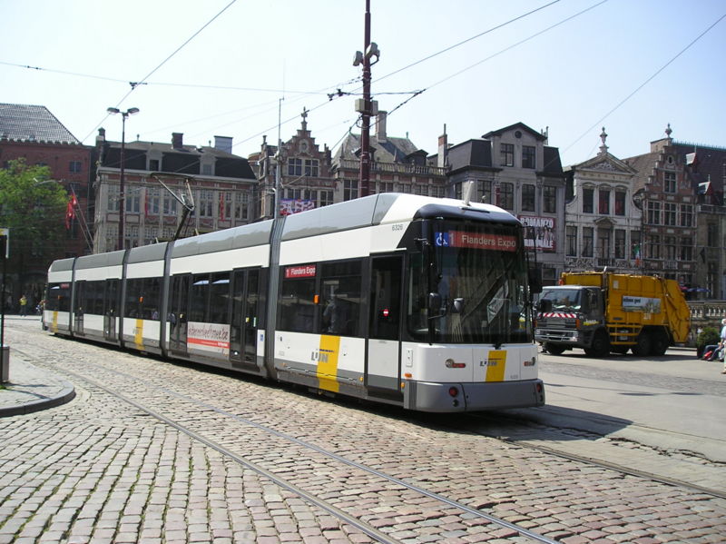
| 1 | Flanders Expo - Sint-Pietersstation - Korenmarkt - Rabot - Wondelgem - Heinakker - Evergem |
| 4 | UZ Gent - Sint-Pietersstation - Rozemarijnbrug - Rabot - Muidebrug - Korenmarkt - Zuid - Gentbrugge Moscou |
| 21 | Zwijnaarde Dorp - Zwijnaardebrug - Sint-Pietersstation - Kouter - Zuid - Stelplaats - Melle Leeuw |
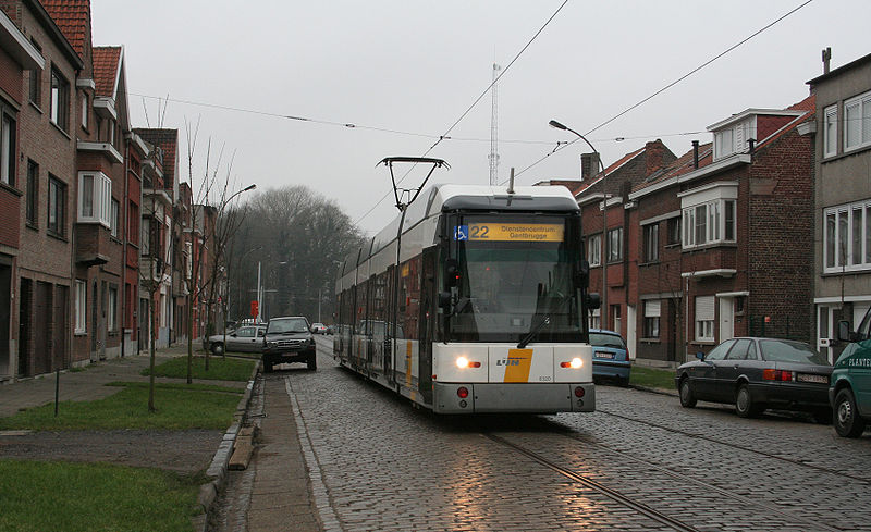
| 22 | Kouter - Sint-Pietersstation - Rozemarijnbrug - Kouter - Zuid - Stelplaats - Gentbrugge DC |
CHARACTERISTICS OF THE SYSTEM
NETWORK LENGTH
- Urban trams: 30 km.
HISTORY
- Urban trams: (horse-drawn) 24 May 1874 - ?; (battery) 1898 - 1904; (electric) 1 Dec. 1901 - today.
- Interurban trams: (steam) 1887 - 1956; (electric) 1901 - 30 May 1959.
GAUGE
- Trams : 1000 mm.
- Interurban trams (SNCV): 1000 mm.
SOURCES
- Davies, W.J.K. The Vicinal story - Light railways in Belgium, 1885-1991. Scarborough [England]: Light Rail Transit Association, 2nd ed., 2006.
- Koenot, L., Justens, S. & Hamal, T. Tram 2000 - Flash 1996. Bruxelles: Hamal, 1996.
- Pulling, N. "Gent - Expansion and modernisation", Tramways & Urban Transit, Nov. 2008 (71:851), p.423-425.
- Pulling, N. "Systems Factfile No.62 - Ghent, Belgium", Tramways & Urban Transit, Nov. 2012 (75:899), p.423-426.
- Vancraeynest, B.R. "The Gent tramways", Modern Tramway & Light Rail Transit, Jan. 1991 (54: 637), p.11-22.
- Wansbeek, C.J. "Gent: Small but perfectly formed", Tramways & Urban Transit, Jan. 2002 (64:769), p.8-11.
WIKIS
WEB SITES
Thanks to Guy Cools (from Brussels, Belgium) for corrections made to this page.
Copyright Gabor Sandi 1998-2026
Disclaimer: Everything on this site was written and/or prepared at the author's discretion. The author has tried to be accurate where facts are presented, but this does not mean that these facts are necessarily accurate. People needing more reliable information should refer to appropriate sources presented, on the Internet or elsewhere, by authoritative professional or academic bodies.
To get in touch with the webmaster, send an e-mail to g_sandi at hotmail.com.
Flags on this site are from the FOTW Flags Of The World website.