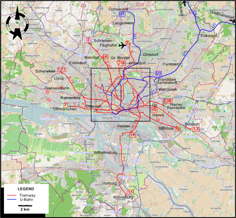
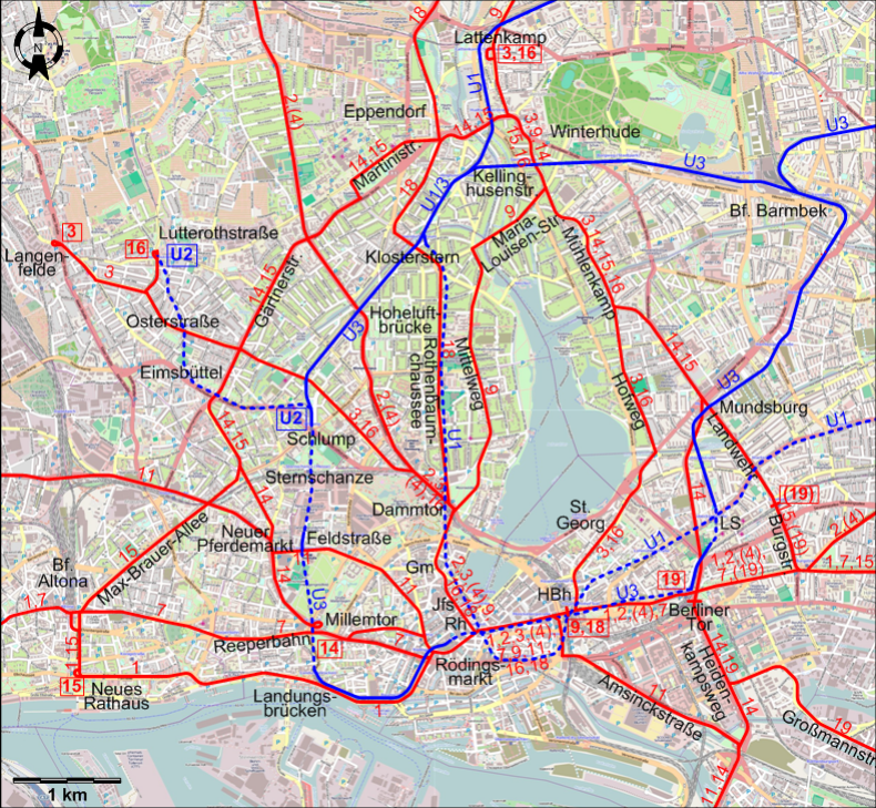
CENTRAL HAMBURG MAP
ABBREVIATIONS ON THE MAPS
>
| Ds |
Diagonalstr. |
Jfs |
Jungfernstieg |
| Gm |
Gänsemarkt |
LS |
Lübecker Straße |
| HBh |
Hauptbahnhof (Main Station) |
Rh |
Rathaus (City Hall) |
ROUTES
Operator: Hamburger Hochbahn AG
TRAM ROUTES
>
| 1 |
Schenefeld - Lurup – Bahrenfeld Trabrennbahn (Bahrenfeld Racetracks) – Bahrenfeld – Ottensen - Bf. Altona (Altona Station) – Landungsbrücken –
Rödingsmarkt – Rathaus (City Hall) - Hauptbahnhof (Main Station) - Berliner Tor – Hamm - Billstedt |
| 2 |
Schnelsen – Niendorf – Hoheluftbrücke – Dammtor – Gänsemarkt – Rathaus (City Hall) - Hauptbahnhof (Main Station) -
Berliner Tor – Horner Rennbahn (Horn Racetracks) |
| 3 |
Langenfelde – Osterstraße – Dammtor – Gänsemarkt – Rathaus (City Hall) - Hauptbahnhof (Main Station) –
St. Georg – Hofweg – Mühlenkamp – Winterhude - Lattenkamp |
| 4 |
Niendorf – Hoheluftbrücke – Dammtor – Gänsemarkt – Rathaus (City Hall) - Hauptbahnhof (Main Station) -
Berliner Tor – Horner Rennbahn (Horn Racetracks) [Rush hours only] |
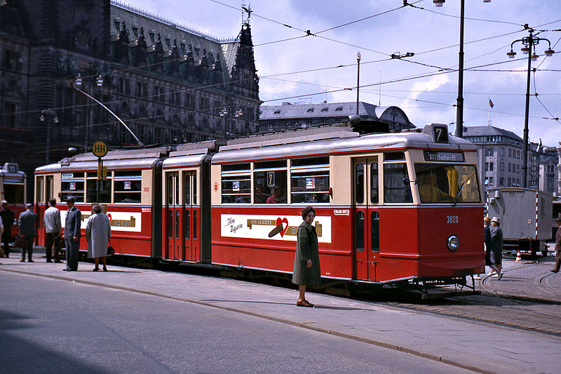
| 7 |
Othmarschen - Ottensen - Bf. Altona (Altona Station) – Reeperbahn – Rödingsmarkt – Rathaus (City Hall) -
Hauptbahnhof (Main Station) - Berliner Tor – Hamm - Billstedt |
| 9 |
Flughafen (Airport) – Alsterdorf – Lattenkamp - Winterhude – Maria-Louisen-Str. – Mittelweg – Dammtor – Gänsemarkt –
Rathaus (City Hall) – Hauptbahnhof (Main Station) |
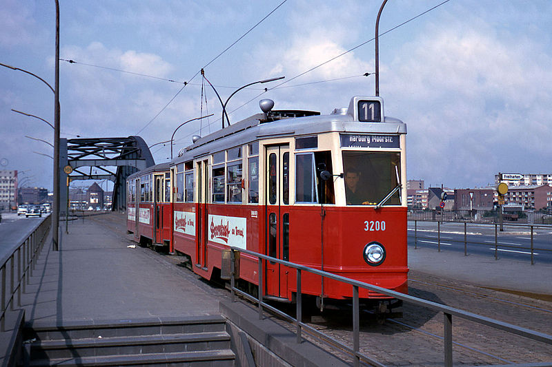
| 11 |
Schenefeld - Lurup – Bahrenfeld Trabrennbahn (Bahrenfeld Racetracks) – Neuer Pferdemarkt - Feldstraße – Rödingsmarkt – Rathaus (City Hall) – Amsinckstraße – Veddel –
Wilhelmsburg - Harburg – Rönneburg |
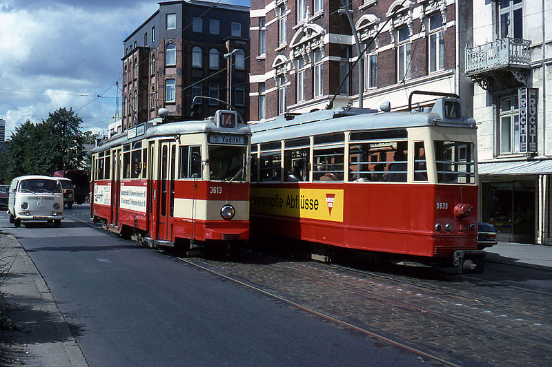
| 14 |
Millemtor - Neuer Pferdemarkt - Gärtnerstr. –
Martinistr. – Eppendorf - Winterhude - Mühlenkamp – Mundsburg - Berliner Tor – Heidenkampsweg - Veddel |
| 15 |
Neues Rathaus (New Altona City Hall) – Bf. Altona (Altona Station) – Max-Brauer-Allee – Gärtnerstr. – Martinistr. –
Eppendorf - Winterhude – Mühlenkamp – Mundsburg - Landwehr – Burgstraße - Hamm (Diagonalstr.) |
| 16 |
Lutterothstraße – Osterstraße – Dammtor – Gänsemarkt – Rathaus (City Hall) - Hauptbahnhof (Main Station) –
St. Georg – Hofweg – Mühlenkamp – Winterhude - Lattenkamp |
| 18 |
Gr. Borstel – Eppendorf – Klosterstern - Rothenbaumchaussee – Dammtor – Gänsemarkt –
Rathaus – Hauptbahnhof (Main Station) |
| 19 |
[Rush hours only: Landwehr – Burgstraße - ] Berliner Tor – Heidenkampsweg – Großmannstr. – Billbrook |
U-BAHN (UNDERGROUND) LINES
>
| U1 |
Ohlstedt / Großhansdorf - Volksdorf - Farmsen - Wandsbek Gartenstadt - Wandsbek -
Lübecker Straße - Hauptbahnhof (Main Station) - Rathaus (City Hall) - Jungfernstieg - Dammtor - Klosterstern - Kellinghusenstraße – Alsterdorf - Ohlsdorf - Langenhorn - Ochsenzoll |
| U2 |
Schlump – Lutterothstraße |
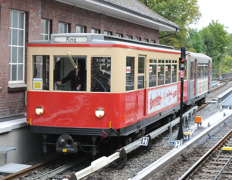
| U3 |
Hauptbahnhof (Main Station) – Berliner Tor – Mundsburg - Bf. Barmbek – Kellinghusenstraße – Hoheluftbrücke -
Schlump – Landungsbrücken – Rödingsmarkt - Rathaus – Hauptbahnhof (Main Station) [Ring line, both directions] |
| U3 |
(Branch:) Bf. Barmbek - Wandsbek Gartenstadt |
Note: U-Bahn lines in 1965 did not as yet have numbers (line numbers U1/2/3 were introduced in 1966). For convenience, however, these numbers to come
are indicated on the maps and in the line listings.
CHARACTERISTICS OF THE SYSTEM
NETWORK LENGTH
- Tramway: ? km.
- U-Bahn (underground): 74.9 km.
|