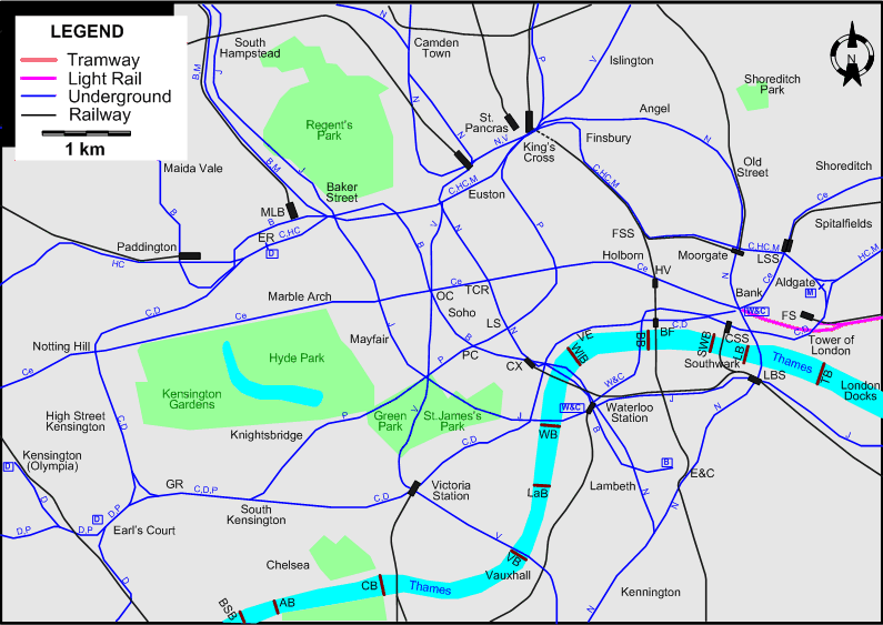
Because of the complexity of the London-area rail transportation system, there are altogether six maps showing the routes:
It is possible to by-pass the maps:
CENTRAL LONDON
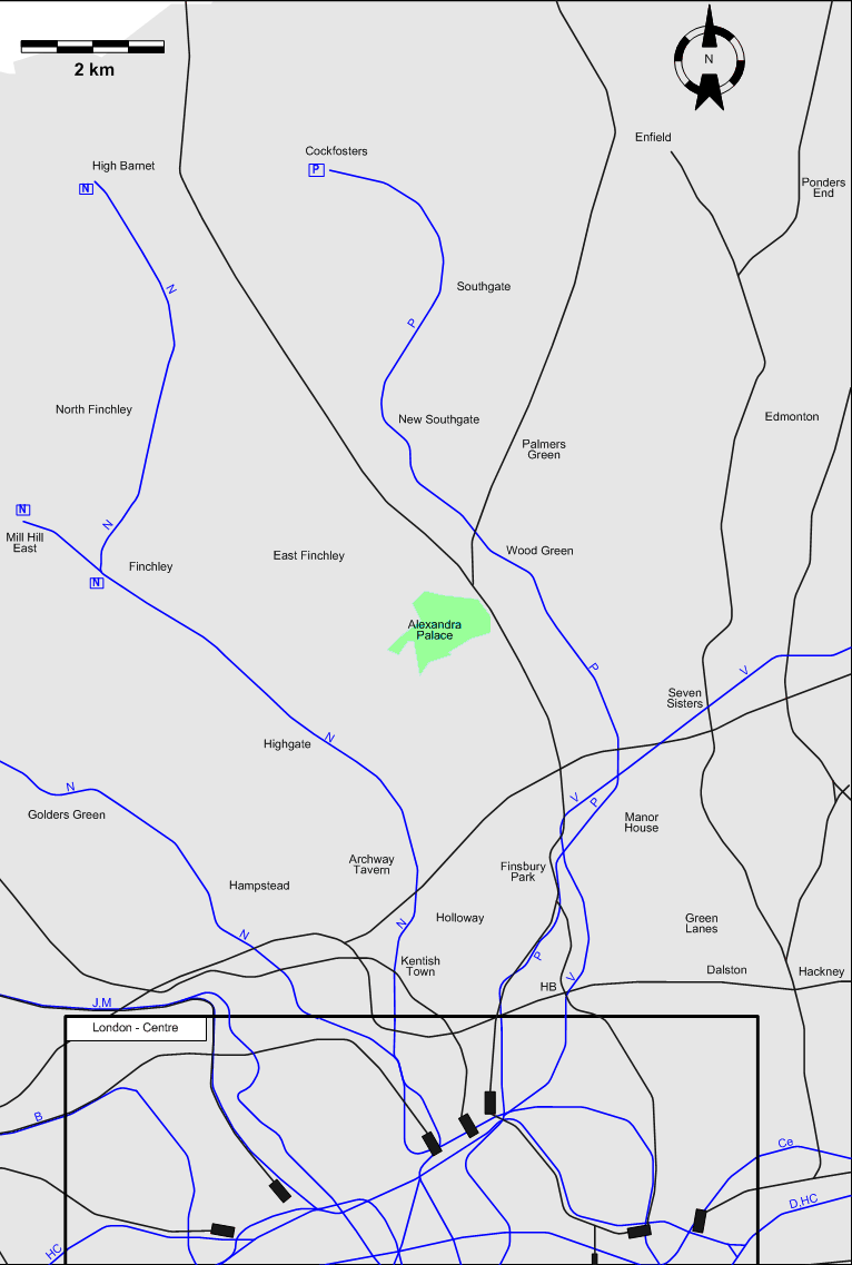
NORTH LONDON
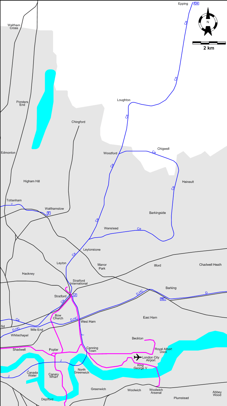
EAST LONDON
SOUTHEAST LONDON

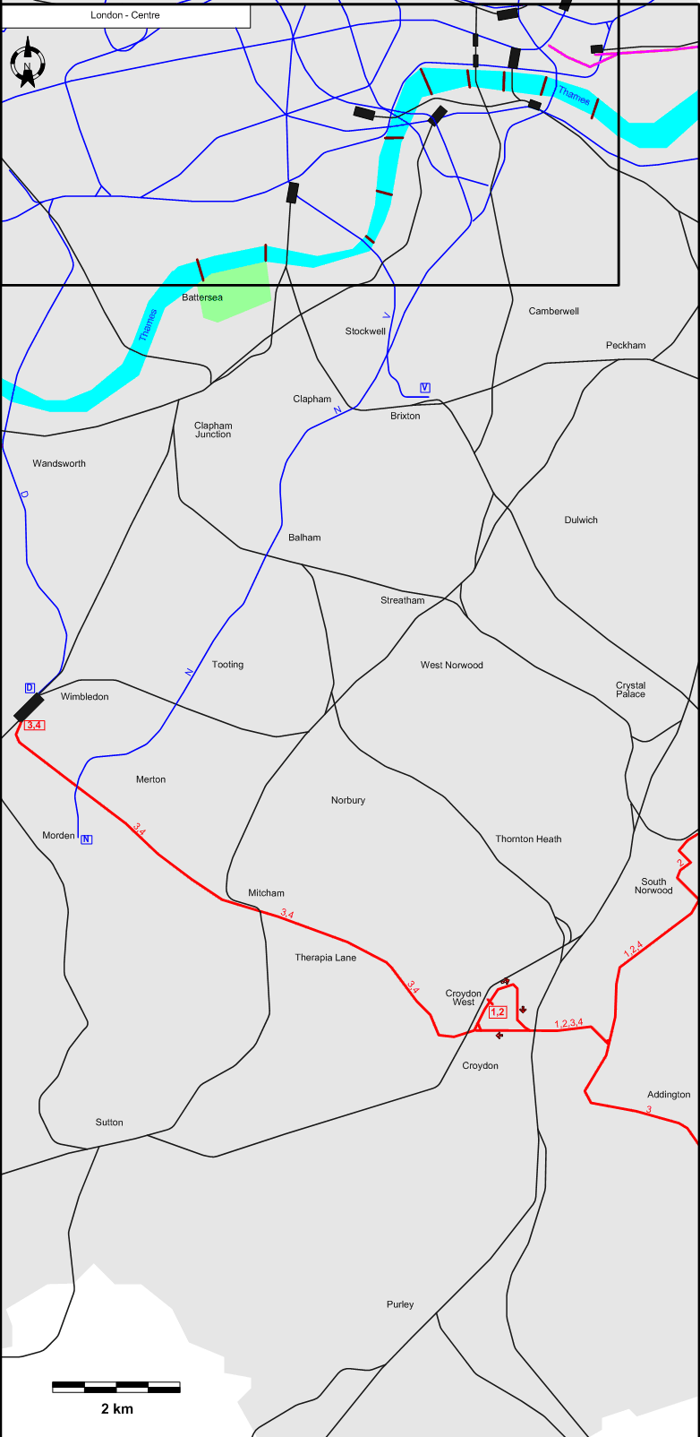
SOUTH LONDON
WEST LONDON

ABBREVIATIONS ON THE MAPS
| AB |
Albert Bridge |
LBS |
London Bridge Station |
| AT |
Acton Town |
LS |
Leicester Square |
| BB |
Blackfriars Bridge |
LSS |
Liverpool Street Station |
| BF |
Blackfriars |
MLB |
Marylebone |
| BSB |
Battersea Bridge |
OC |
Oxford Circus |
| CB |
Chelsea Bridge |
PC |
Piccadilly Circus |
| CSS |
Cannon Street Station |
SB |
Shepherd's Bush |
| CX |
Charing Cross |
Sd |
Shoreditch |
| E&C |
Elephant & Castle |
SWB |
Southwark Bridge |
| ER |
Edgware Road |
TB |
Tower Bridge |
| FS |
Fenchurch Street Station |
TCR |
Tottenham Court Road |
| FSS |
Farringdon Street Station |
TG |
Turnham Green |
| GR |
Gloucester Road |
VB |
Vauxhall Bridge |
| HB |
Highbury Station |
VE |
Victoria Embankment |
| HV |
Holborn Viaduct Station |
WB |
Westminster Bridge |
| LaB |
Lambeth Bridge |
WlB |
Waterloo Bridge |
| LB |
London Bridge |
|
|
Operator: Transport for London (TfL)
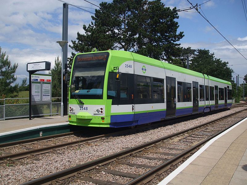
TRAM ROUTES (TRAMLINK)
| 1 |
West Croydon - Woodside - Beckenham Junction |
| 2 |
West Croydon - Woodside - Elmers End |
| 3 |
Wimbledon - Mitcham - Therapia Lane - Croydon - Addington - New Addington |
| 4 |
Wimbledon - Mitcham - Therapia Lane - Croydon - Woodside - Elmers End |
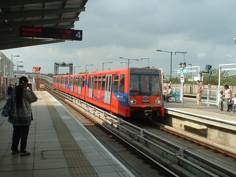
LIGHT RAIL ROUTES (DOCKLANDS LIGHT RAILWAY [DLR])
| |
Bank - Shadwell - Poplar - Canning Town - London City Airport - King George V - Woolwich Arsenal |
| |
Bank - Shadwell - Canary Wharf - Greenwich - Lewisham |
| |
Tower Gateway - Shadwell - Poplar - Canning Town - Royal Albert Dock - Beckton |
| |
Stratford - Bow Church - Poplar - Canary Wharf - Greenwich - Lewisham |
| |
Stratford International - Stratford - West Ham - Canning Town - Royal Albert Dock - Beckton |
| |
Stratford International - Stratford - West Ham - Canning Town - London City Airport - King George V - Woolwich Arsenal [Weekday
peak hours only] |
UNDERGROUND ROUTES
Note: The one- or two-letter route designations are strictly local to this site, and have never been used by the operating companies. Branches of individual lines are listed separately.
| B |
Bakerloo Line |
Elephant & Castle – Waterloo – Charing Cross – Piccadilly Circus – Oxford Circus – Marylebone – Paddington – Maida Vale – Harlesden – Wembley – Harrow & Wealdstone – Watford Junction |
| C |
Circle Line |
Gloucester Road – South Kensington – Victoria Station – Embankment – Blackfriars – Aldgate – Liverpool Street Station – Moorgate
- Farringdon Street Station – King's Cross St Pancras – Euston - Baker Street - Edgware - Paddington - Notting Hill - High Street Kensington - Gloucester Road [Circular route, both directions] |
| Ce |
Central Line |
Epping - Loughton - Woodford - Leytonstone - Leyton - Startford - Mile End - Liverpool Street Station – Bank – Holborn – Tottenham Court Road –
Oxford Circus – Marble Arch – Notting Hill – Shepherd's Bush – North Acton - Ealing Broadway |
| Ce |
Central Line |
[Branch]: Woodford - Chigwell - Hainault - Barkingside - Wanstead - Leytonstone |
| Ce |
Central Line |
[Branch]: North Acton - Greenford - West Ruislip |
| D |
District Line |
[Ealing Broadway – Acton Town] / [Richmond] – Turnham Green – Hammersmith – Earl's Court – Gloucester Road – South Kensington – Victoria Station – Embankment – Blackfriars – Aldgate – Whitechapel – Mile End – Barking – Dagenham – Upminster |
| D |
District Line |
[Branch:] Edgware Road – Paddington Station – Notting Hill – High Street Kensington – Earl's Court – Putney – Wimbledon |
| D |
District Line |
[Branch:] Earl's Court - Kensington (Olympia) |
| HC |
Hammersmith & City Line |
Hammersmith – Shepherd's Bush – Paddington – Edgware – Baker Street – Euston – King's Cross St Pancras – Farringdon Street Station – Moorgate – Liverpool Street Station –
Aldgate - Whitechapel – Mile End – Barking |
| J |
Jubilee Line |
Stratford - West Ham - North Greenwich - Canary Wharf - Canada Water - London Bridge - Waterloo -
Westminster - Baker Street – South Hampstead – Wembley Park – Stanmore |
| M |
Metropolitan Line |
Aldgate - Liverpool Street Station – Moorgate – Farringdon Street Station – King's Cross St Pancras – Euston – Baker Street – South Hampstead – Wembley Park – Harrow – Ruislip – Uxbridge |
| M |
Metropolitan Line |
[Branch:] Harrow – Moor Park – Watford / Chesham / Amersham |
| N |
Northern Line |
Edgware – Hendon – Golders Green – Hamstead – Camden Town – Euston – Tottenham Court Road – Leicester Square – Charing Cross – Waterloo – Kennington – Stockwell – Clapham – Tooting – Morden |
| N |
Northern Line |
[Branch:] High Barnet - Finchley - Highgate - Archway – Kentish Town – Camden Town |
| N |
Northern Line |
[Branch:] Mill Hill East - Finchley |
| N |
Northern Line |
[Branch:] Camden Town – Euston – King's Cross St.Pancras – Angel – Old Street – Moorgate – Bank – Elephant & Castle – Kennington |
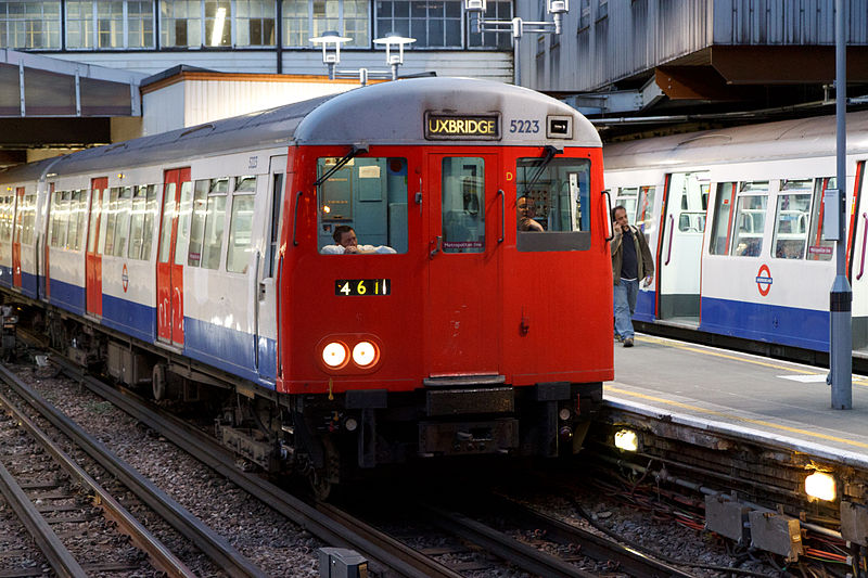
| P |
Piccadilly Line |
Uxbridge – Ruislip – Sudbury – North Ealing – Acton Town – Turnham Green – Hammersmith – Earl's Court – Gloucester Road – South Kensington – Knightsbridge – Piccadilly Circus –
Leicester Square – Holborn – King's Cross St.Pancras – Finsbury Park – Manor House – Wood Green – Southgate – Cockfosters |
| P |
Piccadilly Line |
[Branch:] Heathrow Airport - Hounslow West – Acton Town |
| V |
Victoria Line |
Walthamstow - Tottenham - Seven Sisters - Finsbury Park - Islangton - King's Cross St.Pancras - Euston - Oxford Circus - Victoria - Vauxhall - Stockwell - Brixton |
| W&C |
Waterloo & City Line |
Waterloo – Bank |
NETWORK LENGTH
- Tramway (Tramlink): 75 km.
- Light rail (DLR): 28 km.
- Underground: 401 km.
|