 |
 |
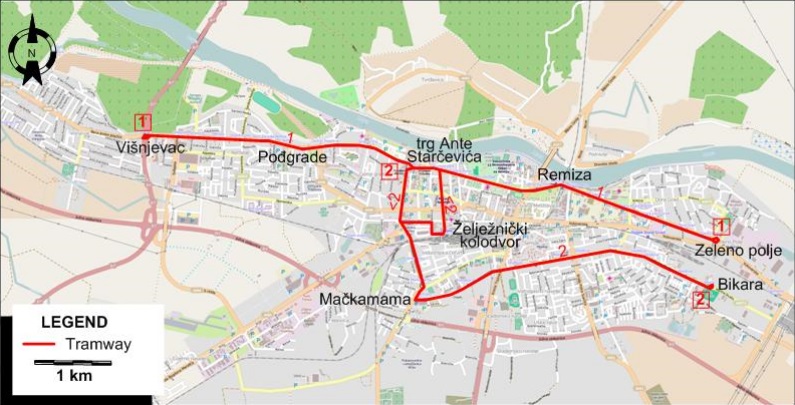
I created the above map by overlaying OpenStreetMap (OSM) maps with my own data. The underlying map data is © OpenStreetMap contributors, licensed under the Open Database License (ODbL).
Please note that the OSM map used as a template for this map corresponds to the situation at the time the map was downloaded and may show features that did not exist at the time the GS Tram Site is supposed to show. In particular, it may show bridges and highways that were built later.
ROUTES
Operator: Gradski prijevoz putnika d.o.o. Osijek (GPP Osijek)
TRAM ROUTES
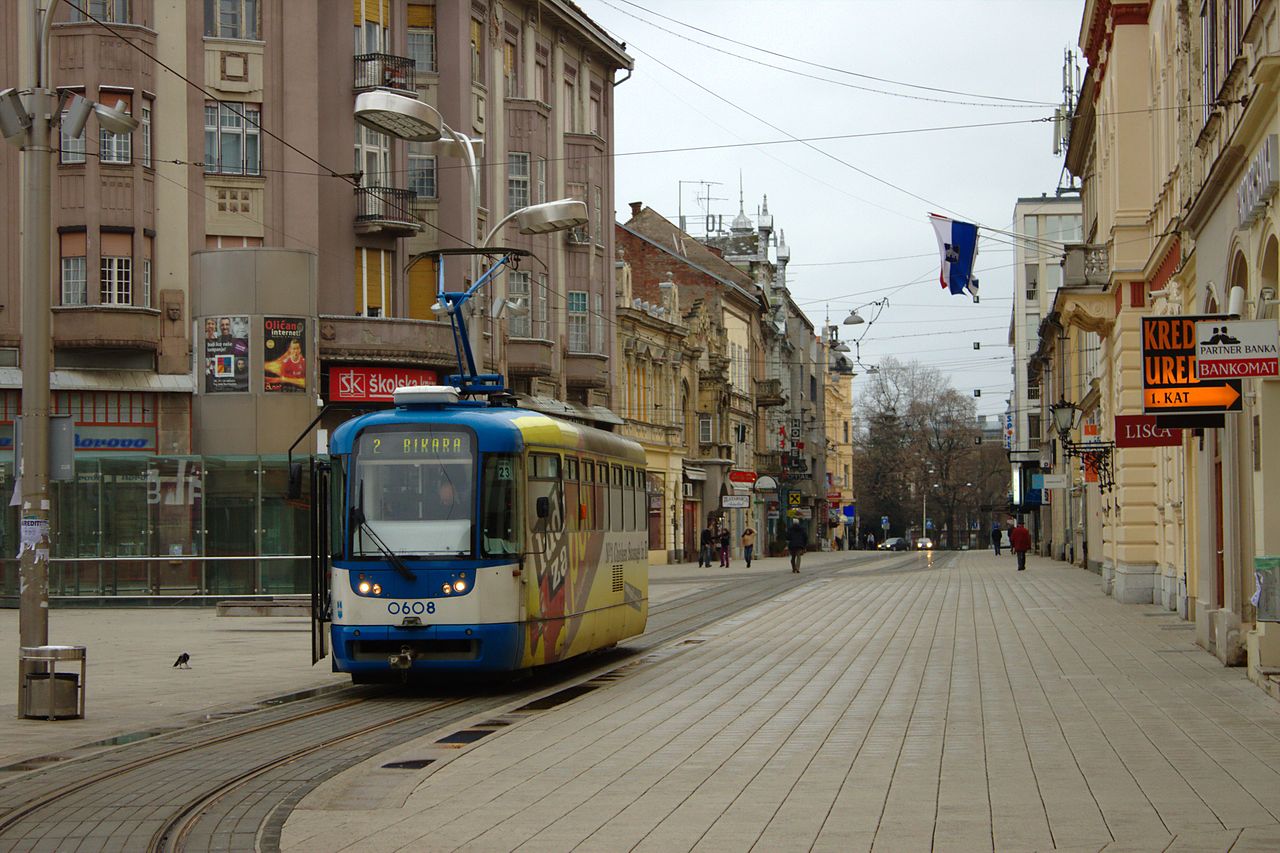
| 1 | Višnjevac – Pođgrade – trg Ante Starčevića – Remiza – Zeleno polje |
| 2 | trg Ante Starčevića [back through Želježnički kolodvor (Railway Station)] – Mačkamama – Bikara |
CHARACTERISTICS OF THE SYSTEM
NETWORK LENGTH
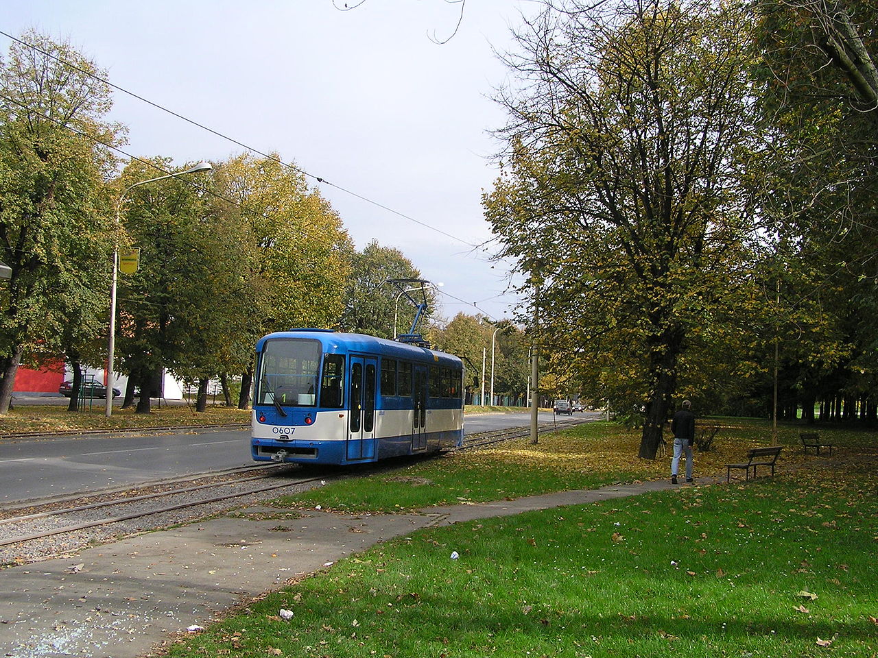
- Tramway: 12 km.
HISTORY
- Horse-drawn trams: 10 Sept. 1884 - 1926; City trams: 31 March 1926 - today.
GAUGE
- Electric trams: 1000 mm.
SOURCES
- Lehnhart, H. & Jeanmaire, C. Tramway systems of Eastern Europe II. Villigen AG (Switzerland): Verlag Eisenbahn, 1977.
- Simons, V. "Croatian tramways today" Tramways & Urban Transit. Jan. 2011 (74: 877), p.15-18.
WIKIS
WEB SITES
- Gradski prijevoz putnika d.o.o. Osijek (GPP Osijek)
- Osijek (on UrbanRail.Net)
Copyright Gabor Sandi 1998-2026
Disclaimer: Everything on this site was written and/or prepared at the author's discretion. The author has tried to be accurate where facts are presented, but this does not mean that these facts are necessarily accurate. People needing more reliable information should refer to appropriate sources presented, on the Internet or elsewhere, by authoritative professional or academic bodies.
To get in touch with the webmaster, send an e-mail to g_sandi at hotmail.com.
Flags on this site are from the FOTW Flags Of The World website.