INSET: CENTRAL DUBLIN
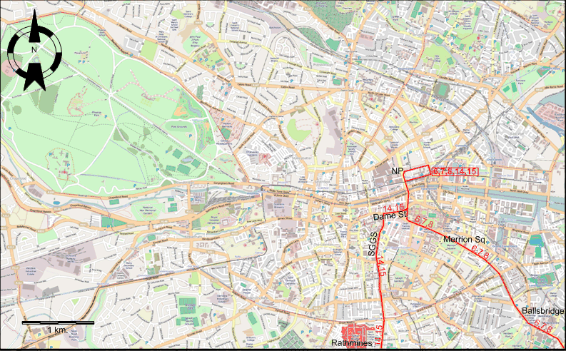
Note: Names of streets, squares etc. used below are those used at the time of the map - when different, today's names are added in square brackets. The maps use today's names only.
ABBREVIATIONS ON THE MAPS
| NP |
Nelson Pillar |
SGGS |
South Great George's Street |
ROUTES
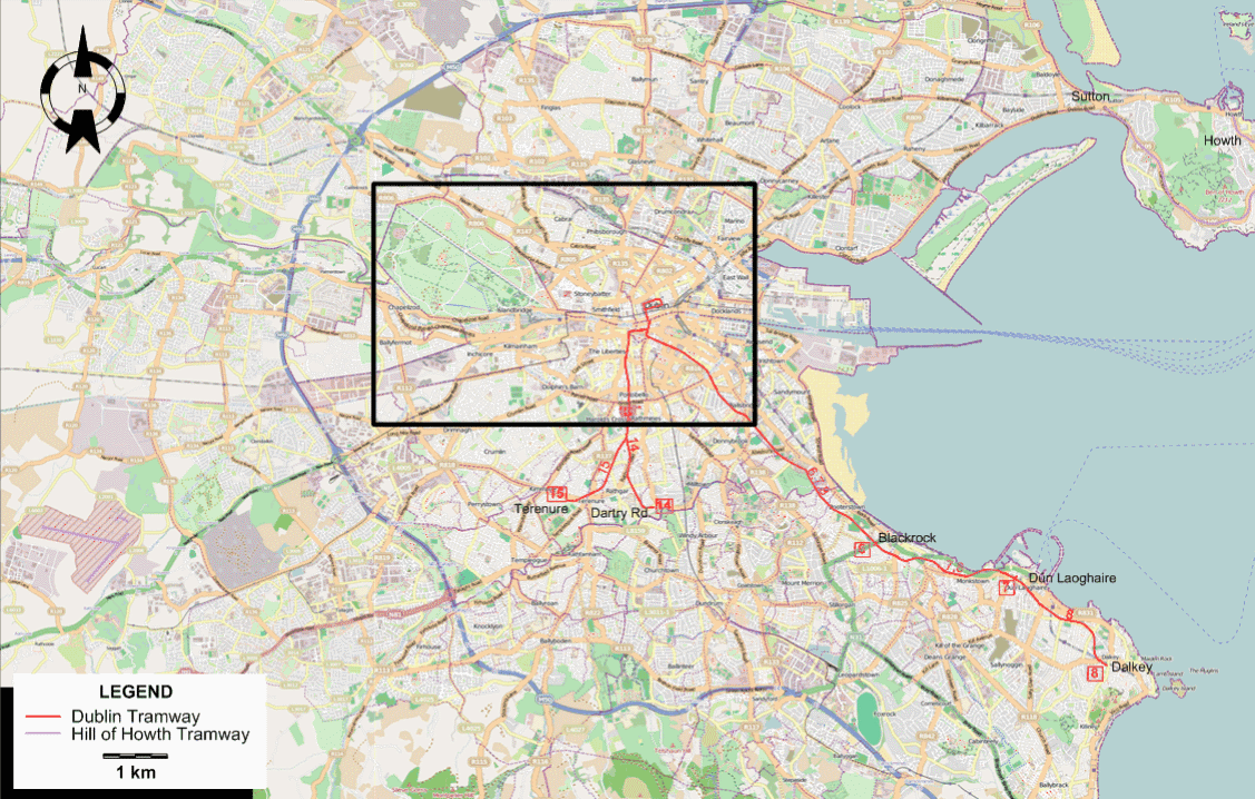
Dublin tramways
Operator: Córas Iompair Éireann (CIÉ) (Transport System of Ireland)
| 6 |
Nelson Pillar - Merrion Sq. - Ballsbridge - Blackrock |
| 7 |
Nelson Pillar - Merrion Sq. - Ballsbridge - Blackrock - Dún Laoghaire |
| 8 |
Nelson Pillar - Merrion Sq. - Ballsbridge - Blackrock - Dún Laoghaire - Dalkey |
| 14 |
Nelson Pillar - Dame St. - South Great George's St. - Rathmines - Dartry Rd. |
| 15 |
Nelson Pillar - Dame St. - South Great George's St. - Rathmines - Terenure |
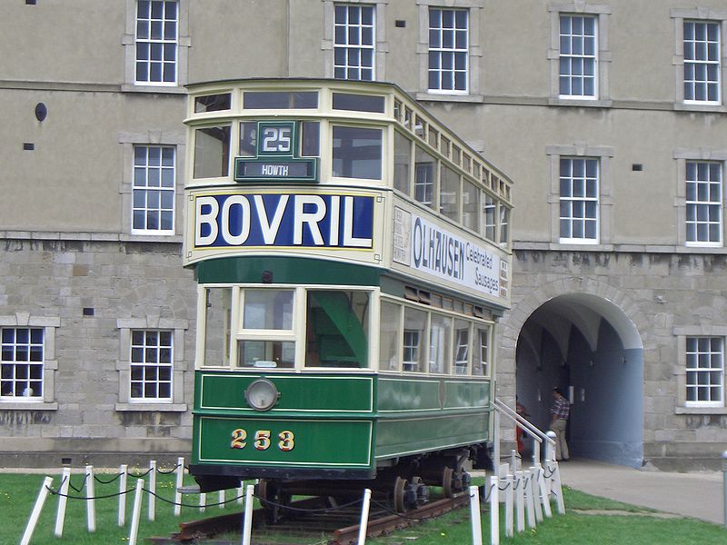
Hill of Howth Tramway
Operator: Great Northern Railway (Ireland) (GNR(I))
Dates of abandonment of routes:
- 30 March 1929: 22*
- 31 July 1932: 4*
- 16 Apr. 1938: 23, 24
- 31 May 1938: 30
- 1 Jan. 1939: 12
- 5 March 1939: 19,20
- 1 May 1939: 16,17
- 2 July 1939: 11
- 4 Feb. 1940: 21
- 26 March 1940: 1, 2, 3
- 12 Apr. 1940: 25, 26
- 1 Dec. 1940: 18
- 2 June 1940: 10
- 6 June 1940: 9
- 29 March 1941: 31
- 31 Oct. 1948: 14,15
- 9 July 1949: 6,7,8
* These lines were already abandoned before 1938.
NETWORK LENGTH
- Dublin Tramways: ca. 15 km.
- Hill of Howth Tramway: 9 km.
|