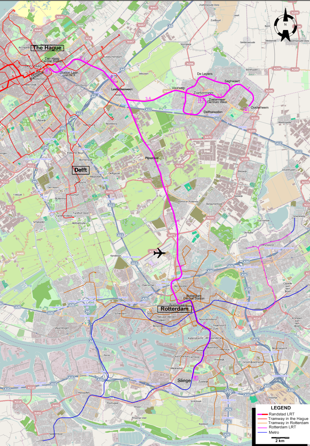
The RandstadRail Light Rapid Rail system, joining The Hague, Rotterdam and nearby smaller municipalties, is shown on a separate map in its entirety.
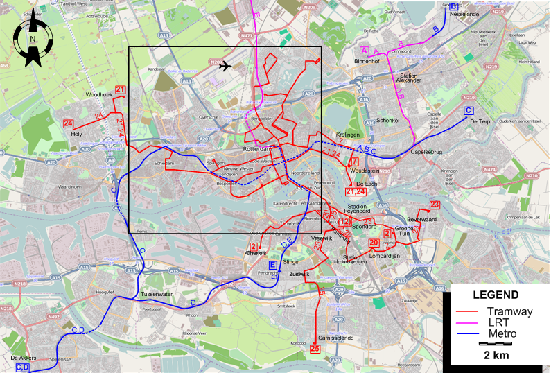
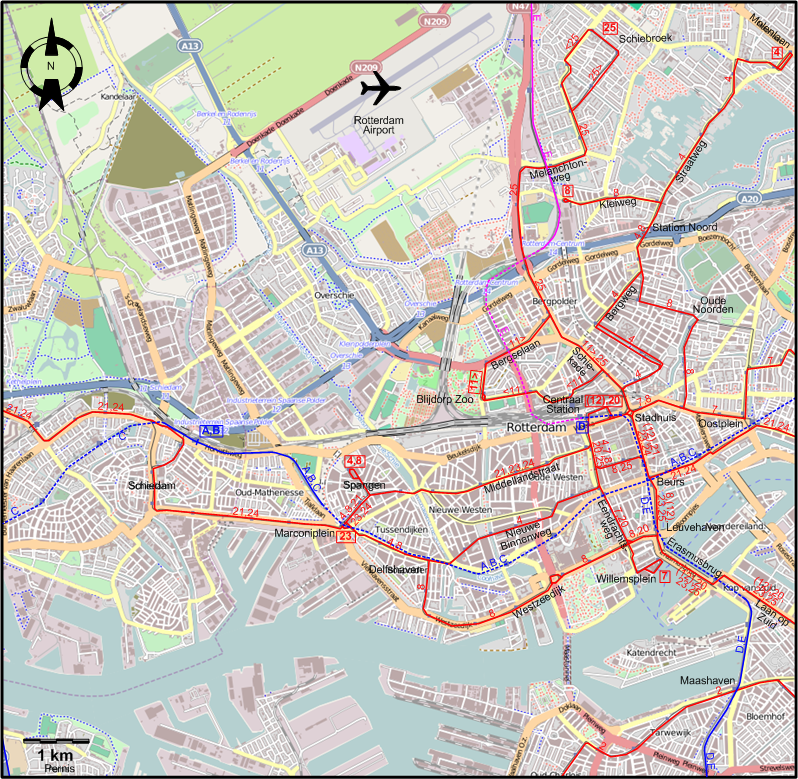
INSET: CENTRAL ROTTERDAM
By-pass the Randstad system map.
THE RANSTADRAIL SYSTEM
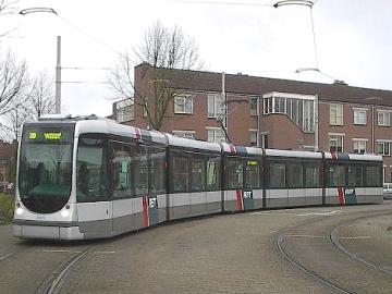
Operator: RET
URBAN TRAM ROUTES
| 2 |
Charlois – Maashaven – Randweg – Station Lombardijen - Lombardijen – Groene Tuin |
| 4 |
Spangen - Marconiplein – Delfshaven – Nieuwe Binnenweg - Centraal Station – Bergweg – Station Noord – Straatweg - Molenlaan |
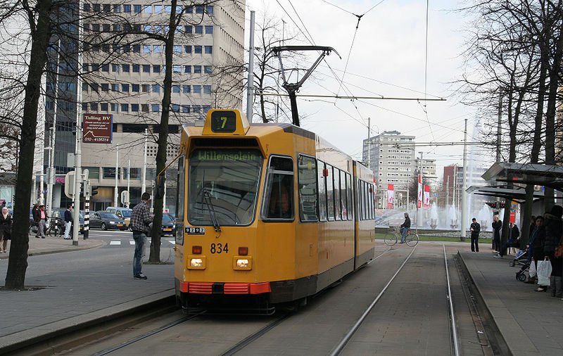
| 7 |
Willemsplein – Eendrachtsweg - Centraal Station – Stadhuis – Hofplein – Oostplein – Kralingen – Woudestein |
| 8 |
Spangen – Marconiplein – Delfshaven – Westzeedijk – Leuvehaven – Beurs - Centraal Station – Stadhuis
– Oude Noorden – Station Noord – Kleiweg |
| 11 |
Blijdorp Zoo – Bergselaan - Schiekade - Centraal Station (north entrance) – Blijdorp Zoo [Circular route, clockwise] |
| 12 |
Centraal Station – Stadhuis – Leuvehaven – Erasmusbrug – Laan op Zuid – Stadion Feyenoord [Only for football games and other special events at
Feyenoord stadium] |
| 20 |
Centraal Station – Eendrachtsweg – Leuvehaven – Erasmusbrug – Laan op Zuid – Randweg – Station Lombardijen - Lombardijen |
| 21 |
De Esch – Woudestein – Oostplein – Beurs - Stadhuis - Centraal Station – Middellandstraat – Marconiplein –
Schiedam – Woudhoek |
| 23 |
Beverwaard – Groene Tuin – Sportdorp – Laan op Zuid – Erasmusbrug – Leuvehaven – Beurs - Stadhuis -
Centraal Station – Middellandstraat – Marconiplein |
| 24 |
De Esch – Woudestein – Oostplein – Beurs - Stadhuis - Centraal Station – Middellandstraat – Marconiplein –
Schiedam – Holy |
| 25 |
Carnisselande – Zuidwijk - Vreewijk – Randweg – Laan op Zuid – Erasmusbrug – Leuvehaven – Beurs -
Centraal Station – Schiekade - Bergpolder – Melanchton
weg - Schiebroek |
METRO AND LRT ROUTES
| A |
Binnenhof – Station Alexander - Schenkel – Capelsebrug – Oostplein - Beurs – Delfshaven – Marconiplein – Schiedam [Sneltram (Fast Tram) between Binnenhof & Capelsebrug] |
| B |
Nesselande – Station Alexander - Schenkel – Capelsebrug – Oostplein - Beurs – Delfshaven – Marconiplein – Schiedam [Sneltram (Fast Tram) between Nesselande & Capelsebrug] |
| C |
De Terp – Capelsebrug – Oostplein - Beurs – Delfshaven – Marconiplein – Schiedam – Pernis – Tussenwater – De Akkers |
| D |
Centraal Station – Beurs – Leuvehaven – Maashaven – Slinge – Tussenwater – De Akkers |
| E |
Den Haag Centraal Station – Station Laan van NOI – Leidschenveen – Pijnacker – Berkel en Rodenrijs – Rotterdam Centraal Station
Beurs – Leuvehaven – Maashaven – Slinge [Between Den Haag Centraal Station - Rotterdam Centraal Station is the LRT line formerly known as
the Erasmuslijn, between Rotterdam Centraal Station - Slinge, runs in the metro tunnel] |
CHARACTERISTICS OF THE SYSTEM
NETWORK LENGTH
- Urban trams: ? km.
- Metro: 55 km. (incl. 8.4 km of Sneltram (Fast Tram))
- LRT lines (shared with The Hague): 68 km.
|