FIRST INSET: DOWNTOWN LOS ANGELES

SECOND INSET: THE LOS ANGELES REGION
Note: For the sake of clarity, only interurban (PE) routes are shown on this map.

ROUTES
STREETCAR ROUTES
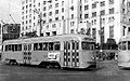
Operator: Los Angeles Metropolitan Transit Authority (LAMTA) ["Yellow Cars"]
| J |
Jefferson Park – Jefferson Blvd. – Grand Av. – 7th St. – Santa Fe Av. – Pacific Blvd. – Huntington Park |
| P |
Brooklyn Av. [today: Cesar Chavez Av.] – 1st St. – Broadway – Pico Blvd. – Mid City (Rimpau Loop) |
| R |
3rd & Western – 3rd St. – Vermont Av. – 7th St. – Whittier Ave. – East Los Angeles (Brannock Av.) |
| S |
8th & Western – 8th St. – Vermont Av. – 7th St. – San Pedro St. – Avalon Blvd. –
Central Av. – Watts (Manchester Av.) |
| V |
East Holliwood (Monroe St.) – Vermont Av. – Vernon Av. – Vernon Yard |
INTERURBAN ROUTES
Operator: Pacific Electric Railway ["Red Cars"]
Note: The two-character codes used to identify routes below and in the maps are for convenience only, and were not used by the operating company.
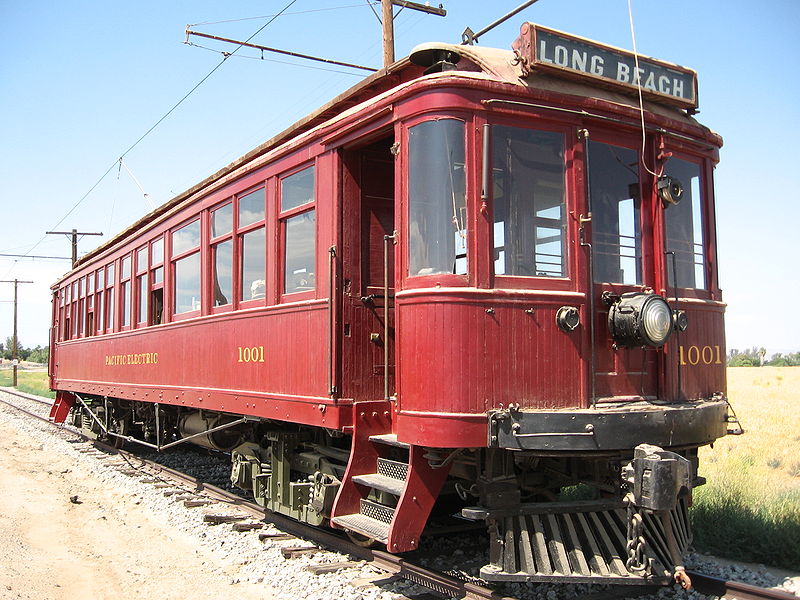
| LB |
Long Beach |
6th & Main – Main – 9th St. – Long Beach Av. – Willowbrook Av. – Long Beach |
| WA |
Watts Local |
6th & Main – Main – 9th St. – Long Beach Av. – Watts |
The last two interurban routes were discontinued on 9 April 1961. The last streetcar lines were discontinued in 1963.
CHARACTERISTICS OF THE SYSTEM
NETWORK LENGTH
- Streetcar lines: ? km.
- Interurban lines: ? km.
|