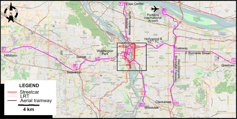
INSET: DOWNTOWN PORTLAND
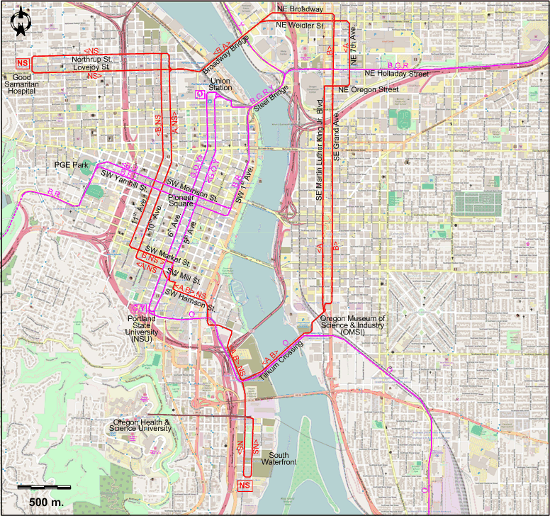
Operator: TriMet (Tri-County Metropolitan Transportation District of Oregon)
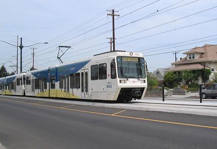
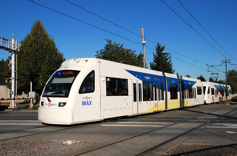
LIGHT RAIL ROUTES
| B |
Blue Line |
Hillsboro – Beaverton – Sunset – Washington Park – PGE Park – Library / SW 9th – Pioneer Square – SW 1st Ave. – Steel Bridge – NE Holladay Street –
Hollywood & 42nd TC – Gateway – E Burnside Street – Gresham |
| G |
Green Line |
Portland State University (PSU) – 6th Ave. [back: 5th Ave.] (past Pioneer Square) – Union Station – Steel Bridge – NE Holladay Street – Hollywood & 42nd TC – Gateway –
War Veterans Memorial Freeway – Clackamas |
| O |
Orange Line |
Union Station – 5th Ave. [back: 6th Ave.] (past Pioneer Square) - Portland State University (PSU) –
Tilikum Crossing - Milwaukie |
| R |
Red Line |
Beaverton – Sunset – Washington Park – PGE Park – Library / SW 9th – Pioneer Square – SW 1st Ave. – Steel Bridge – NE Holladay Street –
Hollywood & 42nd TC – Gateway – Portland International Airport |
| Y |
Yellow Line |
Portland State University (PSU) – 6th Ave. [back: 5th Ave.] (past Pioneer Square)
– Union Station – Steel Bridge – North Insterstate Avenue – Expo Center |
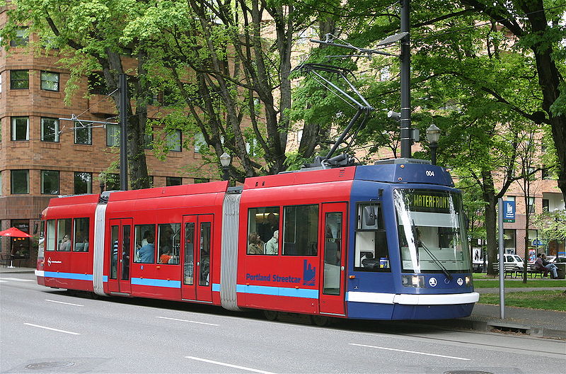
STREETCAR ROUTES
| A |
A Loop Streetcar Line |
Oregon Museum of Science & Industry (OMSI) – Tilikum Crossing - SW Harrison St. –
SW Mill St. - 10th Ave. - Broadway Bridge - NE Weidler St. - NE 7th Ave. - NE Oregon Street -
SE Martin Luther King Jr. Blvd. - Oregon Museum of Science & Industry (OMSI) [Loop line, clockwise] |
| B |
B Loop Streetcar Line |
Oregon Museum of Science & Industry (OMSI) – SE/NE Grand Ave. -
NE Broadway - Broadway Bridge - 11th Ave. – SW Market St. [back: SW Mill St.] -
SW Harrison St. – Tilikum Crossing - Oregon Museum of Science & Industry (OMSI) [Loop line, counterclockwise] |
| NS |
North-South Streetcar Line |
Good Samaritan Hospital – Lovejoy St. [back: Northrup St.] –
11th Ave. [back: 10th Ave.] –
SW Harrison St. – South Waterfront |
Note: Route designations by letter are not used by the operator.
AERIAL TRAMWAY (CABLE CAR) ROUTE
Operator: Oregon Health & Science University (OHSU)
| |
|
South Waterfront - Oregon Health & Science University (OHSU) |
CHARACTERISTICS OF THE SYSTEM
NETWORK LENGTH
- Streetcar line: 13 km.
- Light rail lines: 96 km.
- Aerial tramway: 1 km.
|