VIDEOS
 |
 |
 |
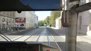
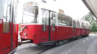
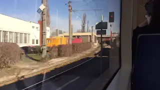
| Above: YouTubeCA video - 2017.08.15 Tram ride in Vienna, Austria - Length: 5:38 mins. | Above: YouTubeCA video - Straßenbahn Wien Trams in Vienna - Length: 36:30 mins. | Above: YouTubeCA video - Strassenbahnen in Wien 1988 - Length: 15:32 mins. |
 |
 |
 |
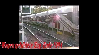
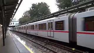
| Above: YouTubeCA video - Die U6 Wien 1993-1994 - Alser Strasse-Heiligenstadt - Length: 7:11 mins. | Above: YouTubeCA video - Vienna, Austria - U-Bahn HD (2013) - Length: 3:59 mins. | Above: YouTubeCA video - Lokalbahn Wien–Baden (Tram-Treno) - Length: 8:23 mins. |
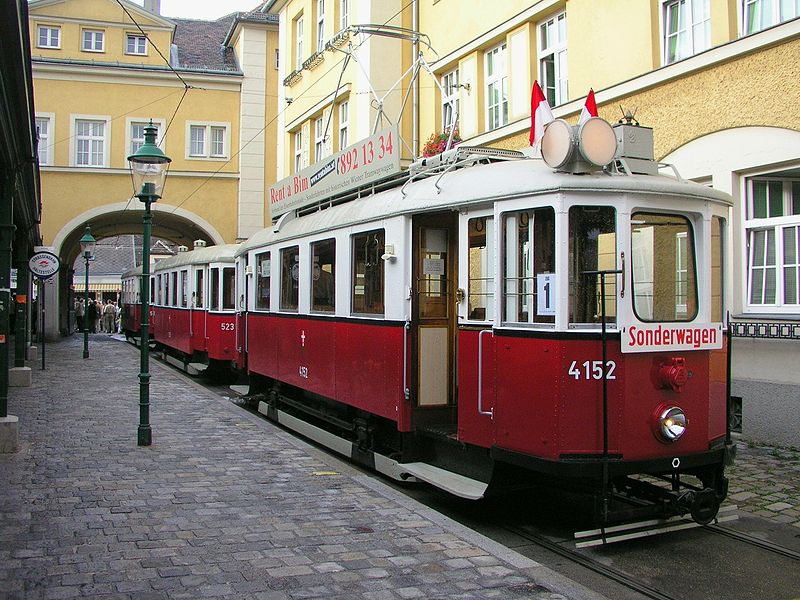
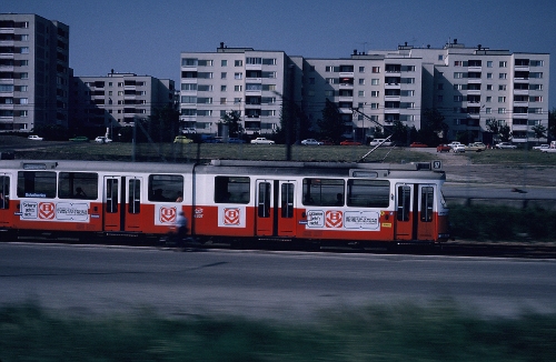
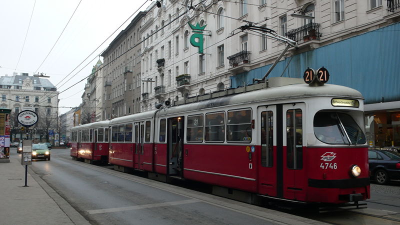
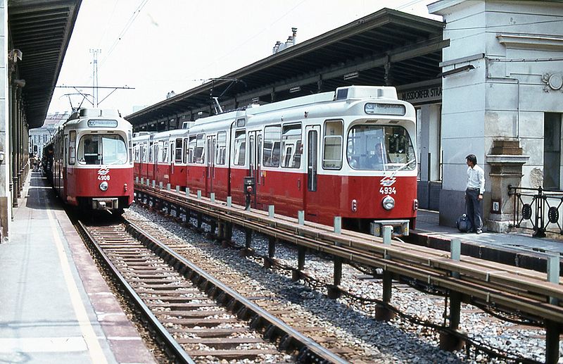
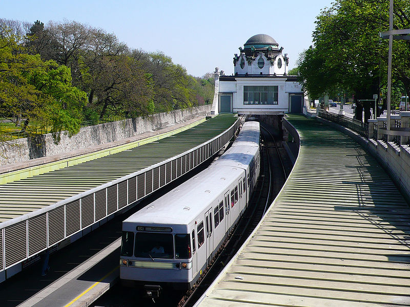
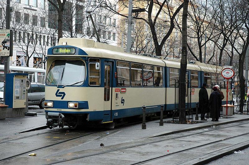
PHOTOS
 |
 |
 |
 |
 |
 |
MAPS
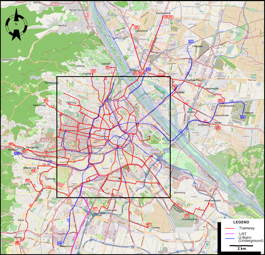
INSET: CENTRAL VIENNA
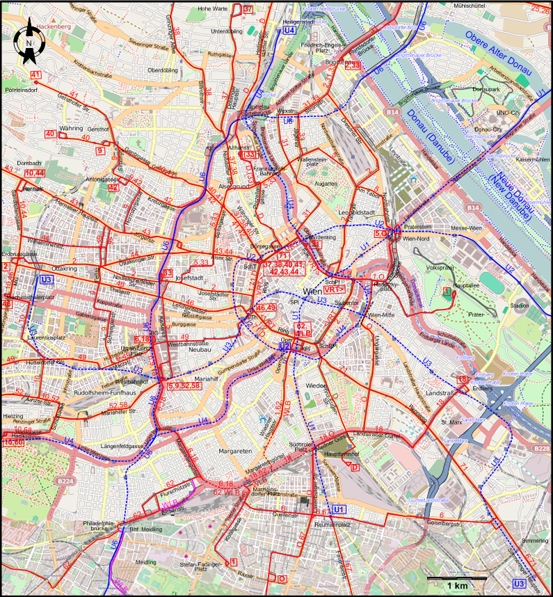
ABBREVIATIONS ON THE MAPS
| BG | Burggasse (Stadthalle) | SchBPl | Schwarzenbergplatz |
| FJK | Franz-Josefs-Kai | SchPl | Schwedenplatz |
| HH | Hietzinger Hauptstraße | SchT | Schottentor |
| Kpl | Karlsplatz | SPl | Stephansplatz |
| LS | Lainzer Straße | Ts | Tokiostraße |
| MG | Maroltingergasse | VTh | Volkstheater |
| NRG | Neilreichgasse |
I created the above maps by overlaying OpenStreetMap (OSM) maps with my own data. The underlying map data is © OpenStreetMap contributors, licensed under the Open Database License (ODbL).
Please note that the OSM maps used as a template for these maps corresponds to the situation at the time the map was downloaded and may show features that did not exist at the time the GS Tram Site is supposed to show. In particular, it may show bridges and highways that were built later.
DISCONTINUATION DATES OF TRAM TRACKS BETWEEN 5 OCT. 2013 AND 2 SEPT. 2017 (affected route numbers in parentheses).
- 2017 Sept. 2: Reumannplatz - Favoritenstraße – Oberlaa (Kurzentrum) (67)
ROUTES
Operator: Wiener Linien
URBAN TRAM ROUTES
| D | Nußdorf (Beethovengang) – Heiligenstädter Straße – Franz-Josefs-Bahnhof – Porzellangasse – Ring – Prinz-Eugen-Straße – Hauptbahnhof |
| O | Praterstern – Franzensbrücke – Radetzkyplatz – Bahnhof Wien-Mitte – Ungargasse – Hauptbahnhof – Wiedner Gürtel – Südtiroler Platz – Laxenburger Straße – Neilreichgasse - Raxstraße |
| VRT | Schwedenplatz – Stubentor – Schwarzenbergplatz – Oper – Volkstheater – Schottentor – Schottenring – Franz-Josefs-Kai – Schwedenplatz [Vienna-Ring-Tram: Circular route, clockwise – Special fare] |
| 1 | Prater-Hauptallee – Radetzkyplatz – Schwedenplatz – Franz-Josefs-Kai – Ring – Oper – Wiedner Hauptstraße – Margaretengürtel – Knöllgasse – Stefan-Fadinger-Platz |
| 2 | Friedrich-Engels-Platz – Dresdner Straße – Taborstraße – Schwedenplatz – Ring – Josefstädter Straße – Neulerchenfelder Straße – Ottakringer Straße – Ottakring (Erdbrustgasse) |
| 5 | Westbahnhof – Kaiserstraße – Spitalgasse – Franz-Josefs-Bahnhof – Wallensteinplatz – Am Tabor – Nordbahnstraße – Praterstern |
| 6 | Burggasse (Stadthalle) – Urban-Loritz-Platz – Westbahnhof – Margaretengürtel – Matzleinsdorfer Platz – Quellenstraße – Reumannplatz - Geiselbergstraße – Simmeringer Hauptstraße – Zentralfriedhof - Kaiserebersdorf (Zinnergasse) |
| 9 | Westbahnhof – Urban-Loritz-Platz – Märzstraße – Schweglerstraße – Feßtgasse – Hormayrgasse – Kreuzgasse – Simonygasse – Gersthof (Wallrißstraße) |
| 10 | Dornbach (Güpferlingstraße) – Sandleitengasse – Ottakring – Maroltingergasse – Joachimsthalerplatz – Laurentiusplatz – Linzer Straße – Schloßallee – Hadikgasse – Hietzing (Kennedybrücke) |
| 18 | Burggasse (Stadthalle) – Urban-Loritz-Platz – Westbahnhof – Margaretengürtel – Wiedner Gürtel – Südtiroler Platz – Hauptbahnhof – Landstraßer Gürtel – St. Marx – Erdberg |
| 25 | Aspern (Oberdorfstraße) – Donauspital - Stadlau – Kagran (Donauzentrum) – Tokiostraße - Floridsdorf |
| 26 | Hausfeldstraße – Hirschstetten - Kagraner Platz - Floridsdorf – Strebersdorf (Edmund-Hawranek-Platz) |
| 30 | Floridsdorf – Brünner Straße – Stammersdorf |
| 31 | Schottenring – Augarten – Wexstraße – Stromstraße – Friedrich-Engels-Platz – Floridsdorfer Brücke – Floridsdorf – Brünner Straße – Stammersdorf |
| 33 | Josefstädter Straße – Spitalgasse – [Evenings, weekends & holidays: – Althanstraße] – Franz-Josefs-Bahnhof – Wallensteinplatz – Jägerstraße – Stromstraße – Friedrich-Engels-Platz |
| 37 | Schottentor – Währinger Straße – Nußdorfer Straße – Döblinger Hauptstraße – Hohe Warte |
| 38 | Schottentor – Währinger Straße – Nußdorfer Straße – Billrothstraße – Grinzinger Allee – Grinzing |
| 40 | Schottentor – Währinger Straße – Gentzgasse – Herbeckstraße – Gersthof - Währing |
| 41 | Schottentor – Währinger Straße – Gentzgasse – Gersthofer Straße – Pötzleinsdorfer Straße – Pötzleinsdorf |
| 42 | Schottentor – Währinger Straße – Kreuzgasse – Antonigasse |
| 43 | Schottentor – Alser Straße – Jörgerstraße – Hernalser Hauptstraße – Dornbach – Neuwaldegg |
| 44 | Schottentor – Alser Straße – Ottakringer Straße – Wilhelminenstraße – Sandleitengasse – Dornbach (Güpferlingstraße) |
| 46 | Dr.-Karl-Renner-Ring (Volkstheater) – Lerchenfelder Straße – Thaliastraße – Maroltingergasse – Joachimsthalerplatz |
| 49 | Dr.-Karl-Renner-Ring (Volkstheater) – Westbahnstraße – Märzstraße – Hütteldorfer Straße – Penzing - Baumgarten – Linzer Straße – Hütteldorf |
| 52 | Westbahnhof – Mariahilfer Straße – Linzer Straße – Baumgarten |
| 58 | Westbahnhof – Mariahilfer Straße – Hadikgasse – Hietzing (Kennedybrücke) – Hietzinger Hauptstraße – Unter-St.Veit (Hummelgasse) |
| 60 | Hietzing (Kennedybrücke) – Lainzer Straße – Speisinger Straße – Mauer – Rodaun |
| 62 | Kärnter Ring, Oper – Wiedner Hauptstraße – Margaretengürtel – Flurschützstraße – Meidling - Hetzendorf – Speisinger Straße – Lainz |
| 67 | Otto-Probst-Platz – Frödenplatz – Neilreichgasse – Laxenburger Straße – Quellenstraße – Reumannplatz - Favoritenstraße – Oberlaa (Kurzentrum) |
| 71 | Börsegasse - Ring - Schwarzenbergplatz – Rennweg – St. Marx – Simmeringer Hauptstraße – Zentralfriedhof |
UNDERGROUND (U-BAHN) ROUTES
| U1 | Leopoldau – Kagran – Praterstern/Wien Nord – Schwedenplatz – Stephansplatz – Karlsplatz – Südtiroler Platz – Reumannplatz |
| U2 | Seestadt - Hausfeldstraße - Aspernstraße - Donauspital - Stadion – Messe-Wien - Praterstern/Wien Nord – Schottenring – Schottentor – Volkstheater – Karlsplatz |
| U3 | Ottakring – Westbahnhof – Volkstheater – Stephansplatz – Landstraße (Wien-Mitte) – Erdberg – Simmering |
| U4 | Heiligenstadt – Spittelau - Schottenring – Schwedenplatz – Landstraße (Wien-Mitte) – Karlsplatz – Längenfeldgasse – Hietzing (Zoo) – Hütteldorf |
| U6 | Floridsdorf – Spittelau – Westbahnhof – Längenfeldgasse – Bahnhof Meidling – Siebenhirten |
Operator: Wiener Lokalbahnen AG
INTERURBAN (LRT) ROUTE
| WLB (515) | Kärnter Ring, Oper – Wiedner Hauptstraße – Margaretengürtel – Eichenstraße – Bahnhof Meidling – Wiener Neudorf – Guntramsdorf – Traiskirchen – Baden |
CHARACTERISTICS OF THE SYSTEM
NETWORK LENGTH
- Tram routes: 170 km.
- Interurban (LRT) route: 27 km. (+ 3 km. using the rails of the urban tram system)
- Underground (U-Bahn) routes: 78 km.
HISTORY
- City trams: 1865 - today (4 Oct. 1865- 29 Jan. 1902: horse-drawn; 27 Oct. 1883 - 22 Jan. 1922: steam; 28 Jan. 1897 - today: electric)
- Wiener Lokalbahn: 1874 - today (1874-1886: horse-drawn; 1886-1906: steam; 1894 - today: electric)
- Stadtbahn (today's U-Bahn Line No.6): 1898 - today (1898 - 1918: steam; 1925 - today: electric) . Became part of the U-Bahn network: 1989.
- U-Bahn: 1976 - today (electric)
GAUGE (all systems)
- 1435 mm.
Note: Trams in Vienna ran on the left side of the road until 19 Sept. 1938.
SOURCES
- Buckley, R.J. Tramways and Light Railways of Switzerland and Austria. Milton Keynes (England): Light Rail Transit Association, 1st ed., 1984.
- Buckley, R.J. Tramways and Light Railways of Switzerland and Austria. Milton Keynes (England): Light Rail Transit Association, 2nd ed., 2000.
- Lehnhart, H. & Jeanmaire, C. Die alten Wiener Tramways 1865-1945 / The old Viennese tramways (Austria) Villigen (Switzerland): Verlag Eisenbahn, 1972.
- Pawlik, H.P. and Slezak, J.O. Wiener Straßenbahn-Panorama: Bilder aus der Zeit von 1865 bis 1982. Wien: Verlag Josef Otto Slezak, 1995.
- Russell, M. "Wien's tramway at 150", Tramways & Urban Transit, Jan. 2016 (79:937), p.36-37.
- "System Factfile No.104: Vienna, Austria", Tramways & Urban Transit, June 2016 (79: 942), p.224-228.
- Thompson, A. "System Factfile No.195: Wien, Austria", Tramways & Urban Transit, Jan. 2024 (87: 1033), p.26-30.
- Thompson, A. "Wien: An expanding giant", Tramways & Urban Transit, Apr. 2026 (89: 1060), p.139-141.
- Walshe, M.O'C. "Vienna: The city that still believes in trams", The Modern Tramway, Jan. 1960 (23: 265), p.32-40.
- Wansbeek, C.J. "Wien: Welcome to ULF city!", Tramways & Urban Transit, Jan. 2005 (68: 805), p.12-15. and Feb. 2005 (68: 806), p.52-55.
WIKIS
- Lokalbahn Wien–Baden
- Stadtverkehr-Austria-Wiki (Wiki site devoted to urban transportation in Austria)
- Straßenbahn Wien
- U-Bahn Wien
- Vienna U-Bahn
- Wiener Lokalbahnen
- Wiener Linien
- Wiener Stadtbahn
WEB SITES
- Öffentlicher Verkehr in Wien
- Das Straßenbahnjournal
- U-Bahn Wien
- Wien (on UrbanRail.Net)
- Wiener Lokalbahnen AG
- Wiener Linien
- Zeitlinie
Copyright Gabor Sandi 1998-2026
Disclaimer: Everything on this site was written and/or prepared at the author's discretion. The author has tried to be accurate where facts are presented, but this does not mean that these facts are necessarily accurate. People needing more reliable information should refer to appropriate sources presented, on the Internet or elsewhere, by authoritative professional or academic bodies.
To get in touch with the webmaster, send an e-mail to g_sandi at hotmail.com.
Flags on this site are from the FOTW Flags Of The World website.