VIDEO
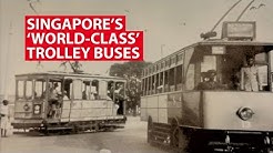 |
| Above: YouTubeCA video - Singapore's 'World-Class' Trolley Buses (some trams) - Length: 0:58 mins. |
PHOTO
 |
MAP
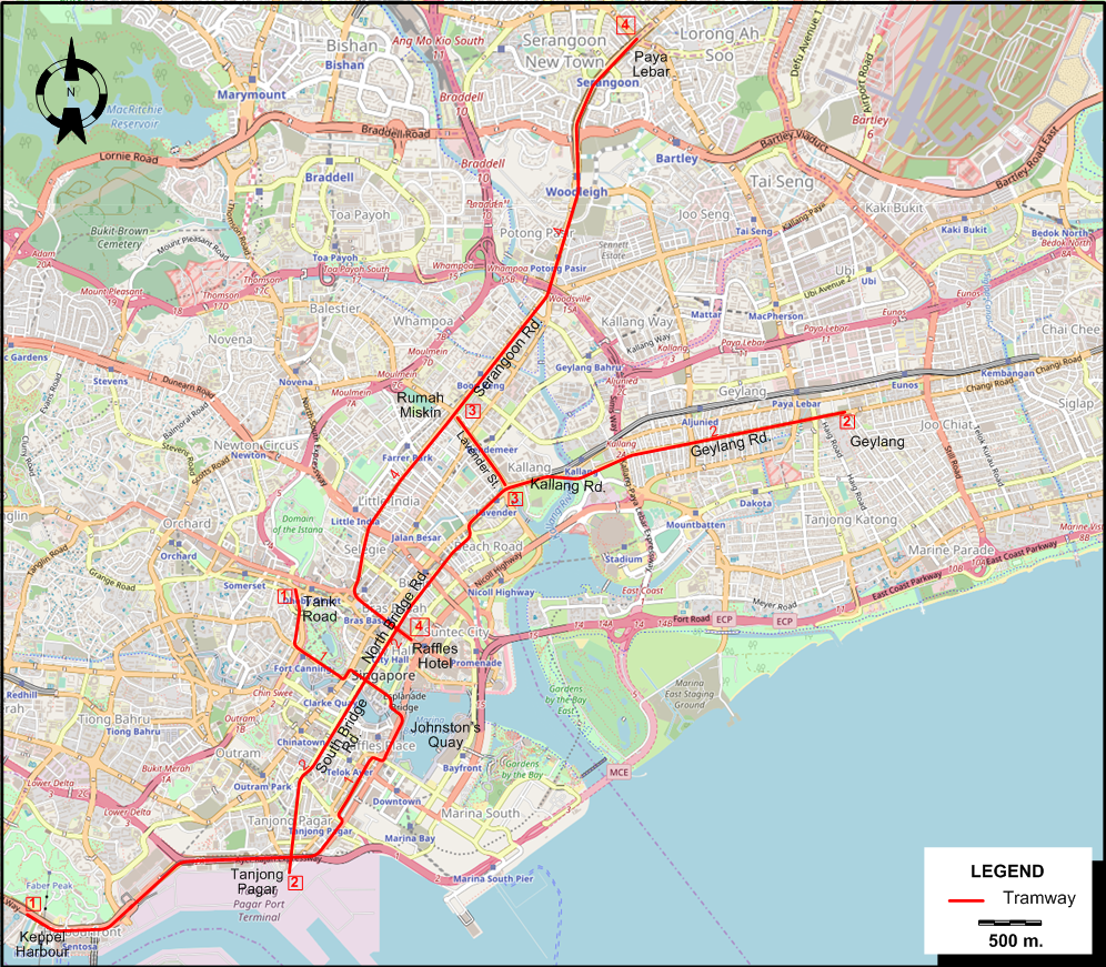
I created the above map by overlaying OpenStreetMap (OSM) maps with my own data. The underlying map data is © OpenStreetMap contributors, licensed under the Open Database License (ODbL).
Please note that the OSM map used as a template for this map corresponds to the situation at the time the map was downloaded and may show features that did not exist at the time the GS Tram Site is supposed to show. In particular, it may show bridges and highways that were built later.
TRAM ROUTES
Operator: Singapore Electric Tramways.
Route numbers are mostly indicative, and were not used on the trams themselves.
| 1 | Keppel Harbour - Tanjong Pagar - Johnston's Quay - Tank Road |
| 2 | Tanjong Pagar - South Bridge Rd. - North Bridge Rd. - Kallang Rd. - Geylang Rd. - Geylang |
| 3 | Kallang Rd. - Lavender St. - Rumah Miskin |
| 4 | Raffles Hotel - Serangoon Rd. - Rumah Miskin - Paya Lebar |
CHARACTERISTICS OF THE SYSTEM
NETWORK LENGTH
- Trams: 25 km.
HISTORY
- Steam trams: 3 May 1886 - 1 June 1894
- Electric trams: 25 July 1905 - 4 Sept. 1927
- Underground (Mass Rapid Transit Rail [MRT]): 7 Nov. 1987 - today.
- Light Rapid Transit (LRT) [automated]: 6 Nov. 1999 - today.
- Monorail (Sentosa Express): 15 Jan. 2007 - today.
GAUGE
- Steam & electric trams: 1000 mm.
- MRT/LRT: 1435 mm.
SOURCES
- York, F. W, & Phillips, A. R. Singapore: A history of its trams, trolleybuses and buses - Vol.1: 1880's to 1960. Croydon (England): DTS Publishing, 1996
WIKIS
- Light Rapid Transit (Singapore)
- Mass Rapid Transit (Singapore)
- Rail transport in Singapore
- Sentosa Express
- Trams in Singapore
- Transport in Singapore
WEB SITES
Copyright Gabor Sandi 1998-2026
Disclaimer: Everything on this site was written and/or prepared at the author's discretion. The author has tried to be accurate where facts are presented, but this does not mean that these facts are necessarily accurate. People needing more reliable information should refer to appropriate sources presented, on the Internet or elsewhere, by authoritative professional or academic bodies.
To get in touch with the webmaster, send an e-mail to g_sandi at hotmail.com.
Flags on this site are from the FOTW Flags Of The World website.