VIDEO
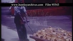 |
| Above: YouTubeCA video - Johannesburg And South African Gold Mining, 1950s (includes trams) - Length: 1:35 mins. |
PHOTO
 |
MAPS
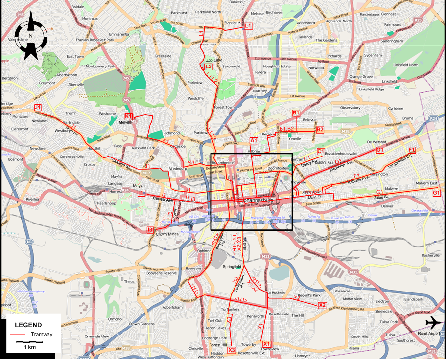
INSET: CENTRAL JOHANNESBURG
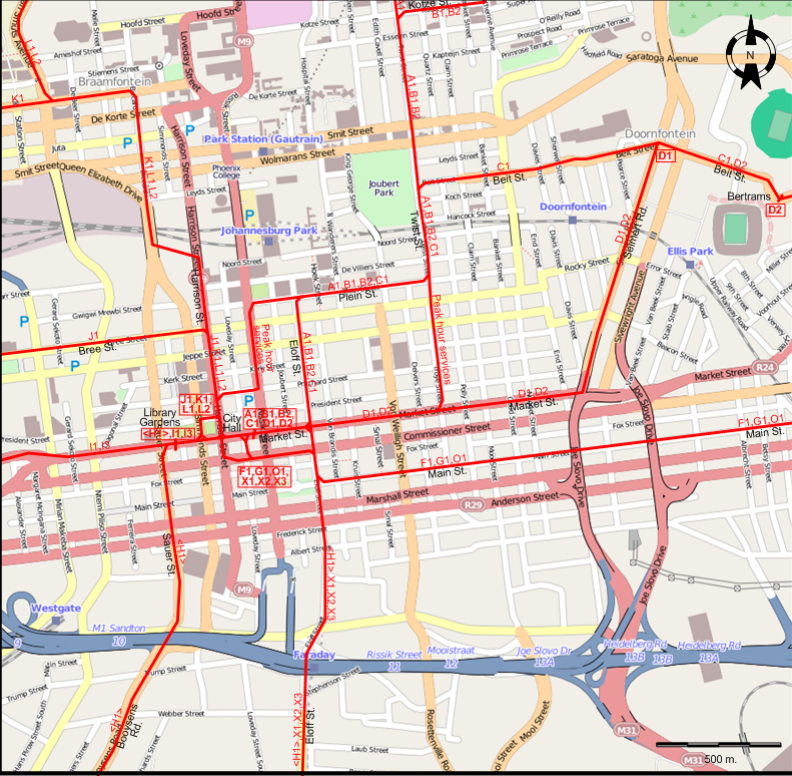
I created the above maps by overlaying OpenStreetMap (OSM) maps with my own data. The underlying map data is © OpenStreetMap contributors, licensed under the Open Database License (ODbL).
Please note that the OSM maps used as a template for these maps corresponds to the situation at the time the map was downloaded and may show features that did not exist at the time the GS Tram Site is supposed to show. In particular, it may show bridges and highways that were built later.
TRAM ROUTES
Operator: Johannesburg Transport Department
| A1 | Twist St. | City Hall - Market St. - Eloff St. - Plein St. - Twist St. - Hillbrow |
| B1 | Yeoville | City Hall - Market St. - Eloff St. - Plein St. - Twist St. - Kotze St. - Raleigh St. - Yeoville |
| B2 | Observatory | City Hall - Market St. - Eloff St. - Plein St. - Twist St. - Kotze St. - Raleigh St. - Observatory |
| C1 | Judith's Paarl | City Hall - Market St. - Eloff St. - Plein St. - Twist St. - Beit St. - Judith's Paarl |
| D1 | Marlborough House | City Hall - Market St. - Seimert Rd. - Doornfontein |
| D2 | Bertrams | City Hall - Market St. - Seimert Rd. - Beit St. - Bertrams |
| F1 | Kensington | City Hall - Main St. - Roberts Ave. - Langerman Dr. - Kensington |
| G1 | Malvern | City Hall - Main St. - Jules St. - Malvern East |
| H1 | Turffontein | Library Gardens - Market St. - Sauer St. - Booysens Rd. - Ophirton - Booysens - Turffontein - Rosettenville - La Rochelle - Springfield - Eloff St. - Market St. - Library Gardens [Circular route, both directions] |
| O1 | Bezuidenhout Valley | City Hall - Main St. - Kitchener Ave. - Bezuidenhoutsvallei |
| I1 | Mayfair | Library Gardens - Market St. - Central Ave. - Mayfair |
| I3 | Crown Mines | Library Gardens - Market St. - Hanover St. - Crown Mines |
| J1 | Malvern | City Hall - Harrison St. - Bree St. - Caroline St. - Main Rd. - Newlands (Shortmarket St.) |
| K1 | Melville | City Hall - Harrison St. - Braamfontein - Vrededorp - Auckland Park - Melville |
| L1 | Parktown North | City Hall - Harrison St. - Braamfontein - Parktown - Forest Town - Jan Smuts Ave. - Zoo Lake - Parktown North - Rosebank |
| L2 | Zoo Lake | City Hall - Harrison St. - Braamfontein - Parktown - Forest Town - Jan Smuts Ave. - Zoo Lake |
| X1 | Rosettenville | City Hall - Market St. - Eloff St. - Springfield - La Rochelle - Rosettenville - Townsview |
| X2 | Regents Park | City Hall - Market St. - Eloff St. - Springfield - La Rochelle - Rosettenville - Regents Park |
| X3 | Forest Hill | City Hall - Market St. - Eloff St. - Springfield - Turffontein Rd. - Turffontein - Forest Hill |
Note: The line designations X1, X2 and X3 are for the convenience of readers of this site only. I have not been able to determine the actual line designations used by the Johannesburg Transport Department for these routes.
CHARACTERISTICS OF THE SYSTEM
NETWORK LENGTH
- Tram lines: ? km.
HISTORY
- Horse tramways: 2 Feb. 1891 - 14 July 1906
- Electric tramways: 14 Feb. 1906 - 18 March 1961.
GAUGE
- All tramways: 1435 mm.
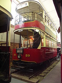
TRAM PRESERVATION
The James Hall Museum of Transport has one preserved double-decker tram in its collection.
SOURCES
- Spit, T. (with additional material by Patton, B.) Johannesburg tramways. London: Light Railway Transport League, 1976.
- Williams, D.E. "Johannesburg Municipal Tramways", The Modern Tramway, Feb. 1954 (17:194), p.27-37.
WIKIS
WEB SITES
Copyright Gabor Sandi 1998-2026
Disclaimer: Everything on this site was written and/or prepared at the author's discretion. The author has tried to be accurate where facts are presented, but this does not mean that these facts are necessarily accurate. People needing more reliable information should refer to appropriate sources presented, on the Internet or elsewhere, by authoritative professional or academic bodies.
To get in touch with the webmaster, send an e-mail to g_sandi at hotmail.com.
Flags on this site are from the FOTW Flags Of The World website.