VIDEO
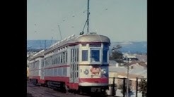 |
| Above: YouTubeCA video - Adelaide Trams from 1965 to 1976. Silent Movie - Length: 17:36 mins. |
PHOTOS
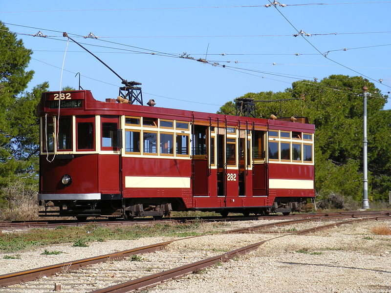 |
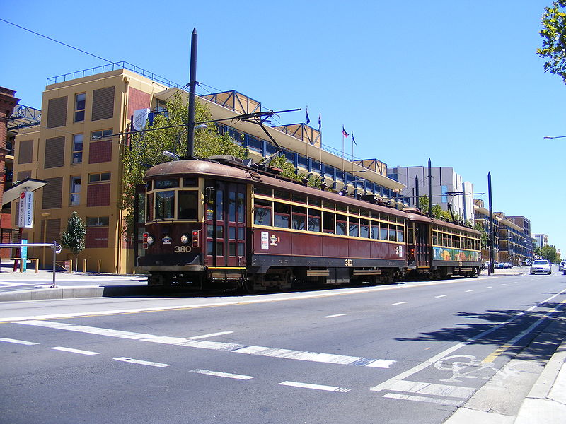 |
MAP
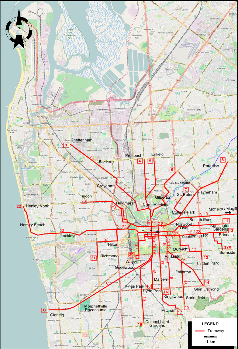
I created the above map by overlaying OpenStreetMap (OSM) maps with my own data. The underlying map data is © OpenStreetMap contributors, licensed under the Open Database License (ODbL).
Please note that the OSM map used as a template for this map corresponds to the situation at the time the map was downloaded and may show features that did not exist at the time the GS Tram Site is supposed to show. In particular, it may show bridges and highways that were built later.
TRAM ROUTES
Operator: Municipal Tramways Trust
| G | Glenelg | City Centre - Goodwood - Morphettville Racecourse - Glenelg | |
| 3 | Cheltenham | 1958/11/22 | City Centre - North Adelaide - Croydon - Kilkenny - Cheltenham |
| 4 | Prospect | 1958/7/20 | City Centre - North Adelaide - Prospect |
| 5 | Enfield | 1957/12/8 | City Centre - North Adelaide - Enfield |
| 6 | Walkerville North | 1955/11/? | City Centre - North Adelaide - Gilberton - Walkerville |
| 7 | St. Peters | 1958/7/? | City Centre - College Park - St. Peters |
| 8 | Paradise | 1958/7/? | City Centre - College Park - Payneham - Paradise |
| 9 | Morialta | 1956/3/17 | City Centre - Beulah Park - Morialta |
| 10 | Magill | 1957/2/? | City Centre - Beulah Park - Magill |
| 11 | Kensington Gardens | 1957/2/3 | City Centre - Norwood Oval - Kensington Gardens |
| 12 | Erindale | 1952/5/24 | City Centre - Kensington Rd. - Erindale |
| 12X | Burnside | 1952/5/24 | City Centre - Kensington Rd. - Burnside |
| 13 | Linden park | 1952/5/24 | City Centre - Dulwich - Linden Park |
| 14 | Glen Osmond | 1953/10/? | City Centre - Parkside - Glen Osmond |
| 15 | Fullarton / Springfield | 1958/7/? | City Centre - Parkside - Fullarton - Springfield |
| 16 | Kingswood | 1955/7/? | City Centre - Parkside - Kingswood |
| 17 | Mitcham | 1958/7/? | City Centre - Malvern - Mitcham |
| 18 | Hyde Park | 1955/11/? | City Centre - Hyde Park |
| 19 | Colonel Light Gardens | 1957/12/8 | City Centre - Goodwood - Kings Park - Colonel Light Gardens |
| 20 | Wayville West | 1957/12/? | City Centre - Wayville West |
| 21 | Hilton / Richmond | 1957/2/? | City Centre - Hilton - Richmond |
| 22 | Henley North | 1957/2/3 | City Centre - Lockleys - Henley Beach - Henley North |
| 23 | Findon | 1953/10/? | City Centre - Hindmarsh - Findon |
NB (1): The route numbers given above and on the map are for the convenience of readers, and were not used by the operator (who used the route designation given in the second column). I adopted them from the map designed by R.T. Horne (see in the printed sources). The dates in the table above are those of the abandonment of the route in question.
NB (2): All routes terminated in the city centre, but I have no sources as to where the city terminal of any one route was. In any case, many routes were part of through services, with no actual terminal in the city centre, just a change of route designation. For example, the Cheltenham - Wayville West (routes 3 and 20) were part of a through service.
CHARACTERISTICS OF THE SYSTEM
NETWORK LENGTH
- 68 km.
HISTORY
- Horse tramways (1): 1861 - 1866.
- Horse tramways (2): Dec. 1878 - 1914.
- Electric tramways in Adelaide: 9 March 1909 - today.
- Electric tramways in Port Adelaide: Apr. 1917 - July 1935.
GAUGE
- Tramways: 1435 mm. (with one early exception at 1600 mm., later converted to 1435 mm.)
TRAM PRESERVATION
The Tramway Museum, St Kilda, north of Adelaide, has a large collection of preserved trams, often used for tourist rides on city streets.
SOURCES
- Hammond, I. "Port Adelaide: Light relief for old railway" Tramways & Urban Transit, Apr. 2006 (69: 820), p.158-159.
- Horne, R.T. "Adelaide", letter to the editor (with a map) in Modern Tramway and Light Rail Review, March 1973 (36: 423), p.98.
- Price, J.H. "Adelaide, 1988" Modern Tramway and Light Rail Transit, Oct. 1989 (52: 622), p.337-343.
- "Rethinking Adelaide" Tramways & Urban Transit, Apr. 2018 (81: 964), p.140.
- Taplin, M. & Hammond, I. "Systems Factfile No.64: Adelaide, Australia" Tramways & Urban Transit, Jan. 2013 (76: 901), p.19-22.
WIKIS
WEB SITES
Copyright Gabor Sandi 1998-2026
Disclaimer: Everything on this site was written and/or prepared at the author's discretion. The author has tried to be accurate where facts are presented, but this does not mean that these facts are necessarily accurate. People needing more reliable information should refer to appropriate sources presented, on the Internet or elsewhere, by authoritative professional or academic bodies.
To get in touch with the webmaster, send an e-mail to g_sandi at hotmail.com.
Flags on this site are from the FOTW Flags Of The World website.