VIDEOS
 |
 |
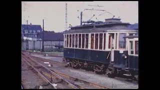 |
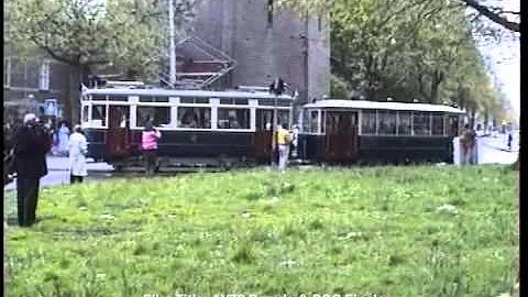
| Above: YouTubeCA video - Oude tram in Amsterdam 1999 - Length: 0:16 mins. | Above: YouTubeCA video - Amsterdam 'TRAM 91' Parade in May 1991 - Length: 1:31 mins. | Above: YouTubeCA video - De Blauwe Tram deel 1 - Smalspoor - Nederlands • Great Railways - Length: 51:45 mins. |
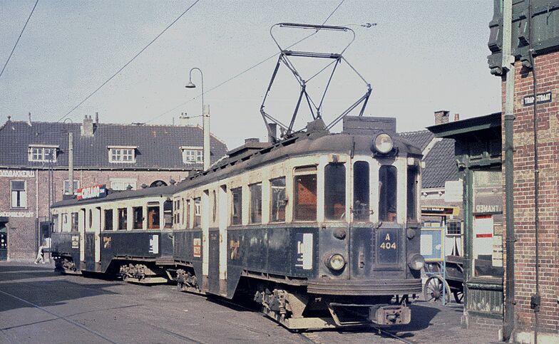
PHOTOS
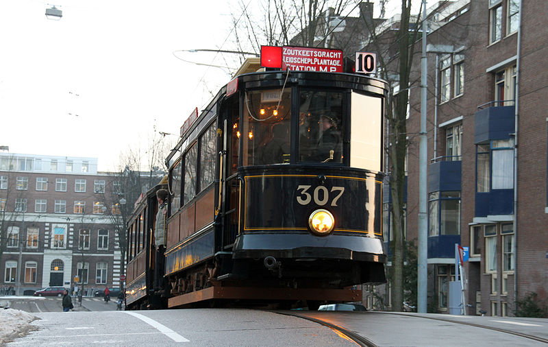 |
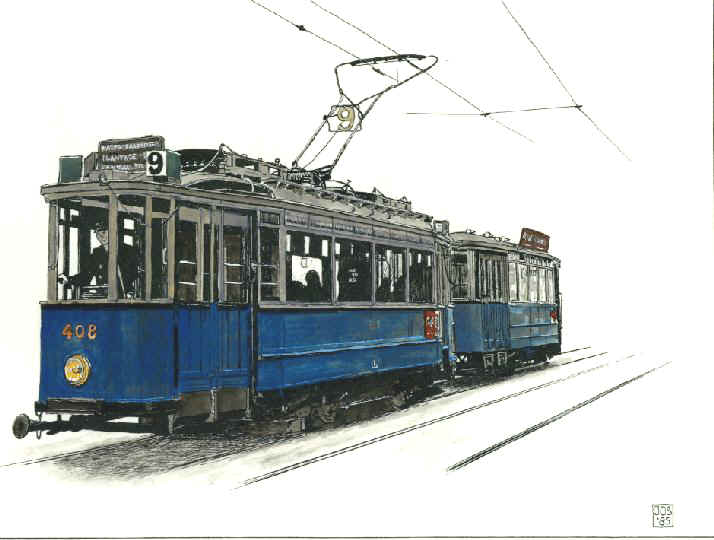 |
 |
MAP
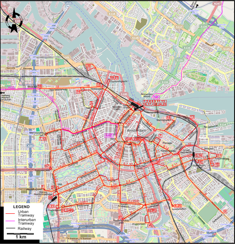
ABBREVIATIONS ON THIS MAP
| ACS | Albert Cuypstraat | RP | Rembrandtplein |
| DRK | de Ruijterkade | SHK | Stadhouderskade |
| FHP | Frederik Hendrikplantsoen | SWL | Saxen Weimarlaan |
I created the above map by overlaying OpenStreetMap (OSM) maps with my own data. The underlying map data is © OpenStreetMap contributors, licensed under the Open Database License (ODbL).
Please note that the OSM map used as a template for this map corresponds to the situation at the time the map was downloaded and may show features that did not exist at the time the GS Tram Site is supposed to show. In particular, it may show bridges and highways that were built later.
ROUTES
URBAN TRAM ROUTES
Operator: Gemeentetram Amsterdam (GTA), predecessor of Gemeentevervoerbedrijf (GVB)
| 1 | Centraal Station – Voorburgwal - Paleis - Spui - Leidsestraat - Stadhouderskade - Overtoom - Hoofddorpplein |
| 2 | Centraal Station – Voorburgwal - Paleis - Spui - Leidsestraat - Stadhouderskade - Willemsparkweg - Saxen Weimarlaan |
| 3 | Frederik Hendrikplantsoen - Frederik Hendrikstr. - Bilderdijkstraat - Overtoom - Stadhouderskade – Ceintuurbaan – Weesperzijde - Stat. Weesperpoort - Sarphatistraat - Alexanderplein - Mauritskade - Linnaeusstraat - 1e van Swindenstr. |
| 4 | Centraal Station – Damrak - Dam - Rokin - Muntplein - Vijzelstraat - Ceintuurbaan – Van Woustraat - Rivierenlaan |
| 5 | Oostzaanstraat - Nassauplein - Haarlemmerstraat - Centraal Station – Damrak - Dam - Rokin - Muntplein - Utrechtsestraat - Frederiksplein - Van Woustraat - Weesperzijde - Ceintuurbaan - Wibautstraat - Amstelstation |
| 6 | Stadionplein - Amstelveenseweg - Overtoom - Stadhouderskade - Weteringschans - Frederiksplein - Sarphatistraat - Wibautstraat - Oosterpark - Stat. Muiderpoort |
| 7 | Mercatorplein - Jan Evertsenstraat - Witte de Withstraat - Kinkerstraat - Marnixstraat - Weteringschans - Frederiksplein - Sarphatistraat - Roeterstraat - Plantage Parklaan |
| 8 | Centraal Station – Geldersekade - Waterlooplein - Weesperstraat - Sarphatistraat - Wibautstraat - Ceintuurbaan - Van Woustraat - Zuider Amstellaan - Westerscheldeplein |
| 9 | Centraal Station – Damrak - Dam - Rokin – Muntplein - Waterlooplein - Plantage – Alexanderplein - Linnaeusstraat - Middenweg - Gaffelstraat |
| 10 | Zoutkeetsgracht - Marnixstraat - Weteringschans – Frederiksplein - Sarphatistraat – Alexanderplein - Mauritskade - Javaplein - Molukkenstraat |
| 11 | Centraal Station – Damrak - Dam - Rokin - Muntplein - Utrechtsestraat - Frederiksplein - Sarphatistraat - Wibautstraat - Oosterpark - Stat. Muiderpoort - Insulindeweg |
| 13 | Centraal Station - Voorburgwal - Paleis - Rozengracht – De Clercqstraat - Jan Evertsenstraat - Mercatorplein |
| 14 | Van Hallstraat - Nassaukade - Marnixstraat - Rozengracht – Paleis - Dam – Rokin – Muntplein - Waterlooplein - Plantage – Alexanderplein - Linnaeusstraat - 1e van Swindenstr. |
| 16 | Centraal Station – Damrak - Dam - Rokin - Muntplein - Vijzelstraat - Albert Cuypstraat - De Lairessestraat - Station Haarlemmermeer |
| 17 | Centraal Station – Voorburgwal - Paleis - Rozengracht – Marnixstraat - Kinkerstraat – Hoofdweg - Surinameplein |
| 18 | Sloterdijk - Haarlemmerweg - Nassauplein |
| 22 | Centraal Station – De Ruijterkade - Centraal Station [Circular line, clockwise only] |
| 23 | Zoutkeetsgracht - Marnixstraat - Frederik Hendrikplantsoen - Frederik Hendrikstr. - Bilderdijkstraat - Kinkerstraat - J.P. Heijestraat - Overtoom - Amstelveenseweg - Stadionplein |
| 24 | Centraal Station – Damrak - Dam - Rokin - Muntplein - Vijzelstraat - Ceintuurbaan - Beethovenstraat - Stadionweg - Olympiaweg |
| 24R | Rembrandtplein - Muntplein - Vijzelstraat - Ceintuurbaan - Beethovenstraat - Stadionweg - Olympiaweg [Rush hours only] |
| 25 | Centraal Station – Damrak - Dam - Rokin - Muntplein - Vijzelstraat - Noorder Amstellaan - Amstellaan - Amstelstation |
| 25R | Rembrandtplein - Muntplein - Vijzelstraat - Noorder Amstellaan - van Woustraat - Leekstraat [Rush hours only] |
INTERURBAN TRAM ROUTES
Operator: Noord-Zuid-Hollandse Tramweg (Vervoer) Maatschappij (NZH)
| Amsterdam - Haarlem - Zandvoort (AHZ) | Amsterdam Spuistraat - Paleis - Rozengracht - de Clercqstraat - Admiraal de Ruijterweg - Sloterdijk - Halfweg - Haarlem - Zandvoort |
| Waterlandse tram (Wt) | Amsterdam Noord - Het Schouw - [Purmerend] / [Monnickendam - Edam] |
CHARACTERISTICS OF THE SYSTEM
NETWORK LENGTH
- Urban trams: 66 km.
- Interurban trams:
- Amsterdam - Haarlem - Zandvoort: 28 km.
- Amsterdam - Het Schouw - Purmerend: 15.5 km.
- Het Schouw - Edam - Volendam: 18.5 km.
HISTORY
- Urban trams: (horse-drawn) 3 June 1875 - 6 Aug. 1916; (electric) 14 Aug. 1900 - today.
- LRT: 1 Dec. 1990 - today.
- Metro: 16 Oct. 1977 - today.
- Interurban trams (NZH):
- Amsterdam - Het Schouw - Monnickendam - Purmerend: 22 June 1894 - 22 June 1932 (steam), 23 June 1932 - 14 May 1949 (electric).
- Amsterdam - Het Schouw - Edam: 13 Dec. 1888 - 30 Nov. 1932 (steam), 1 Dec. 1932 - 30 Sept. 1956 (electric; extended to Volendam)
- Amsterdam - Haarlem - Zandvoort: 6 Oct. 1904 - 31 Aug. 1957.
- Amsterdam - Haarlem - Zandvoort: 6 Oct. 1904 - 31 Aug. 1957.
- Amsterdam Weesperpoort - Diemen - Muiden - Muiderberg - Naarden - Laren (GoTM): 22 July 1881 - 15 Jan. 1932 (steam), 16 Jan. 1932 - 12 Feb. 1940 (Murderberg - Laren ceased to operate on 14 Oct. 1939) (petrol engines).
GAUGE
- Horse.drawn trams: 1422 mm.
- Urban trams: 1435 mm.
- Metro/LRT: 1435 mm.
- Interurban trams (NZH): 1000 mm.
- Interurban trams (GoTM): 1435 mm.
TRAM PRESERVATION
The Electrische Museumtramlijn Amsterdam, started in 1975, runs old trams (from Amsterdam and elsewhere) along a 7-km track starting at Haarlemmermeerstation.
SOURCES
- Deacon, R. Amsterdam trams - From horse car to Combino Welling, England: LRTA, 2013
- Koenot, L. Tram 2000 - Flash 1998. Bruxelles: Tram 2000, 1998.
- Moerland, M. "Amsterdam - Amstelveen Line sets the pattern for the future". In: Light Rail Review 3. London: Light Rail Transit Association, 2001 [p.19-24].
- Pulling, N. "Amsterdam - the rough and the smooth", Tramways & Urban Transit, Dec. 2009 (72: 864), p.470-472.
- Pulling, N. "Systems Factfile No.44: Amsterdam, The Netherlands", Tramways & Urban Transit, May 2011 (74: 881), p.179-182.
- Pulling, N. "Systems Factfile No.173: Amsterdam, The Netherlands", Tramways & Urban Transit, March 2022 (85: 1011), p.100-105.
- Van Dam, F. "Amsterdam meets the energy crisis", Modern Tramway, Feb. 1974 (37:434), p.57-60.
- Van Mechelen, C. Trams en tramlijnen: 70 jaar elektrische tram in Amsterdam - 1900-1970. Rotterdam: Uitgevers Wyt, 1970.
- Vernieuwen en veranderen - Vervoer en vervoerbedrijf van Amsterdam in de periode 1945-1980. Amsterdam: Gemeentevervoerbedrijf 1982.
- Vreedenberg, H.A. "Enemy occupation and tramways in the Netherlands", The Modern Tramway, Apr. 1946 (9: 97), p.29-31, 36, 38.
- Wansbeek, C.J. "Amsterdam metro grows - but trams still hold sway", Tramways & Urban Transit, June 2008 (71: 846), p.219-222.
- Wansbeek, C.J. "Blue Tram: Top notch LRT shouldn't have been axed", Tramways & Urban Transit, March 2008 (71: 843), p.100-1042.
- Wansbeek, C.J. & Fox, P. "Amsterdam - A tottering giant". In: Light Rail Review 8. London: Light Rail Transit Association, 1996 [p.4-16].
WIKIS
- Amsterdam Metro
- Amsterdams trammaterieel
- Amsterdamse tram
- Gemeentelijk Vervoerbedrijf
- Gemeentetram Amsterdam
- Gooische Stoomtram
- Noord-Zuid-Hollandsche Stoomtramweg-Maatschappij
- Tramlijn Amsterdam - Haarlem - Zandvoort
- Waterlandse tram
WEB SITES
Thanks to Prof. Maurits van Witsen from the Netherlands (and of the web site lightrail.nl) for the large amount of historical information on the Amsterdam system he furnished me through personal communication.
Thanks to Peter Zondag (from Utrecht, The Netherlands) for information obtained through personal communication.
Copyright Gabor Sandi 1998-2026
Disclaimer: Everything on this site was written and/or prepared at the author's discretion. The author has tried to be accurate where facts are presented, but this does not mean that these facts are necessarily accurate. People needing more reliable information should refer to appropriate sources presented, on the Internet or elsewhere, by authoritative professional or academic bodies.
To get in touch with the webmaster, send an e-mail to g_sandi at hotmail.com.
Flags on this site are from the FOTW Flags Of The World website.