VIDEOS
 |
 |
 |
| Above: YouTubeCA video - Trams in The Hague/Den Haag, Netherlands (March 2019) - Length: 7:48 mins. | Above: YouTubeCA video - Trams in Den Haag - PCC Cars - Length: 5:20 mins. | Above: YouTubeCA video - Trams in Den Haag,Nederland. in the 1980's.(HTM open dag 1986.). - Length: 9:12 mins. |
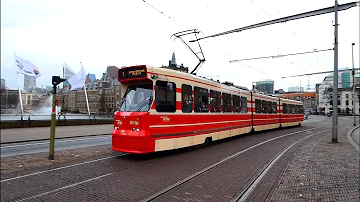
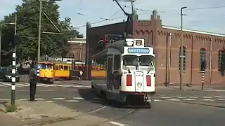
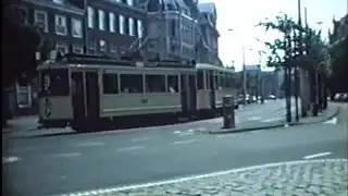
PHOTOS
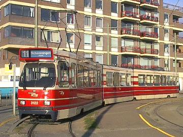 |
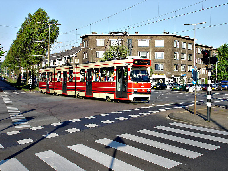 |
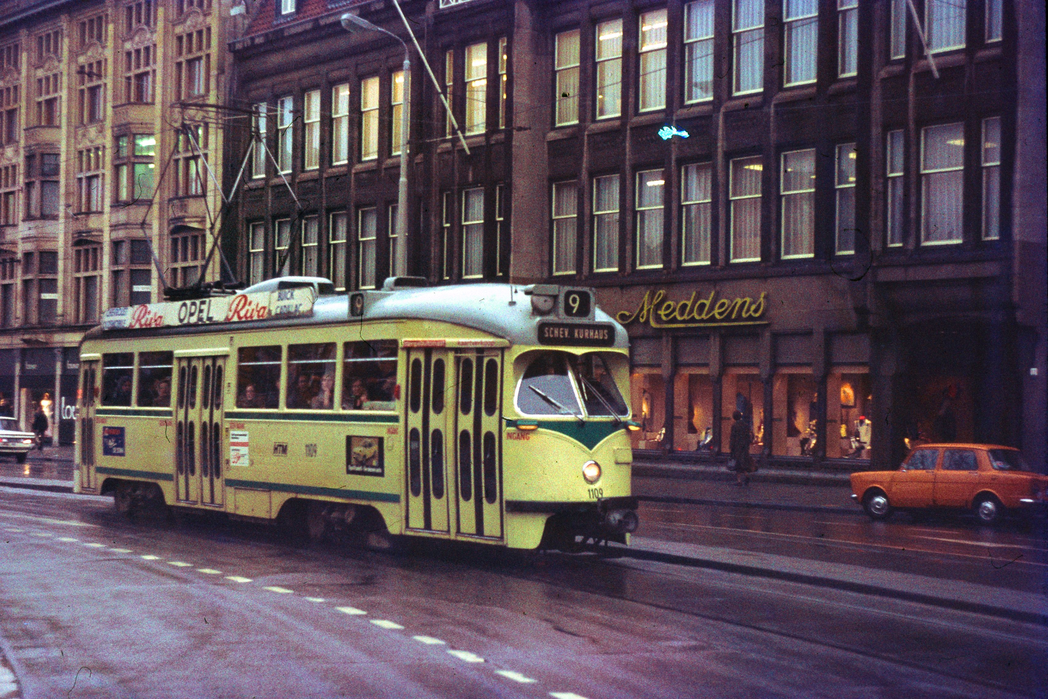 |
MAPS
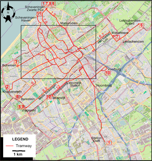
INSET: THE HAGUE - CENTRE
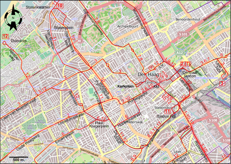
ABBREVIATIONS ON THE MAP
| Km | Kalvermarkt | LV | Lange Voorhout |
I created the above maps by overlaying OpenStreetMap (OSM) maps with my own data. The underlying map data is © OpenStreetMap contributors, licensed under the Open Database License (ODbL).
Please note that the OSM maps used as a template for these maps corresponds to the situation at the time the map was downloaded and may show features that did not exist at the time the GS Tram Site is supposed to show. In particular, it may show bridges and highways that were built later.
ROUTES
Operator: Gemengd Bedrijf Haagsche Tramweg-Maatschappij (GBHTM) (predecessor of HTM Personenvervoer NV)
| 1 | Scheveningen Zwarte Pad – Madurodam – Koninginnegracht – Centraal Station – Kalvermarkt – Station HS – Rijswijkseweg – Hoornbrug – Station Delft |
| 2 | Kraayenstein – Oude Haagweg – Loosduinsekade - Prinsegracht - Grote Marktstraat – Kalvermarkt – Centraal Station |
| 3 | Bohemen – Laan van Meerdervoort – Kerkplein - Kalvermarkt – Centraal Station – Station Laan van NOI |
| 6 | Berestein – Escamplaan – De Heemstraat – Hobbemastraat – Prinsegracht - Grote Marktstraat – Kalvermarkt – Centraal Station – Het Kleine Loo – Mariahoeve – Leidschendam – Leidschendam Noord |
| 7 | Scheveningen Zwarte Pad – Scheveningseweg – Kalvermarkt – Centraal Station – Het Kleine Loo – Mariahoeve [In the evening and on weekends, to Centraal Station only] |
| 8 | Scheveningen Zwarte Pad – Scheveningseweg – Kalvermarkt – Station HS – Parallelweg – Melis Stokelaan – Vrederust |
| 9 | Scheveningen Zwarte Pad – Madurodam – Koninginnegracht – [In the evening: Only from Lange Voorhout] – Centraal Station – Station HS – Parallelweg – Melis Stokelaan – Vrederust |
| 10 | Statenkwartier – Statenplein – Stadhouderslaan - Waldeck Pyrmontkade - Prinsegracht - Grote Marktstraat – Kalvermarkt – Station HS – Rijswijkseweg – Voorburg Station |
| 11 | Scheveningen Haven – Statenkwartier – Van Boetzelaerlaan - Conradkade – De Heemstraat – Parallelweg – Station HS |
| 12 | Duindorp – Nieboerweg – Laan van Meerdervoort – Beeklaan – De Heemstraat – Parallelweg – Station HS – Lekstraat – Centraal Station – Lange Voorhout – Kalvermarkt – Station HS – Rijswijkseweg – Goeverneurlaan - Moerwijk Station – Erasmusweg – Moerwijk |
CHARACTERISTICS OF THE SYSTEM
NETWORK LENGTH
- Urban trams: ? km.
HISTORY
- Urban trams: (horse-drawn) 25 June 1864 - 3 March 1907; (steam) 1 July 1879 - 31 Dec. 1925; (battery) 1 Aug. 1890 - 5 Aug. 1904; (electric, from overhead wire) 6 Aug. 1904 - today.
- HSM Station HS-Scheveningen Strand (Steam trams): 12 June 1886 - 15 July 1927 (from 1 Jan. 1926, operated by HTM) [electrified, and transferred to the Hague tram network]
- WSM lines (Steam trams): 1 May 1883 (branch Poeldijk-'s Gravenzande: from 14 August 1883) - 1 October 1932 (branch Loosduinen-Kijkduin, till 1928)
- Den Haag-Rijswijk-Delft Haagpoort (interurban): horse-drawn on 1524 mm gauge 26 June 1866 - 30 Nov. 1874; horse-drawn on 1445 mm gauge: 20 Jan. 1877 - 30 July 1887; steam traction: 31 July 1887 - 30 June 1924; electric: 7 Feb. 1923 - today (urban since 9 January 1965)
- Den Haag-Marlot-Wassenaar-Leiden (interurban): steam ? - ; electric 16 May 1925 - 9 Nov. 1961
- Scheveningen-Den Haag (interurban): 1 July 1879 - 12 Apr. 1924; electric: 12 Apr. 1924 - 31 Aug. 1957
- Den Haag-Voorburg-Leiden (interurban): steam on 1067 mm gauge 20 June 1885 - 24 Jan. 1924; electric: 12 Apr. 1924 - 9 Nov. 1961
- Interurban LRT: 29 Oct. 2006 - today
GAUGE
- Trams: 1435 mm. (except for some interurbans, see under history)
- Interurban LRT: 1435 mm.
TRAM PRESERVATION
The Haags Openbaar Vervoer Museum exhibits old trams from the city.
SOURCES
- Albers, L.J.P. Trams en tramlijnen: De 'Blauwe Tram' - 1924-1961. Rotterdam: Uitgevers Wyt, 1971.
- Koenot, L. Tram 2000 - Flash 1998. Bruxelles: Tram 2000, 1998.
- Pulling, N. "Systems Factfile No.49 - Den Haag, The Netherlands", Tramways & Urban Transit, Oct. 2011 (74: 886), p.395-397.
- Pulling, N. "Systems Factfile No.150 - Den Haag, The Netherlands", Tramways & Urban Transit, Apr. 2020 (83: 988), p.145-149.
- van Dam, F. "A new tram route in Den Haag", Modern Tramway, Dec. 1974 (37:444), p.419-423.
- Vreedenberg, H.A. "Enemy occupation and tramways in the Netherlands", The Modern Tramway, Apr. 1946 (9: 97), p.29-31, 36, 38.
- Wansbeek, C.J. "RanDstadRail: The tram-train-metro compromise", Tramways & Urban Transit, Oct. 2006 (69: 826), p.380-384.
- Wansbeek, C.J. "Blue Tram: Top notch LRT shouldn't have been axed", Tramways & Urban Transit, March 2008 (71: 843), p.100-104.
WIKIS
- Haagse tram
- HTM Personenvervoer
- Noord-Zuid-Hollandsche Stoomtramweg-Maatschappij
- RandstadRail
- Tramlijn Den Haag HSM - Scheveningen Strand
- Westlandsche Stoomtramweg Maatschappij
WEB SITES
Thanks to Maurits van Witsen (from the Netherlands) for the large amount of useful information he kindly sent me concerning the history of the tram system of the Hague. Peter Zondag (from Utrecht, The Netherlands) has also kindly contributed his knowledge concerning this city.
Copyright Gabor Sandi 1998-2026
Disclaimer: Everything on this site was written and/or prepared at the author's discretion. The author has tried to be accurate where facts are presented, but this does not mean that these facts are necessarily accurate. People needing more reliable information should refer to appropriate sources presented, on the Internet or elsewhere, by authoritative professional or academic bodies.
To get in touch with the webmaster, send an e-mail to g_sandi at hotmail.com.
Flags on this site are from the FOTW Flags Of The World website.