VIDEOS
 |
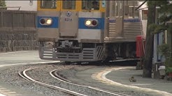 |
| Above: YouTubeCA video - Trams in Kumamoto, Japan (Sept. 7, 2013) - Length: 18:26 mins. | Above: YouTubeCA video - 軒下かすめて菊池電車-熊本 Japan Kumamoto old tram - Length: 1.44 mins. |
PHOTOS
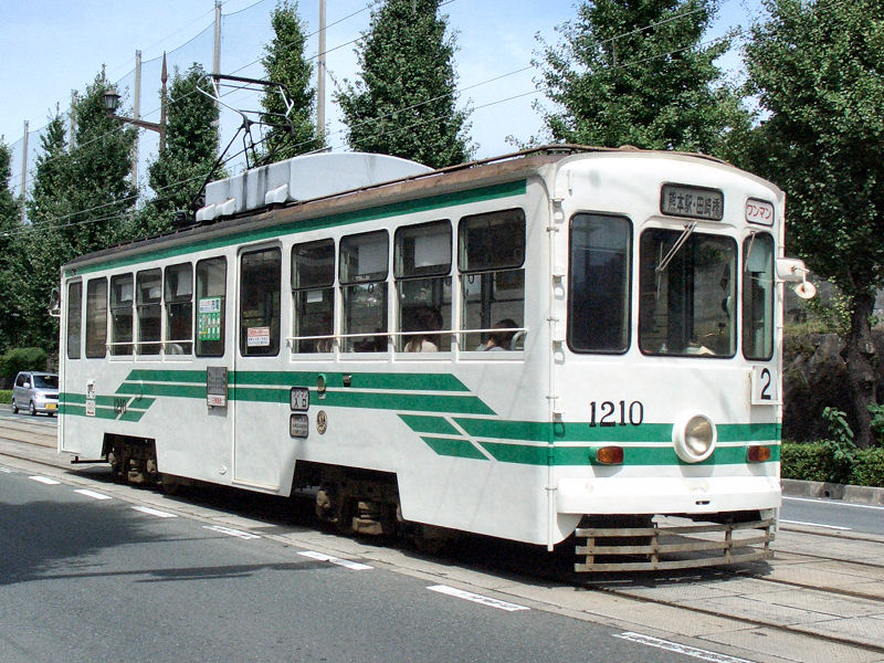 |
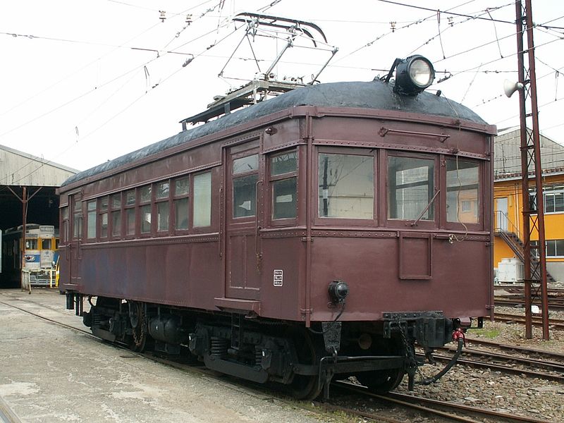 |
MAP
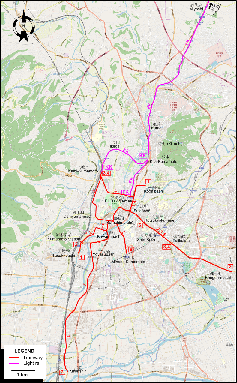
I created the above map by overlaying OpenStreetMap (OSM) maps with my own data. The underlying map data is © OpenStreetMap contributors, licensed under the Open Database License (ODbL).
Please note that the OSM map used as a template for this map corresponds to the situation at the time the map was downloaded and may show features that did not exist at the time the GS Tram Site is supposed to show. In particular, it may show bridges and highways that were built later.
DISCONTINUATION DATES OF TRAM AND INTERURBAN TRACKS BETWEEN 1964 and 1986 (affected route designations in parantheses)
- 1965 Feb. 22: Kawashiri line (7)
- 1970 May 1: Tsuboi line (4); Minami-Kumamoto line (6)
- 1972 March 1: Kogaibashi line (1)
- 1986 Feb. 16: Miyoshi - Kikuchi (LRT line)
ROUTES
TRAM ROUTES
Operator: Kumamoto City Transportation Bureau (熊本市交通局 - Kumamoto-shi Kōtsūkyoku)
| 1 | 子飼橋 (Kogaibashi) - 水道町 (Suidōchō) - 辛島町 (Karashima-chō) - 河原町 (Kawaramachi) - 熊本駅前 (Kumamoto Station) - 田崎橋 (Tasaki-bashi) |
| 2 | 健軍町 (Kengun-machi) - 体育館 (Taiikukan) - 新水前寺 (Shin-Suizenji) - 交通局前 (Kōtsūkyoku-mae) - 水道町 (Suidōchō) - 辛島町 (Karashima-chō) - 河原町 (Kawaramachi) - 熊本駅前 (Kumamoto Station) |
| 3 | 体育館 (Taiikukan) - 新水前寺 (Shin-Suizenji) - 交通局前 (Kōtsūkyoku-mae) - 水道町 (Suidōchō) - 辛島町 (Karashima-chō) - 段山町 (Daniyama-machi) - 上熊本 (Kami-Kumamoto) |
| 4 | 体育館 (Taiikukan) - 新水前寺 (Shin-Suizenji) - 交通局前 (Kōtsūkyoku-mae) - 水道町 (Suidōchō) - 藤崎宮前 (Fujisakigū-mae) - 上熊本 (Kami-Kumamoto) |
| 6 | 交通局前 (Kōtsūkyoku-mae) - 水道町 (Suidōchō) - 辛島町 (Karashima-chō) - 南隈本 (Minami-Kumamoto) |
| 7 | 河原町 (Kawaramachi) - 世安橋 (Yoyasubashi) - 川尻 (Kawashiri) |
LRT ROUTES
Operator: Kumamoto City Transportation Bureau (熊本市交通局 - Kumamoto-shi Kōtsūkyoku)
| FK | 藤崎宮前 (Fujisakigū-mae) - 北熊本 (Kita-Kumamoto) - 亀井 (Kamei) - 須屋 (Suya) - 御代志 (Miyoshi) - 菊池 (Kikuchi) |
| KK | 上熊本 (Kami-Kumamoto) - 池田 (Ikeda) - 北熊本 (Kita-Kumamoto) |
NB: The route indicators FK and KK are for convenience only, and were not used by the operator.
CHARACTERISTICS OF THE SYSTEM
NETWORK LENGTH
- Municipal tram lines: 25.2 km.
- Interurban lines: 26.6 km.
HISTORY
- Steam tramway (Municipal): 20 Dec. 1907 - 2 July 1920.
- Electric tramway (Municipal): 1 Aug. 1924 - today.
- Interurban steam tramway (Kikuchi Tramway): 1 Oct. 1911 - 31 Aug. 1923
- Interurban electric tramway (Kikuchi Tramway, later Kumamoto Electric Railway): 2 Aug. 1923 - today.
GAUGE
- Steam tramway (Municipal): 762 mm.
- Electric tramway (Municipal): 1435 mm.
- Interurban electric tramway (LRT) (1 Oct. 1911 - 31 Aug. 1923): 914 mm.; (31 Aug. 1923 - today): 1067 mm.
SOURCES
- Demery, L.W., Forty, R., De Groote, R. and Higgins, J.W. Electric railways of Japan - Vol.3: Western Japan. Gloucester (England): Light Rail Transit Association, 1997.
- Forty, R. & Higgins, J.W. "Japan today - Part 2: Nagasaki, Kumamoto and Kagoshima", Modern Tramway & Light Rapid Transit, Feb. 1977 (40: 470), p.50-60.
WIKIS
WEB SITES
- 熊本市交通局 (Kumamoto City Transportation Bureau)
- Kumamoto Electric Tramway (熊本電気鉄道 - Kumamoto Denki Tetsudō)
- 熊本市電データベース (Kumamoto Shiden dētabēsu)
Copyright Gabor Sandi 1998-2026
Disclaimer: Everything on this site was written and/or prepared at the author's discretion. The author has tried to be accurate where facts are presented, but this does not mean that these facts are necessarily accurate. People needing more reliable information should refer to appropriate sources presented, on the Internet or elsewhere, by authoritative professional or academic bodies.
To get in touch with the webmaster, send an e-mail to g_sandi at hotmail.com.
Flags on this site are from the FOTW Flags Of The World website.