VIDEOS
 |
 |
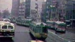 |
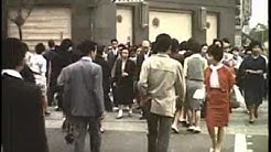
| Above: YouTubeCA video - A day in Tokyo, Japan, in 1963 東京 (With trams) - Length: 6:02 mins. | Above: YouTubeCA video - The Last Tokyo Tram - Length: 2:25 mins. | Above: YouTubeCA video - Tamagawa tram streetcar circa 1969 Tokyo - Length: 1:23 mins. |
 |
 |
 |
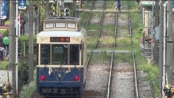
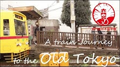
| Above: YouTubeCA video - A train Journey to Old Tokyo - The Arakawa Toden Train - Length: 2:08 mins. | Above: YouTubeCA video - Tokyo Metro: A Subway Network On Time & On Track - Length: 28:00 mins. | Above: YouTubeCA video - Tokyo, Japan - Tokyo Metro Museum - Full Tour HD (2017) - Length: 7:02 mins. |
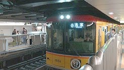
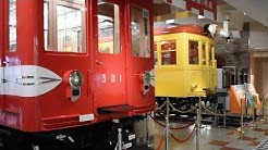
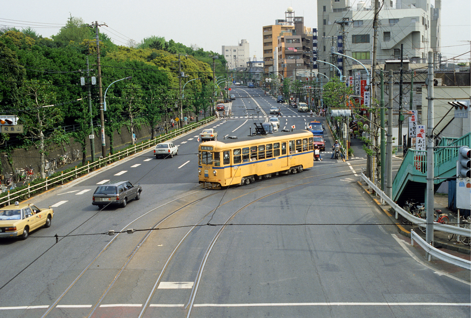
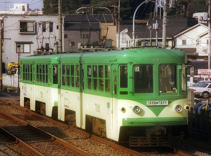
PHOTOS
 |
 |
 |
MAPS
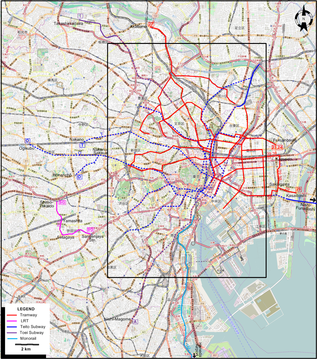
INSET: CENTRAL TOKYO
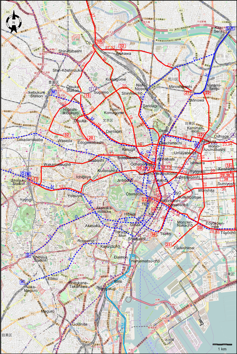
I created the above maps by overlaying OpenStreetMap (OSM) maps with my own data. The underlying map data is © OpenStreetMap contributors, licensed under the Open Database License (ODbL).
Please note that the OSM maps used as a template for these maps corresponds to the situation at the time the map was downloaded and may show features that did not exist at the time the GS Tram Site is supposed to show. In particular, it may show bridges and highways that were built later.
ABBREVIATIONS ON THE MAPS
| KB | 京橋 (Kyōbashi) | TE | 東京駅 (Tōkyō Station) |
| NG | 人形町 (Ningyōchō) | TS | 通三丁目 (Tōri-Sanchōme) |
ROUTES
URBAN TRAM ROUTES
Operator: 東京都市交通局 (Tokyo Municipal Transportation Bureau)
| 12 | 新宿駅前 (Shinjuku Station) – 四谷(Yotsuya) – 市ヶ谷 (Ichigaya) – 九段下 (Kudanshita) – 須田町 (Sudachō) – 岩本町 (Iwamotochō) |
| 13 | 新宿駅前 (Shinjuku Station) – 若松町(Wakamatsu-chō) – 飯田橋 (Iidabashi) – 水道橋 (Suidōbashi) – 御茶ノ水(Ochanomizu) – 秋葉原 (Akihabara) – 岩本町 (Iwamotochō) |
| 16 | 大塚 駅前 (Ōtsuka Station) – 大塚 (Ōtsuka) – 伝通院 (Dentsūin) – 春日 (Kasuga) – 御徒町 (Okachimachi) – 厩橋 (Umayabashi) – 石原 (Ishiwara) – 錦糸町駅前 (Kinshichō Station) |
| 19 | 通三丁目 (Tōri-Sanchōme) – 日本橋 (Nihonbashi) – 神田 (Kanda) – 須田町 (Sudachō) – 本駒込 (Hon-Komagome) – 駒込 (Komagome) – 王子駅前 (Ōji Station) |
| 20 | 須田町 (Sudachō) – 秋葉原 (Akihabara) – 上野 (Ueno) – 千駄木 (Sendagi) – 神明町 (Shinmeichō) – 大塚 (Ōtsuka) – 江戸川橋 (Edogawabashi) |
| 22 | 日本橋 (Nihonbashi) – 浅草橋 (Asakusabashi) – 厩橋 (Umayabashi) – 浅草(Asakusa) – 南千住 (Minami-Senju) |
| 22* | 日本橋 (Nihonbashi) – 浅草橋 (Asakusabashi) – 厩橋 (Umayabashi) – 雷門 (Kaminari-mon) |
| 23 | 月島 (Tsukishima) – 門前仲町 (Monzen-Nakachō) – 森下 (Morishita) – 両国 (Ryōgoku) – 石原 (Ishiwara) – 本所吾妻橋 (Honjo Azumabashi) – 福神橋 (Fukujinbashi) |
| 24 | 須田町 (Sudachō) – 秋葉原 (Akihabara) – 上野 (Ueno) – 雷門 (Kaminari-mon) – 浅草 (Asakusa) – 本所吾妻橋 (Honjo Azumabashi) – 福神橋 (Fukujinbashi) |
| 27 | 三ノ輪橋 (Minowabashi) – 荒川 (Arakawa) – 王子駅前 (Ōji Station) – 赤羽 (Akabane) |
| 28 | 日本橋 (Nihonbashi) – 茅場町 (Kayabachō) – 門前仲町 (Monzen-Nakachō) – 東陽公園前 (Tōyōkōen-mae) – 東陽町 (Tōyōchō) - 住吉 (Sumiyoshi) – 錦糸町駅前 (Kinshichō Station) |
| 29 | 須田町 (Sudachō) – 浅草橋 (Asakusabashi) – 両国 (Ryōgoku) – 錦糸町 (Kinshichō) – 亀戸 (Kameido) – 境川 (Sakaigawa) – 葛西橋 (Kasaibashi) |
| 32 | 早稲田 (Waseda) – 東池袋(Higashi-Ikebukuro) – 大塚 駅前 (Ōtsuka Station) – 新庚申塚 (Shin-Kōshinzuka) – 王子駅前 (Ōji Station) – 荒川 (Arakawa) |
| 36 | 築地 (Tsukiji) – 茅場町 (Kayabachō) – 水天宮前 (Suitengūmae) – 浜町 (Hamachō) – 森下 (Morishita) – 住吉 (Sumiyoshi) – 錦糸町駅前 (Kinshichō Station) |
| 38 | 日本橋 (Nihonbashi) – 茅場町 (Kayabachō) – 門前仲町 (Monzen-Nakachō) – 東陽公園前 (Tōyōkōen-mae) – 東陽町 (Tōyōchō) - 境川 (Sakaigawa) – 亀戸 (Kameido) – 錦糸町 (Kinshichō) |
SUBURBAN TRAM ROUTE
Operator: 東急電鉄 (Tōkyū Dentetsu)
| SG | 世田谷線 | Setagaya Line | 三軒茶屋駅 (Sangenjaya Station) - 世田谷 (Setagaya) - 山下 (Yamashita) - 下高井戸駅 (Shimo-Takaido Station) |
TEITO SUBWAY ROUTES
Operator: Teito Rapid Transit Authority (帝都高速度交通営団 [Teito Kōsokudo Kōtsū Eidan]), commonly known as Eidan or TRTA
| C | 千代田線 | Chiyoda Line | 大手町 (Ōtemachi) - 茶ノ水 (Ochanomizu) – 千駄木 (Sendagi) – 西日暮里 (Nishi-Nippori) - 北千住 (Kita-Senju) |
| G | 銀座線 | Ginza Line | 渋谷駅前 (Shibuya Station) – 赤坂見附 (Akasaka-mitsuke) – 虎ノ門 (Tora-no-mon) – 新橋 (Shinbashi) – 銀座 (Ginza) – 京橋 (Kyōbashi) – 日本橋 (Nihonbashi) – 神田 (Kanda) – 上野 (Ueno) – 浅草 (Asakusa) |
| H | 比谷線 | Hibiya Line | 中目黒 (Naka-Meguro) - 恵比寿 (Ebisu) - 六本木 (Roppongi) – 神谷町 (Kamiyachō) - 日比谷 (Hibiya) - 銀座 (Ginza) - 築地 (Tsukiji) – 八丁 (Hatchōbori) - 茅場町 (Kayabachō) - 人形町 (Ningyōchō) – 秋葉原 (Akihabara) – 上野(Ueno) – 三ノ輪 (Minowa) – 南千住 (Minami-Senju) - 北千住 (Kita-Senju) |
| M | 丸ノ内線 | Marinouchi Line | 新宿駅前 (Shinjuku Station) – 四谷(Yotsuya) – 赤坂見附 (Akasaka-mitsuke) – 銀座 (Ginza) – 東京駅 (Tōkyō Station) – 御大手町 (Ōtemachi) - 茶ノ水 (Ochanomizu) – 池袋駅前 (Ikebukuro Station) |
| O | 荻窪線 | Ogikubo Line | 新宿駅前 (Shinjuku Station) – 中恉坂上 (Nakano-Sakaue) - 荻窪駅 (Ogikubo Station) / 方南町 (Hōnanchō) |
| T | 東西線 | Tōzai Line | 中野 (Nakano) - 高田馬場 (Takadanobaba) - 早稲田線 (Waseda) – 飯田橋 (Iidabashi) – 九段下 (Kudanshita) - 大手町 (Ōtemachi) - – 日本橋 (Nihonbashi) – 茅場町 (Kayabachō) - 門前仲町 (Monzen-Nakachō) – 東陽町 (Tōyōchō) - 西船橋 (Nishi-Funabashi) |
TOEI SUBWAY ROUTES
Operator: Tokyo Metropolitan Bureau of Transportation (東京都交通局 [Tōkyō-to Kōtsū-kyoku]), commonly known as Toei
| A | 鉄浅草線 | Asakusa Line | 西馬込 (Nishi-Magome) - 五反田 (Gotanda) - 泉岳寺 (Sengakuji) - 三田 (Mita) - 大門 (Daimon) - 新橋 (Shinbashi) - 日本橋 (Nihonbashi) – (浅草橋 (Asakusabashi) – 押上 (Oshiage) |
| I | 三田線 | Mita Line | 巣鴨 (Sugamo) - 新板橋 (Shin-Itabashi) - 高島平 (Takashimadaira) |
TOKYO MONORAIL
Operator: Tokyo Monorail Co.
| TM | 羽田線 | Haneda Line | 浜松町 (Hamamatsu-chō) - 羽田空港 (Haneda Airport) |
Note: The route designations SG and TM used above are for the convenience of readers of this site, and were not used by the operators.
CHARACTERISTICS OF THE SYSTEM
NETWORK LENGTH
- Urban tramway: 94 km.
- Suburban tramway (Tamagawa system): 5 km.
- Subway (Teito): 102 km.
- Subway (Toei): 28 km.
- Monorail: 17 km.
HISTORY
- Horse-drawn tramway: 25 June 1882 - 1903.
- Urban electric tramway (including those of the Ōji Electric Tramway): 22 Aug. 1903 - today.
- Suburban electric tramway (Tamagawa/Setagaya/Kinuta system): 6 Mar. 1907 - today.
- Suburban electric tramway (Seibu Railway, later tram line 14): 25 Aug. 1921 - 1 Dec. 1963
- Subway (Chikatetsu), Teito system: 30 Dec. 1927 - today.
- Subway (Chikatetsu), Toei system: 4 Dec. 1960 - today.
- Tokyo Waterfront Area Rapid Transit: 30 March 1996 - today.
- Monorail: 17 Sept 1964 - today.
- Automated guideway transit: Nippori-Toneri Liner (30 March 2008 -today); New Transit Yurikamome (1 Nov. 1995 - today).
GAUGE
- Urban electric tramway (including those of the Ōji Electric Tramway): 1372 mm.
- Suburban electric tramway (Tamagawa/Setagaya/Kinuta system): 1372 mm.
- Suburban electric tramway (Seibu Railway, later tram line 14): 1067 mm.
- Subway: 1067, 1372 and 1435 mm. (depending on the line).
- Tokyo Waterfront Area Rapid Transit: 1067 mm.
SOURCES
- Demery, L.W., Forty, R., DeGroote, R. and Higgins, J.W. Electric railways of Japan - Vol.1: Tōkyō and Northern Japan. Milton Keynes: Light Rail Transit Association, 1983.
- 廃線都電 - 路線案内図 (Haisen Toden - Rosen-annai-zu [Abandonment of the Metropolitan Trams - Guide map to the route network]). Tokyo: Jinbunsha, 2007.
- 林順信 (Hayashi, J.) 都電が走った街・今昔 (Toden trams running in the streets - Now and then). Tokyo: JTB, 1996.
- 林順信 (Hayashi, J.) 東京市電名所図絵 (Pictures of Tokyo trams in scenic places). Tokyo: JTB, 2000.
WIKIS
- Nippori Toneri Liner / 日暮里・舎人ライナー
- Rinkai Line / 東京臨海高速鉄道りんかい線
- Toden Arakawa Line / 都電荒川線
- 都営地下鉄 [To-ei Chikatetsu]
- Tokyo Metro / 東京地下鉄
- Tokyo Metropolitan Bureau of Transportation / 東京都交通局
- Tokyo Monorail / 東京モノレール
- Tokyo Toden / 東京都電車
- Tōkyū Den-en-toshi Line / 東急田園都市線
- Tōkyū Setagaya Line / 東急世田谷線
- Yurikamome / 新交通ゆりかもめ
WEB SITES
- New Transit Yurikamome
- さっしいのホームページ・ぽこぺん
- Tokyo (on UrbanRail.Net)
- Tokyo Metro Co., Ltd. (東京地下鉄株式会社)
- Tokyo Metropolitan Bureau of Transportation / 東京都交通局
- Tokyo Monorail
- Tokyo Waterfront Area Rapid Transit
Copyright Gabor Sandi 1998-2026
Disclaimer: Everything on this site was written and/or prepared at the author's discretion. The author has tried to be accurate where facts are presented, but this does not mean that these facts are necessarily accurate. People needing more reliable information should refer to appropriate sources presented, on the Internet or elsewhere, by authoritative professional or academic bodies.
To get in touch with the webmaster, send an e-mail to g_sandi at hotmail.com.
Flags on this site are from the FOTW Flags Of The World website.