VIDEOS
 |
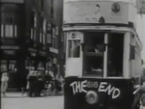 |
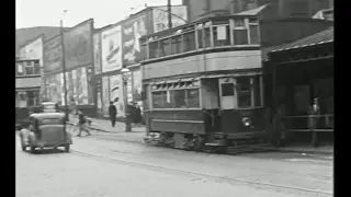
| Above: YouTubeCA video - Birmingham's Trams And Trolleybuses - Length: 30:25 mins. | Above: YouTubeCA video - Last of the Birmingham Trams - Length: 2:51 mins. |
PHOTOS
 |
 |
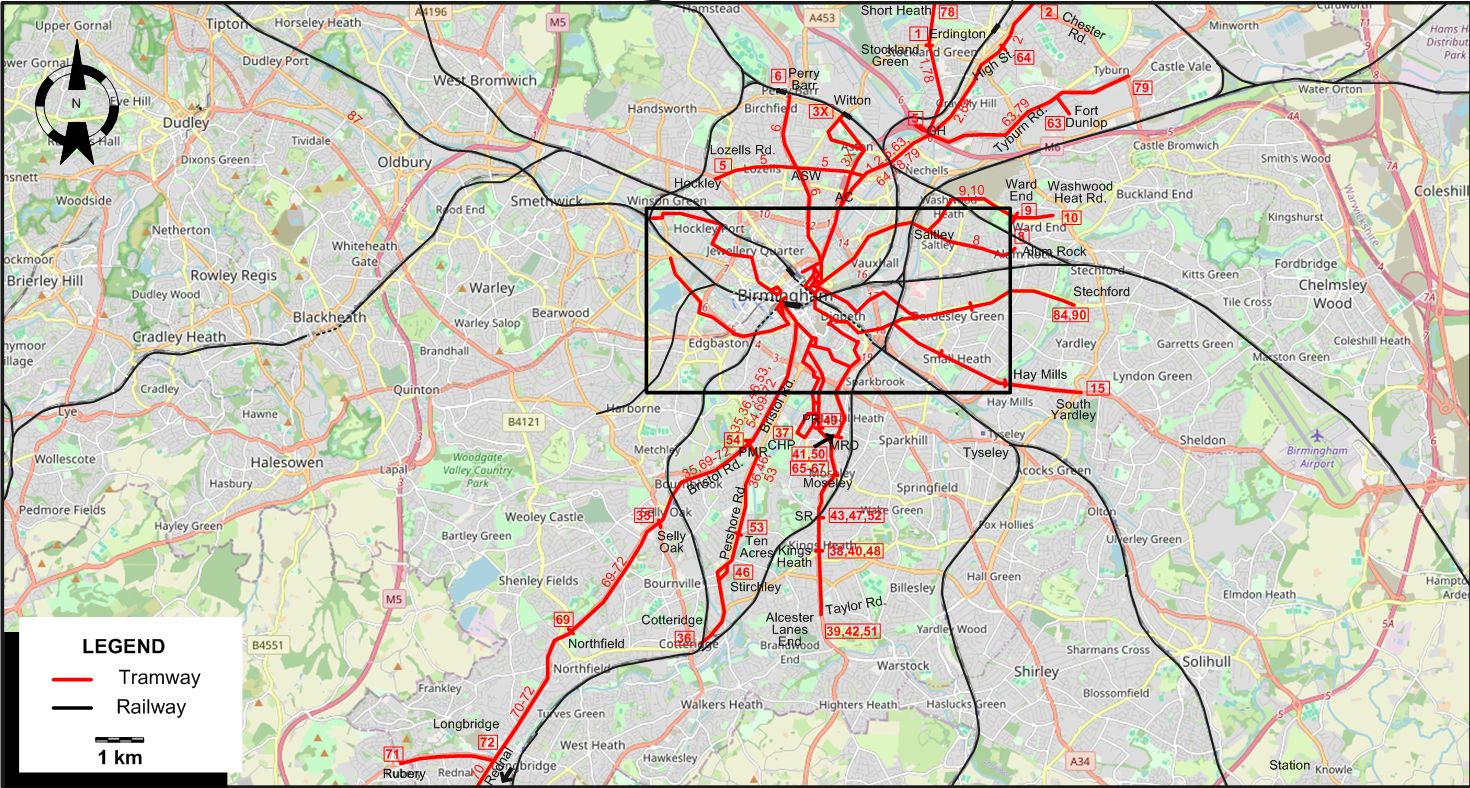
MAPS
INSET: CENTRAL BIRMINGHAM
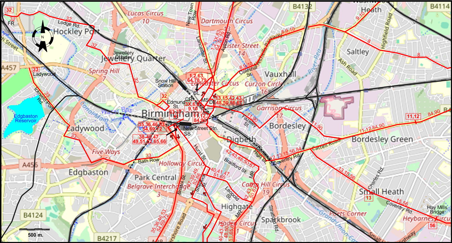
ABBREVIATIONS ON THE MAPS
| AC | Aston Cross | MS | Martineau St. |
| AS | Albert St. | MR | Moseley Rd. |
| ASW | Aston Six Ways | MRD | Moseley Rd. Depot |
| CHP | Cannon Hill Park | NS | Navigation St. |
| CR | Colmore Row | PMR | Pebble Mill Rd. |
| DE | Dale End | PR | Park Rd. |
| FR | Foundry Rd. | SL | Steelhouse Lane |
| GH | Gravelly Hill | SR | Station Rd. |
| HS | Hill St. | SS | Station St. |
I created the above maps by overlaying OpenStreetMap (OSM) maps with my own data. The underlying map data is © OpenStreetMap contributors, licensed under the Open Database License (ODbL).
Please note that the OSM maps used as a template for these maps corresponds to the situation at the time the map was downloaded and may show features that did not exist at the time the GS Tram Site is supposed to show. In particular, it may show bridges and highways that were built later.
TRAM ROUTES
Operator: Birmingham Corporation Tramways
| 1 | Steelhouse Lane - Aston Rd. - Aston Cross - Gravelly Hill - Stockland Green |
| 2 | Steelhouse Lane - Aston Rd. - Aston Cross - Gravelly Hill - Erdington (Chester Rd.) |
| 3X | Martineau St. - Aston Rd. - Aston Cross - Witton |
| 5 | Lozells Road - Aston Six Ways - Gravelly Hill |
| 6 | Martineau St. - Lancaster St. - New Town Row - Aston Six Ways - Perry Barr |
| 8 | Martineau St. - Coleshill St. - Saltley - Alum Rock |
| 9 | Martineau St. - Coleshill St. - Saltley - Ward End |
| 10 | Martineau St. - Coleshill St. - Saltley - Ward End - Washwood Heat Rd. |
| 11 | Albert St. - Fazeley St. - Bordesley Green |
| 12 | Albert St. - Deritend High St. - Coventry Rd. - Bordesley Green |
| 13 | Dale End - Deritend High St. - Coventry Rd. - Small Heath (Charles Rd.) |
| 15 | Dale End - Deritend High St. - Coventry Rd. - Small Heath - Hay Mills - South Yardley |
| 32 | Edmund St. - Jewellery Quarter - Lodge Rd. - Foundry Rd. |
| 33 | Navigation St. - Bath Row - Icknield Port Rd. - Ladywood |
| 35 | Navigation St. - Bristol St. - Bristol Rd. - Selly Oak |
| 36 | Navigation St. - Bristol St. - Bristol Rd. - Pershore Rd. - Cotteridge |
| 37 | Navigation St. - Hurst St. - Sherlock St. - Cannon Hill Park |
| 38 | Hill St. - Hurst St. - Sherlock St. - Park Rd. - Moseley - Kings Heath |
| 39 | Hill St. - Hurst St. - Sherlock St. - Park Rd. - Moseley - Kings Heath - Alcester Lanes End (Taylor Rd.) |
| 40 | Hill St. - Hurst St. - Leopold St. - Mosely Rd. - Moseley - Kings Heath |
| 41 | Navigation St. - Hurst St. - Leopold St. - Mosely Rd. - Moseley Rd. Depot |
| 42 | Dale End - Bradford St. - Moseley Rd. - Moseley - Kings Heath - Alcester Lanes End (Taylor Rd.) |
| 43 | Dale End - Bradford St. - Moseley Rd. - Moseley - Station Rd. |
| 46 | Navigation St. - Bristol St. - Bristol Rd. - Pershore Rd. - Stirchley |
| 47 | Hill St. - Hurst St. - Leopold St.. - Mosely Rd. - Moseley - Station Rd. |
| 48 | Dale End - Bradford St. - Moseley Rd. - Moseley - Kings Heath |
| 49 | Hill St. - Hurst St. - Sherlock St. - Park Rd. |
| 50 | Dale End - Bradford St. - Moseley Rd. - Moseley Rd. Depot |
| 51 | Hill St. - Hurst St. - Leopold St.. - Mosely Rd. - Moseley - Kings Heath - Alcester Lanes End (Taylor Rd.) |
| 52 | Hill St. - Hurst St. - Sherlock St. - Park Rd. - Moseley - Station Rd. |
| 53 | Navigation St. - Bristol St. - Bristol Rd. - Pershore Rd. - Ten Acres |
| 54 | Navigation St. - Bristol St. - Bristol Rd. - Pebble Mill Rd. |
| 56 | Dale End - Deritend High St. - Coventry Rd. - Small Heath - Hay Mills Bridge |
| 63 | Steelhouse Lane - Aston Rd. - Aston Cross - Gravelly Hill - Tyburn Rd. - Fort Dunlop |
| 64 | Steelhouse Lane - Aston Rd. - Aston Cross - Gravelly Hill - Erdington (High St.) |
| 65 | Hill St. - Hurst St. - Leopold St. - Mosely Rd. - Moseley |
| 66 | Hill St. - Hurst St. - Sherlock St. - Park Rd. - Moseley |
| 67 | Dale End - Bradford St. - Moseley Rd. - Moseley |
| 69 | Navigation St. - Bristol St. - Bristol Rd. - Northfield (St. Lawrence Rd.) |
| 70 | Navigation St. - Bristol St. - Bristol Rd. - Northfield - Longbridge - Rednal |
| 71 | Navigation St. - Bristol St. - Bristol Rd. - Northfield - Longbridge - Rubery |
| 72 | Navigation St. - Bristol St. - Bristol Rd. - Northfield - Longbridge |
| 78 | Steelhouse Lane - Aston Rd. - Aston Cross - Gravelly Hill - Stockland Green - Short Heath |
| 79 | Steelhouse Lane - Aston Rd. - Aston Cross - Gravelly Hill - Tyburn Rd. - Chester Rd. |
| 84 | Albert St. - Deritend High St. - Coventry Rd. - Bordesley Green - Stechford |
| 90 | Albert St. - Fazeley St. - Bordesley Green - Stechford |
CHARACTERISTICS OF THE SYSTEM
NETWORK LENGTH
- Tramway: 130 km.
HISTORY
Tramways
- Horse tramways: 20 May 1872 - 1907.
- Steam tramways: 1882 - 31 Dec. 1906.
- Cable tramways: 1888 - 1911.
- First-generation electric tramway: 4 Jan. 1904 - 4 July 1953.
- Revived tramway (Midland Metro): 31 May 1999 - today.
GAUGE
- Tramways (First-generation tramways): 1067 mm.
- Midland Metro: 1435 mm.
SOURCES
- Ballinger, M. "Midland Metro: 'One damn thing after another'" Light Rail & Modern Tramway, July 1995 (58: 691), p.208-210.
- Bett, W.H. & Gillham, J.C. Great British tramway networks. London: Light Railway Transport League, 1962.
- "Birmingham City transport tramway services" The Modern Tramway, Feb. 1946 (9: 97), p.15.
- "Coventry VLR: It’s off the starting blocks", Tramways & Urban Transit, July 2025 (88: 1051), p.253-254.
- Gilbert, C. "Memories of Birmingham's steam trams" Modern Tramway, Apr.-May 1965 (28: 328-329), p.117-127 and 162-170.
- Hewitt, P. & Moreno, A. "Birmingham's 'Big Bang'" Tramways & Urban Transit, July 2017 (80: 955), p.256-261.
- Hewitt, P. & Moreno, A. "Midland Metro to 2030" Tramways & Urban Transit, Sept. 2017 (80: 957), p.335-340.
- Jaques, P. (ed.) Camwell's Birmingham: One man's transport perspective. Droitwich: Birmingham Transport Historical Group, 2007.
- Pulling, N. "Systems Factfile No.189: West Midlands Metro, UK" Tramways & Urban Transit, July 2023 (86: 1027), p.73-277.
WIKIS
- Birmingham Corporation Tramways
- Transport for West Midlands
- Transport in Birmingham
- West Midlands Metro
WEB SITES
Thanks to Urs Mattmann (from Thirsk, England) for the information and photos he kindly sent me concerning the Birmingham system.
Copyright Gabor Sandi 1998-2026
Disclaimer: Everything on this site was written and/or prepared at the author's discretion. The author has tried to be accurate where facts are presented, but this does not mean that these facts are necessarily accurate. People needing more reliable information should refer to appropriate sources presented, on the Internet or elsewhere, by authoritative professional or academic bodies.
To get in touch with the webmaster, send an e-mail to g_sandi at hotmail.com.
Flags on this site are from the FOTW Flags Of The World website.