 |
 |
 |
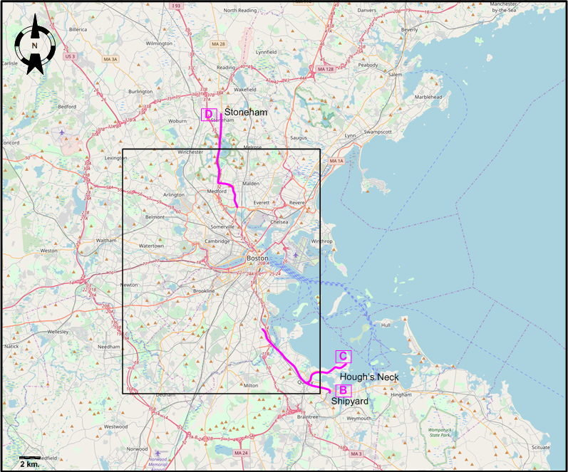
INSET: THE BOSTON AREA
(Only interurban lines are shown)
ABBREVIATIONS ON THE MAPS
| Bw | Bowdoin | MA | Massachusetts Av. |
| GH | Grove Hall | PS | Park Station |
| HA | Humboldt Av. | TSS | Tremont Street subway |
| HB | Harvard Bridge | UC | Uphams Corner |
| Hm | Haymarket | WIP | Wood Island Park |
| LS | Lexington St. | WS | Warren St. |
I created the above maps by overlaying OpenStreetMap (OSM) maps with my own data. The underlying map data is © OpenStreetMap contributors, licensed under the Open Database License (ODbL).
Please note that the OSM maps used as a template for these maps corresponds to the situation at the time the map was downloaded and may show features that did not exist at the time the GS Tram Site is supposed to show. In particular, it may show bridges and highways that were built later.
DISCONTINUATION DATES OF STREETCAR TRACKS BETWEEN 16 FEB. 1941 AND 5 DEC. 1946 (affected route designations in parantheses)
- 1941 Feb. 16: Huntington Av. (N of Camden St.) - Boylston Av. [Surface sections] (39, 57)
- 1941 Nov. 7: Lechmere - Clarendon Hill (via Somerville Av. & Highland Av.) (87, 88)
- 1946 June 30: Quincy - Hough's Neck (EMSR)
- 1946 July 28: Medford - Stoneham (99, EMSR)
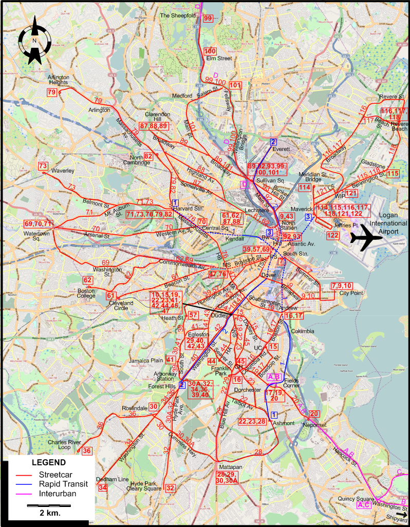
ROUTES
Operator: Boston Elevated Railway
STREETCAR ROUTES
| 7 | South Station - Summer St. - City Point |
| 9 | North Station - Tremont Street subway - Broadway - City Point |
| 10 | Dudley - Southampton St. - City Point |
| 15 | Dudley - Dudley St. - Uphams Corner |
| 16 | Andrew - Boston St. - Columbia Rd. - Franklin Park |
| 17 | Andrew - Boston St. - Bowdoin St. - Fields Corner |
| 19 | Dudley - Warren St. - Fields Corner |
| 20 | Fields Corner - Neponset |
| 22 | Dudley - Warren St. - Blue Hill Av. - Talbot Av. - Ashmont |
| 23 | Dudley - Warren St. - Dorchester - Ashmont |
| 28 | Ashmont - Mattapan |
| 29 | Egleston - Seaver St. - Blue Hill Av. - Mattapan |
| 30 | Mattapan - Cummins Hwy. - Roslindale |
| 30A | Mattapan - Cummins Hwy. - Hyde Park Ave. - Arborway Station |
| 32 | Arborway Station - Hyde Park Ave. - Hyde Park, Cleary Square |
| 34 | Arborway Station - Washington St. - Dedham Line |
| 36 | Arborway Station - Washington St. - Roslindale - Charles River Loop |
| 39 | Park St. Station - Boylston St. - Huntington Av. - South St. - Arborway Station |
| 40 | Egleston - Washington St. - Arborway Station |
| 41 | Dudley - Jamaica Plain |
| 42 | Dudley - Washington St. - Egleston |
| 43 | North Station - Tremont Street subway - Columbus Av. – Egleston |
| 44 | Dudley - Humboldt Av. - Seaver St. |
| 45 | Dudley - Dudley St. - Blue Hill Av. - Grove Hall |
| 47 | Dudley - Massachusetts Av. - Massachusetts Stn. |
| 57 | Park St. Station - Boylston St. - Huntington Av. - Heath St. |
| 61 | Lechmere – North Station - Tremont Street subway - Boylston St. subway - Beacon St. - Cleveland Circle |
| 62 | Lechmere – North Station - Tremont Street subway - Boylston St. subway - Commonwealth Av. - Boston College |
| 69 | Park St. Station - Tremont Street subway - Boylston St. subway - Commonwealth Av. - Washington St. - Watertown Sq. |
| 70 | Central Sq. - Western Av. - Arsenal St. - Watertown Sq. |
| 71 | Harvard Stn. - Mt. Auburn St. - Watertown Sq. |
| 73 | Harvard Stn. - Mt. Auburn St. - Belmont St. - Waverley |
| 76 | Harvard Stn. - Massachusetts Av. - Harvard Bridge - Massachusetts Stn. |
| 79 | Harvard Stn. - Massachusetts Av. - Arlington - Arlington Heights |
| 82 | Harvard Stn. - Massachusetts Av. - North Cambridge |
| 87 | Lechmere - Somerville Av. - Clarendon Hill |
| 88 | Lechmere - Highland Av. - Clarendon Hill |
| 89 | Sullivan Sq. - Broadway - Clarendon Hill |
| 92 | Haymarket - North Stn. - Main St. - Sullivan Sq |
| 93 | Haymarket - North Stn. - Bunker Hill St. - Sullivan Sq |
| 99 | Sullivan Sq. - Wellington Bridge - Fellsway - Elm Street - The Sheepfold |
| 100 | Sullivan Sq. - Wellington Bridge - Fellsway - Elm Street |
| 101 | Sullivan Sq. - Broadway - Main St. - Medford - Salem St. |
| 114 | Maverick - Meridian St. Bridge |
| 115 | Maverick - Bennington St. - Gladstone St. |
| 116 | Maverick - Bennington St. - Broadway - Revere St. - Revere Beach |
| 117 | Maverick - Bennington St. - Broadway - Beach St. - Revere Beach |
| 118 | Maverick - Bennington St. - Revere Beach |
| 121 | Maverick - Lexington St. - Wood Island Park |
| 122 | Maverick - Jeffries Pt. |
SUBWAY ROUTES
| 1 | Harvard Station - Central Sq. - Kendall - Park St. Station - South Stn. - Columbia - Ashmont |
| 2 | Everett - Sullivan Sq. - North Station - Dover - Egleston - Forest Hills |
| 3 | Bowdoin - Atlantic Av. - Maverick |
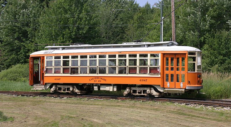
Operator: Eastern Massachusetts Street Railway
INTERURBAN ROUTES
| A | Fields Corner - Neponset - Hancock St. - Quincy Square |
| B | Fields Corner - Neponset - Hancock St. - Quincy Square - Washington St. - Shipyard |
| C | Quincy Square - Hough’s Neck |
| D | Sullivan Sq. - Wellington Bridge - Fellsway - Elm Street - The Sheepfold - Stoneham |
Note that the above numeric and alphabetic route designations are of an indicative nature only, and were not used by the operating companies at the time.
CHARACTERISTICS OF THE SYSTEM
NETWORK LENGTH
- Streetcar lines: ? km.
- Subway lines: ? km.
- Interurban lines: ? km.
HISTORY
- Streetcars: (horse-powered) 26 March 1856 - ca. 1900; (electric) 1 Jan. 1889 - today.
- Subway: 1 Sept. 1897 - today.
- Interurbans: 1892 - 1 May 1948
GAUGE
- Streetcars / Interurbans: 1435 mm.
- Subway: 1435 mm.
TRAM PRESERVATION
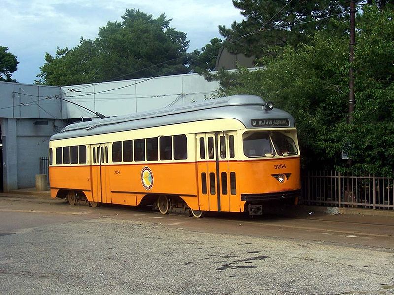
The Seashore Trolley Museum, in Kennebunkport (Maine), just NE of Boston, owns and operates historic Boston-area streetcars and subway vehicles, as well as many other vintage public transportation vehicles from around the world.
SOURCES
- "Boston Green line reaches Somerville" Tramways & Urban Transit, May 2022 (85: 1013), p.164.
- Buckley, R. "No tea party in Boston" Tramways & Urban Transit, Dec. 2012 (75: 900), p.459-461.
- Clarke, B.H. Streetcar Lines of the Hub, the 1940s Heyday of Electric Transit in Boston. Boston: Boston Street Railway Association, 2003.
- Grahl, A. "Great strides in Boston" Tramways & Urban Transit, Jan. 2026 (89: 1057), p.10-13.
- Demery, L.W. "US transit funding - Part 6: Elsewhere in the USA (East Coast) [Boston]" Modern Tramway & Light Rail Transit, July 1990 (53: 631), p. 219-222.
- Kyper, F. "Tramways in Boston today - Part 1" Modern Tramway & Light Railway Review, Jan. 1968 (31: 361), p.11-16.
- Metropolitan Transit Authority (MTA). System Route Map. 1956.
- Pence, H. "Blizzard buries Boston" Tramways & Urban Transit, June 2015 (78: 930), p.226-230.
- Simons, V. "Branching out in Boston", Tramways & Urban Transit, July 2022 (85: 1015), p.254-260.
- Simons, V. "Systems Factfile No.99: Boston, USA", Tramways & Urban Transit, Dec. 2015 (78: 936), p.488-492.
- Taplin, M.R. Tramways of North America, including rapid transit [Tramway Handbooks No.4] Hassocks (West Sussex, England): Light Rail Transit Association, 1981.
WIKIS
- Ashmont–Mattapan High-Speed Line
- Blue Line (MBTA)
- Boston-area streetcar lines
- Boston Elevated Railway
- Boston Street Railway Association
- Eastern Massachusetts Street Railway
- Green Line (MBTA)
- History of the MBTA
- Massachusetts Bay Transportation Authority (MBTA)
- Orange Line (MBTA)
- Red Line (MBTA)
WEB SITES
- Boston (on UrbanRail.Net)
- Boston Street Railway Association
- Massachusetts Bay Transportation Authority (MBTA)
Also, thanks to Jean Liou in France and Russell Powers from Denver CO for information on the history of the Boston system.
Copyright Gabor Sandi 1998-2026
Disclaimer: Everything on this site was written and/or prepared at the author's discretion. The author has tried to be accurate where facts are presented, but this does not mean that these facts are necessarily accurate. People needing more reliable information should refer to appropriate sources presented, on the Internet or elsewhere, by authoritative professional or academic bodies.
To get in touch with the webmaster, send an e-mail to g_sandi at hotmail.com.
Flags on this site are from the FOTW Flags Of The World website.