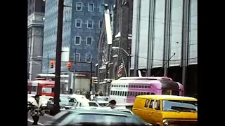
VIDEOS
 |
 |
 |
| Above: YouTubeCA video - Pittsburgh PCC Streetcars 1976 & 1982 Silent Movie - Length: 10:08 mins. | Above: YouTubeCA video - Pittsburgh Streetcars in the 1960s - East Side (East End) Scenes - Length: 20:36 mins. | Above: YouTubeCA video - Pittsburgh: You Wanted To Know About Pittsburgh's Inclines - Length: 3:18 mins. |
PHOTOS
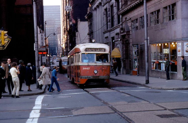 |
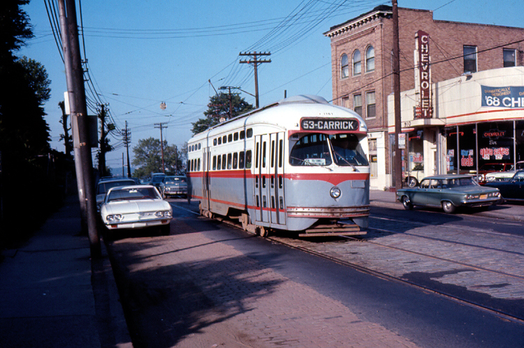 |
 |
MAPS

INSET: DOWNTOWN PITTSBURGH
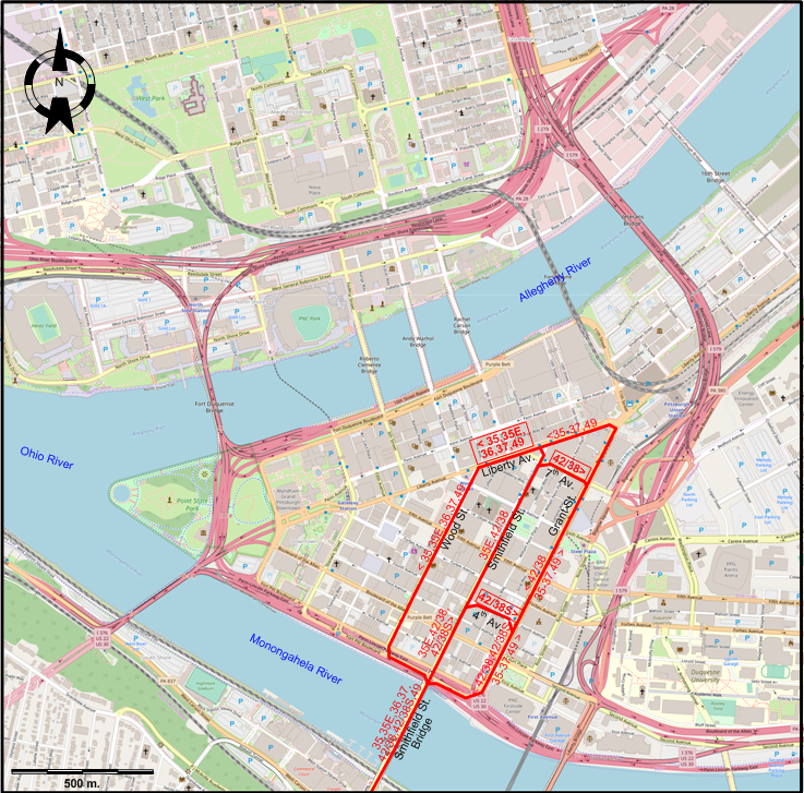
I created the above maps by overlaying OpenStreetMap (OSM) maps with my own data. The underlying map data is © OpenStreetMap contributors, licensed under the Open Database License (ODbL).
Please note that the OSM maps used as a template for these maps corresponds to the situation at the time the map was downloaded and may show features that did not exist at the time the GS Tram Site is supposed to show. In particular, it may show bridges and highways that were built later.
ABBREVIATIONS ON THE MAPS
| DI | Duquesne Incline | MI | Monongahela Incline |
DISCONTINUATION DATES OF STREETCAR/LRT TRACKS BETWEEN AUG. 1973 AND 25 MARCH 2012 (affected route numbers in parentheses).
- 1985 July 3: All downtown surface streetcar trackage (35-37, 42/38, 52 [earlier 49])
- 1999 Sept. 4: Dorchester - Drake (47D, earlier 36)
- 2011 March 27: E. Carson St. - Arlington Av. - Warrington Av. - South Hills Jnctn. (Brown Line, earlier 52, even earlier 49)
ROUTES
STREETCAR ROUTES
Operator: Port Authority of Allegheny County
| 35 | Library | Liberty Av. - Wood St. [back: Grant St.] - Smithfield St. Bridge - Mt. Washington Tunnel - South Hills Jnctn. - Overbrook - Castle Shannon - Bethel Park - Library |
| 35E | Library Express | Liberty Av. - Wood St. [back: Smithfield St.] - Smithfield St. Bridge - Mt. Washington Tunnel - South Hills Jnctn. - Overbrook - Castle Shannon - Bethel Park - Library |
| 36 | Drake | Liberty Av. - Wood St. [back: Grant St.] - Smithfield St. Bridge - Mt. Washington Tunnel - South Hills Jnctn. - Overbrook - Castle Shannon - Drake |
| 37 | Shannon | Liberty Av. - Wood St. [back: Grant St.] - Smithfield St. Bridge - Mt. Washington Tunnel - South Hills Jnctn. - Overbrook - Castle Shannon |
| 42/38 | Mt. Lebanon-Beechview | 7th Av. - Grant St. [back: Smithfield St.] - Smithfield St. Bridge - Mt. Washington Tunnel - South Hills Jnctn. - Beechview - Dormont - Mt. Lebanon - Castle Shannon |
| 42/38S | Mt. Lebanon-Beechview short-turn | 4th Av. - Grant St. [back: Smithfield St.] - Smithfield St. Bridge - Mt. Washington Tunnel - South Hills Jnctn. - Beechview - Dormont - Mt. Lebanon - Castle Shannon |
| 49 | Arlington-Warrington | Liberty Av. - Wood St. [back: Grant St.] - Smithfield St. Bridge - E. Carson St. - Arlington Av. - Warrington Av. - South Hills Jnctn. |
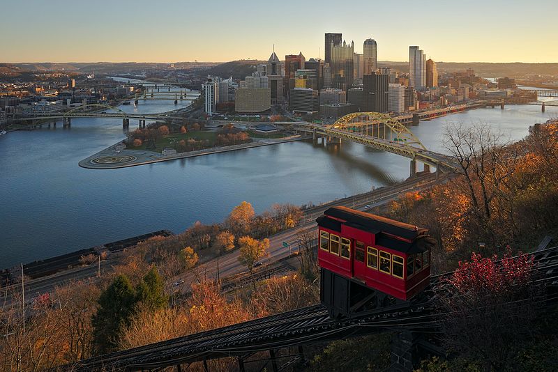
INCLINES (FUNICULARS)
Operator: By private non-profit organization (Duquesne Incline) and by the Port Authority of Allegheny County (Monongahela Incline)
| Duquesne Incline | W Carson St. - Grandview Av. (and Oneida St.) | |
| Monongahela Incline | W Carson St. - Grandview Av. (and Wyoming St.) |
CHARACTERISTICS OF THE SYSTEM
NETWORK LENGTH
- Streetcar network: ca. 40 km.
- Duquesne Incline: 244 m.
- Monongahela Incline: 194 m.
HISTORY
- Streetcars: (horse-powered) 6 Aug. 1859 - 27 Aug. 1923; (electric) 21 Feb. 1888 - today.
- Passenger incline: 28 May 1870 - 21 Nov. 1962 (reopened as a tourist attraction: 1 July 1963 - today).
- Cable cars: 9 Oct. 1888 - 14 June 1897.
- Interurbans: 1891 - 29 Aug. 1953
- Light rail (integrated with the streetcar lines): 15 Apr. 1984 - today.
- Funiculars (Inclines): 28 May 1870 - today.
GAUGE
- Streetcars & Light rail: 1588 mm.
- Funiculars (Inclines): 1524 mm. (Knoxville Incline: 2743 mm.)
SOURCES
- Berman, J. Pittsburgh Railways - Trolley service updated for 1954. Map, June 2019.
- DuPuis, R. "Farewell to the Pittsburgh PCCs - Part 2" Tramways & Urban Transit, Feb. 2000 (63: 746), p.49-51.
- Lyon, M.A. "Pittsburgh trams today: Phoenix or swan song?" Modern Tramway & Rapid Transit Review, Nov. 1974 (37: 443), p.366-373.
- Miller, O.W. History of Pittsburgh area transit since 1840 and PATRansit 1964-1974: Historical data (Draft). Pittsburgh: Port Authority of Allegheny County, 1974.
- Sellin, M.V. & Morgan, S.J. "Pittsburgh light rail progress" Modern Tramway & Light Rail Transit, May 1986 (49: 581), p.155-165.
- Simons, V. "Systems Factfile No.57: Pittsburgh, USA" Tramways & Urban Transit, June 2012 (75: 894), p.223-226.
- Simons, V. "Systems Factfile No.184: Pittsburgh, USA" Tramways & Urban Transit, Feb.2023 (86: 1022), p.63-67.
- Taplin, M.R. Tramways of North America, including rapid transit [Tramway Handbooks No.4] Hassocks (West Sussex, England): Light Rail Transit Association, 1981.
WIKIS
- Duquesne Incline
- Knoxville Incline
- Monongahela Incline
- Pittsburgh Railways
- List of streetcar routes in Pittsburgh
- Pittsburgh light rail
WEB SITES
Special thanks to Russell Powers from Denver CO for information on the history of the Pittsburgh system.
Copyright Gabor Sandi 1998-2026
Disclaimer: Everything on this site was written and/or prepared at the author's discretion. The author has tried to be accurate where facts are presented, but this does not mean that these facts are necessarily accurate. People needing more reliable information should refer to appropriate sources presented, on the Internet or elsewhere, by authoritative professional or academic bodies.
To get in touch with the webmaster, send an e-mail to g_sandi at hotmail.com.
Flags on this site are from the FOTW Flags Of The World website.