VIDEOS
 |
 |
| Above: YouTubeCA video - The Light Rail of Buffalo, New York - Length: 6:14 mins. | Above: YouTubeCA video - The Light Rail of Buffalo, New York 2018 - Length: 8:49 mins. |
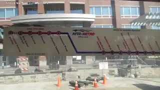
PHOTOS
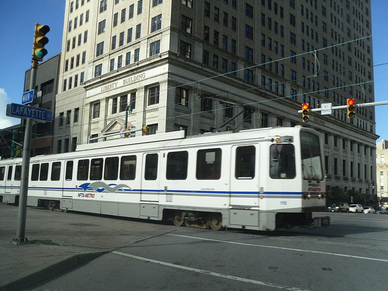 |
 |
MAP
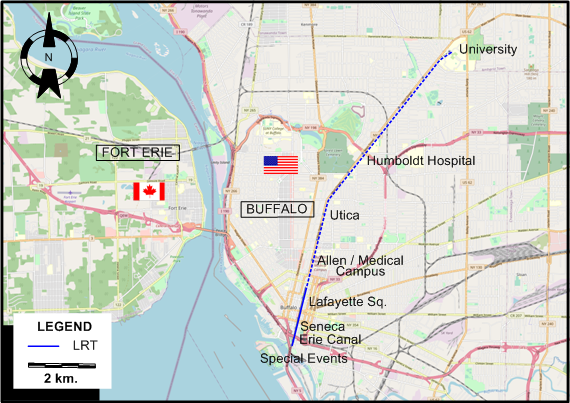
I created the above map by overlaying OpenStreetMap (OSM) maps with my own data. The underlying map data is © OpenStreetMap contributors, licensed under the Open Database License (ODbL).
Please note that the OSM map used as a template for this map corresponds to the situation at the time the map was downloaded and may show features that did not exist at the time the GS Tram Site is supposed to show. In particular, it may show bridges and highways that were built later.
LRT ROUTE
Operator: Niagara Frontier Transportation Authority (NFTA)
| Metro Rail | University - Humboldt Hospital - Utica - Allen / Medical Campus - Lafayette Square - Seneca - Erie Canal [on special occasions: - Special Events] |
CHARACTERISTICS OF THE SYSTEM
NETWORK LENGTH
- LRT: 10.3 km.
HISTORY
- Streetcars (traditional): (horse-powered) 1860 - ; (electric) 1888 - 1 July 1950.
- Interurbans: 1895 - 20 Aug. 1937.
- Modern light rail: 9 Oct. 1984 - today.
GAUGE
- Streetcars & interurbans: 1435 mm.
SOURCES
- Bregger, D.D. Buffalo's historic streetcars and buses. Charleston (SC): Arcadia, 2008.
- Sellin, M.V. "Light rapid transit in Buffalo" Modern Tramway & Light Rail Transit, July 1985 (48: 571), p.228-231.
- Taplin, M.R. Tramways of North America, including rapid transit [Tramway Handbooks No.4] Hassocks (West Sussex, England): Light Rail Transit Association, 1981.
WIKIS
- Buffalo Metro Rail
- International Railway (New York–Ontario)
- Interurban railways (on the Chicago Transit & Railfan site)
- List of routes of City of Buffalo streetcars
WEB SITES
- International Railway Company - Buffalo Streetcar and Bus Guide, Oct. 1935
- NFTA Metro
- Niagara Falls Info: Niagara Falls, USA Streetcars
- OpenStreetMap - Relation: Buffalo-Niagara Falls High-Speed Line (1403975)
Special thanks to Russell Powers from Denver CO for information on the history of the Buffalo system.
Copyright Gabor Sandi 1998-2026
Disclaimer: Everything on this site was written and/or prepared at the author's discretion. The author has tried to be accurate where facts are presented, but this does not mean that these facts are necessarily accurate. People needing more reliable information should refer to appropriate sources presented, on the Internet or elsewhere, by authoritative professional or academic bodies.
To get in touch with the webmaster, send an e-mail to g_sandi at hotmail.com.
Flags on this site are from the FOTW Flags Of The World website.