 |
 |
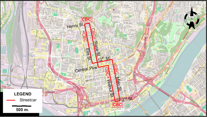
I created the above map by overlaying OpenStreetMap (OSM) maps with my own data. The underlying map data is © OpenStreetMap contributors, licensed under the Open Database License (ODbL).
Please note that the OSM map used as a template for this map corresponds to the situation at the time the map was downloaded and may show features that did not exist at the time the GS Tram Site is supposed to show. In particular, it may show bridges and highways that were built later.
STREETCAR ROUTE
Operator: Go Metro
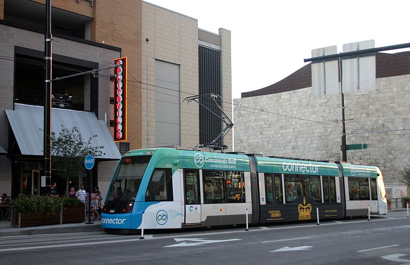
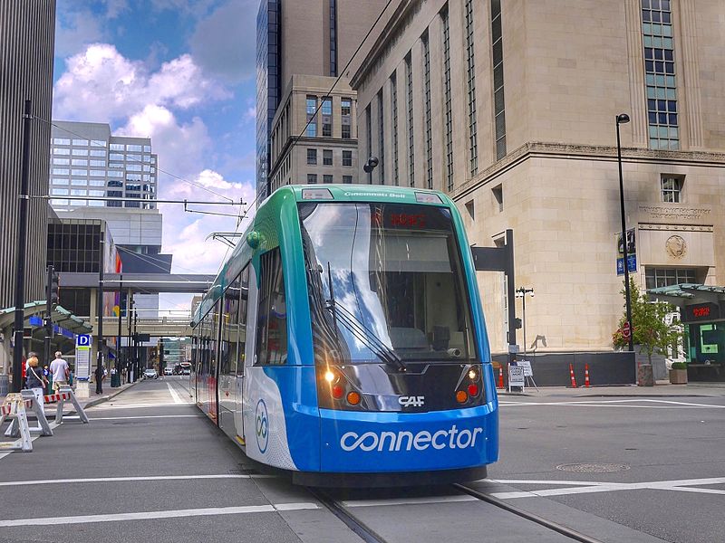
| CBC | Cincinnati Bell Connector | Henry St. - Race St. - Central Pkw. - Walnut St. - 2nd St. - Main St. - 12th St. - Elm St. - Henry St. [One-way loop] |
CHARACTERISTICS OF THE SYSTEM
NETWORK LENGTH
- Streetcar line: 5.8 km. (One-way loop)
HISTORY
- Horse-drawn streetcars: 14 Sept. 1859 - 1904.
- Electric streetcars (1st generation; dual wiring): 1888 - 29 Apr. 1951.
- Electric streetcars (2nd generation): 9 Sept. 2016 - today.
- Interurbans: 1873 - 1943.
- "Steam dummies" (Steam-operated streetcars): 1860 - 1897
- Cable cars: 17 July 1885 - 9 June 1902.
- "Inclined railways" (funiculars carrying streetcars between different levels; powered at first by steam, later by electricity): 1872 - 1948.
GAUGE
- Horse-drawn streetcars: 1588 mm.
- Streetcars (1st generation): 1588 mm.
- Streetcars (2nd generation): 1435 mm.
- Interurbans: 1435 mm., 1588 mm.
SOURCES
- Pence, H. "At last, Cincinnati gets its metals", Tramways & Urban Transit, June 2013 (76: 906), p.256-258.
- Pence, H. & Retallick H. "Re-connecting Cincinnati", Tramways & Urban Transit, Nov. 2016 (79: 947), p.421-425.
- Wagner, R.M. & Wright, R.J. Cincinnati streetcars - No.9: Streamliners and war horses. Wyoming (OH): Trolley Talk, 1984.
WIKIS
- Cincinnati Bell Connector
- Cincinnati Street Railway
- Historical Atlas of Cincinnati: The Relationship Between Transportation and Urban Growth in Cincinnati.
- Southwest Ohio Regional Transit Authority
- Streetcars in Cincinnati
WEB SITES
- Cincinnati Bell Connector
- Cincinnati Traction History
- CINCINNATI-TRANSIT.net
- Cincinnati Transit Historical Association
- Go Metro
- Southwest Ohio Regional Transit Authority (SORTA) Cincinnati Streetcar / Cincinnati Bell Connector
Copyright Gabor Sandi 1998-2026
Disclaimer: Everything on this site was written and/or prepared at the author's discretion. The author has tried to be accurate where facts are presented, but this does not mean that these facts are necessarily accurate. People needing more reliable information should refer to appropriate sources presented, on the Internet or elsewhere, by authoritative professional or academic bodies.
To get in touch with the webmaster, send an e-mail to g_sandi at hotmail.com.
Flags on this site are from the FOTW Flags Of The World website.