 |
 |

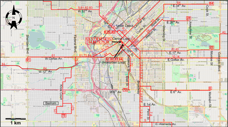
INSET: CENTRAL DENVER
I created the above maps by overlaying OpenStreetMap (OSM) maps with my own data. The underlying map data is © OpenStreetMap contributors, licensed under the Open Database License (ODbL).
Please note that the OSM maps used as a template for these maps corresponds to the situation at the time the map was downloaded and may show features that did not exist at the time the GS Tram Site is supposed to show. In particular, it may show bridges and highways that were built later.
DISCONTINUATION DATES OF STREETCAR TRACKS AFTER 1946 MAY 12 (affected route numbers in parantheses)
- 1947 Nov. 1: Welton St. - E.28t Av. (28)
- 1948 June 6: E.17th Av. - Colorado Blvd. - 23rd Av. - Park Hill (Hudson St.) (20, 40)
- 1948 Nov. 7: E. 6th Av. (6)
- 1949 Sept. 4: Stout St. - Downing St. - E.34th Av. (64); Knox Court - Barnum (75); Larimer St. & W. Colfax Av. (61)
- 1949 Oct. 23: Penn St. - S.Pearl St. - [E.Jewel Av.] / [E.Evans Av. - Denver U.] (7, 8)
- 1950 June 3: Broadway (1, 2, 3, 5); E. Alameda Av. - S.Gaylord St. - E.Louisiana Av. (5); E. Colfax Av. (10, 14); Delaware St. - Elati St. - W.6th Av. (72); Southern Interurban route to Lakewood - Golden (84)
- 1950 July 2: Rest of the Interurban network (81, 82, 83)
STREETCAR ROUTES
Operator: Denver Tramway Corporation (DT)
| 1 | Broadway | Central Loop - 15th St. - Broadway - Alaska Av. |
| 2 | Broadway | Central Loop - 15th St. - Broadway - Colorado Av. |
| 3 | Englewood | Central Loop - 15th St. - Broadway - Colorado Av. - Englewood (Hampden Av.) |
| 5 | Berkeley / S. Gaylord | Berkeley Pk. - W.32nd Av. - 16th St. - 17th St. - Broadway - E. Alameda Av. - S.Gaylord St. - E.Louisiana Av. |
| 6 | E 6th Av. | Union Depot - 17th St. - Broadway - E 6th Av. - Madison St. |
| 7 | S. Pearl | Central Loop - 15th St. - Broadway - E 1st Av. - Penn St. - S.Pearl St. - E.Jewel Av. |
| 8 | University Park | Central Loop - 15th St. - Broadway - E 1st Av. - Penn St. - S.Pearl St. - E.Evans Av. - Denver U. |
| 10 | Colfax | Central Loop - 15th St. - E.Colfax Av. - Birch St. |
| 14 | Aurora | Central Loop - 15th St. - E.Colfax Av. - Montclair (Quebec St.) |
| 20 | E 17th Av. | Union Depot - 17th St. - E.17th Av. - City Park (Monroe St.) |
| 28 | W 44th Av. / E 28th Ave. | Berkeley Pk. - Lowell Blvd. - 44th Av. - Tejon St. - 16th St. - 17th St. - Welton St. - E.28th Av. - Josephine St. |
| 40 | Park Hill | Union Depot - 17th St. - E.17th Av. - Colorado Blvd. - 23rd Av. - Park Hill (Hudson St.) |
| 61 | Larimer | Sheridan Blvd. - W.Colfax Av. - Larimer St. - E40th Ave. & High St. |
| 64 | E 34th Av. | Central Loop - 15th St. - Stout St. - Downing St. - E.34th Av. - Cook St. |
| 72 | Cherokee | Central Loop - 15th St. - [15th St.] [Back: Curtis St. - 17th St. - Larimer St.] - Curtis St. - 13th St. - Delaware St. - Elati St. - W.6th Av. |
| 75 | Barnum | Central Loop - Larimer St. - W.Colfax Av. - Federal Blvd. - Knox Court - Barnum |
| 81 | Arvada | Interurban Loop - 16th St. - W.32nd Av. - Berkeley Pk. - Arvada |
| 82 | Leyden | Interurban Loop - 16th St. - W.32nd Av. - Berkeley Pk. - Arvada - Leyden |
| 83 | Golden | Interurban Loop - 16th St. - W.32nd Av. - Berkeley Pk. - Golden |
| 84 | Golden | Interurban Loop - Champa St. - Larimer St. - W.Colfax Av. - Federal Blvd. - W.12th Av. - Lakewood - Golden |
NB: Routes 81-84 were Interurban lines. Route 84 was operated by the Denver & Intermountain RR, a subsidiary of DT.
CHARACTERISTICS OF THE SYSTEM
NETWORK LENGTH
- Streetcars: ca. 180 km.
HISTORY
- Horse-drawn streetcars: 17 Dec. 1871 - 1890.
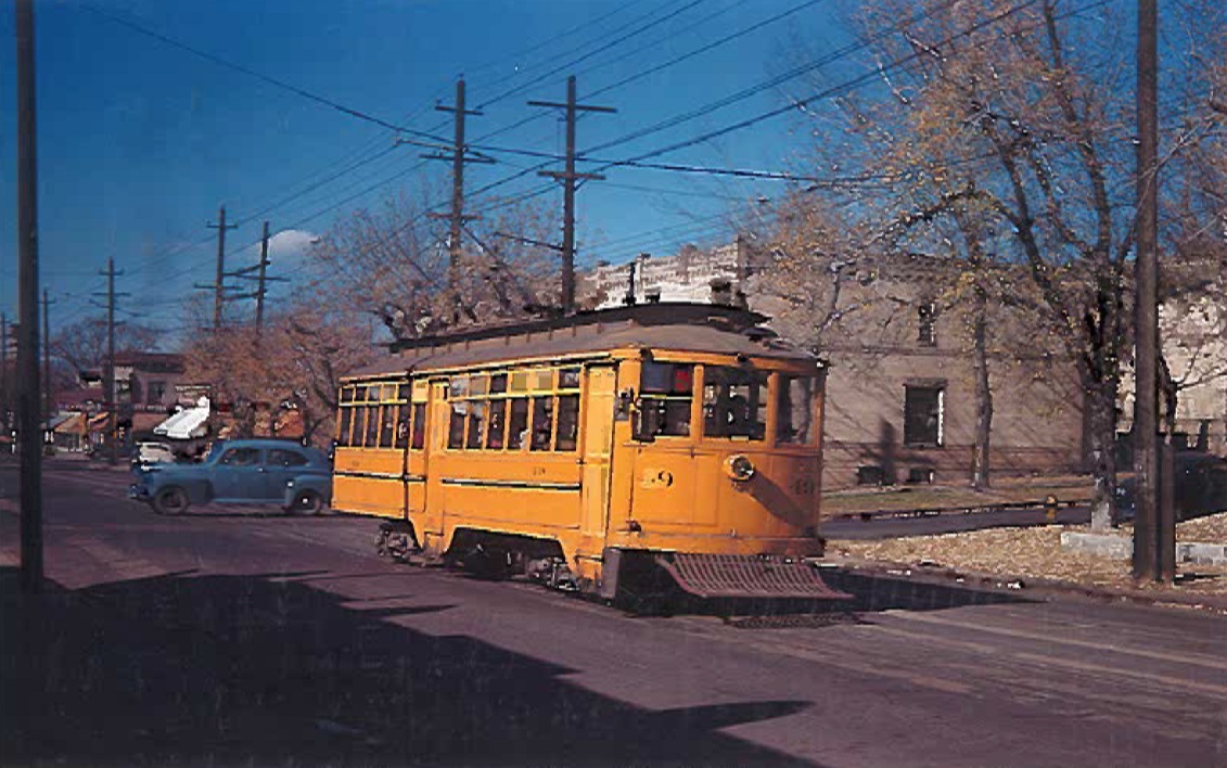
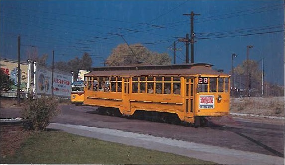
- Electric streetcars (1st generation): 1888 - 3 June 1950.
- Light rail (2nd generation):7 Oct. 1994 - today.
- Commuter rail: 22 Apr. 2016 - today.
- Cable cars: 1888 - 1900.
GAUGE
- Horse-drawn streetcars: 1067 mm.
- Streetcars (1st generation): 1067 mm.
- Interurban: 1067 mm. (routes 81,82,83); 1435 mm. (route 84).
- Light rail (2nd generation) and Commuter rail: 1435 mm.
SOURCES
- Lietwiler, C. "Denver: The politics of expansion", Light Rail & Modern Tramway, Aug. 1996 (59: 704), p.300-301.
- Lietwiler, C. "Denver: Winds of change are blowing cold", Light Rail & Modern Tramway, June 1995 (58: 699), p.170-175.
- Pharris, K. Riding Denver's Rails: A Mile-High Streetcar History. Charleston (SC): The History Press, 2013.
- Robertson, D. & Forrest, K. Denver's Street Railways, Vol. 3: The Interurbans. Golden (CO): Colorado Railroad Museum, 2010.
- Simons, V. "Denver - FasTracks slowed by regulatory approvals", Tramways & Urban Transit, Oct. 2017 (80: 958), p.370-373.
- Simons, V. "FasTracks: Denver's Big Bang", Tramways & Urban Transit, July 2013 (76: 907), p.294-298.
- Simons, V. "Ups and downs in Denver", Tramways & Urban Transit, Feb. 2020 (83: 986), p.294-298.
- Wansbeek, C.J. "Denver: Light rail expansion in all directions", Tramways & Urban Transit, March 2007 (70: 831), p.92-95.
WIKIS
WEB SITES
Special thanks to Russell Powers from Denver CO for information on the history of the Denver system.
Copyright Gabor Sandi 1998-2026
Disclaimer: Everything on this site was written and/or prepared at the author's discretion. The author has tried to be accurate where facts are presented, but this does not mean that these facts are necessarily accurate. People needing more reliable information should refer to appropriate sources presented, on the Internet or elsewhere, by authoritative professional or academic bodies.
To get in touch with the webmaster, send an e-mail to g_sandi at hotmail.com.
Flags on this site are from the FOTW Flags Of The World website.