VIDEO
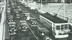 |
| Above: YouTubeCA video - Biscayne Bay Trolleys - Length: 3:19 mins. |
PHOTO
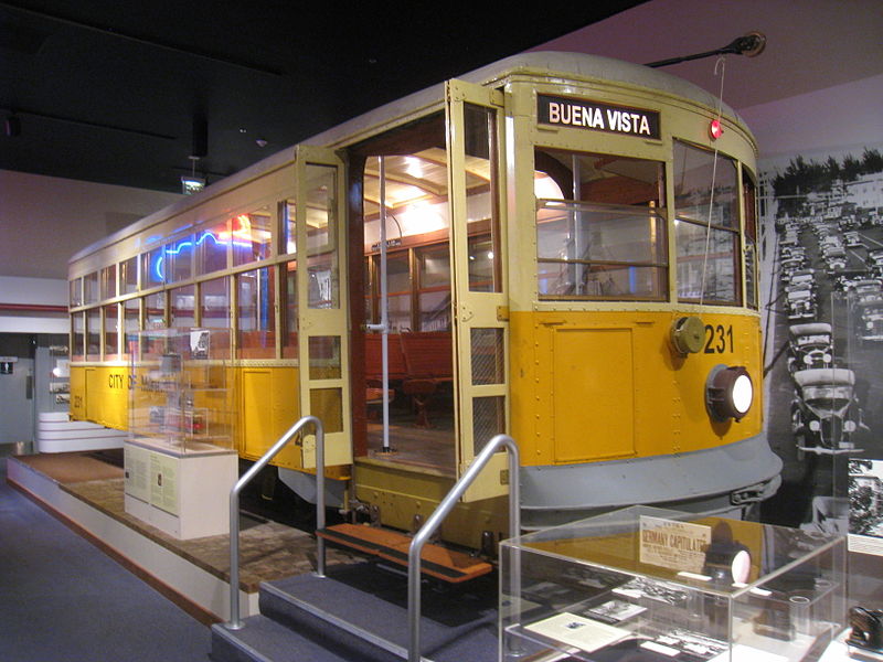 |
MAPS
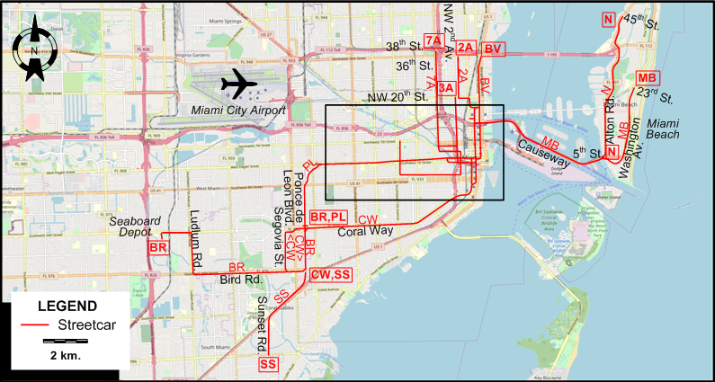
INSET: CENTRAL MIAMI
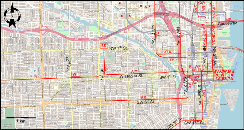
I created the above maps by overlaying OpenStreetMap (OSM) maps with my own data. The underlying map data is © OpenStreetMap contributors, licensed under the Open Database License (ODbL).
Please note that the OSM maps used as a template for these maps corresponds to the situation at the time the map was downloaded and may show features that did not exist at the time the GS Tram Site is supposed to show. In particular, it may show bridges and highways that were built later.
DISCONTINUATION DATES OF STREETCAR TRACKS BETWEEN 20 MAY 1928 AND 16 NOV. 1940 (affected route designations in parentheses).
- 1928 May 20: Bird Road line (BR)
- 1928 July 26: Ponce de Leon line (PL), but route taken over by CW and WF.
- 1931 May: Sunset Road line (SS)
- 1933 July 17: Nautilius line (N)
- 1935 Nov. 4: Coral Way line (CW)
- 1939 Oct. 17: Miami Beach line (MB)
- 1940 Nov. 16: All other routes
STREETCAR ROUTES
Operator: Miami Beach Railway Company (lines MB and N; also operated the other city trolley lines under contract)
| BV | Buena Vista | Flagler St. - NE 2nd Av. [back: NE 1st Av.] - NE 2nd Av. - NE 36th St. |
| MB | Miami Beach | Flagler St. - NE 2nd Av. [back: NE 1st Av.] - Causeway - Miami Beach (Washington Av. - 23rd St.) |
| N | Nautilus | Miami Beach service (5th St. - Alton Rd. - 45th St.) |
| WF | West Flagler St. | 1st Av - [SW 1st St. - SW 3rd Av.] [back: Flagler St.] - W Flagler St. - 22nd Av. |
| 2A | NW Second Avenue | Flagler St. - NE 2nd Av. [back: NE 1st Av.] - NW 17th St. [back: N Miami Av. - 14th St.] - NE 20th St. - NW 2nd Av. - NW 36th St. |
| 3A | NW Third Avenue | 1st Av - [SW 1st St. - SW 1st Av.] [back: Flagler St.] - W Flagler St. - NW 3rd Av. - NW 20th St. |
| 6S | SW 6th Street | 1st Av - [SW 1st St. - SW 3rd Av.] [back: Flagler St.] - W Flagler St. - SW 2ndAv. - SW 6th St. - 16th Av. - NW 7th St. |
| 7A | SW 6th Street | 1st Av - [SW 1st St. - SW 1st Av.] [back: Flagler St.] - W Flagler St. - [NW 3rd Av. - NW 5th St.] [back: NW 4th St. - NW 2nd Av.] - NW 7th Av. - 38th St. |
Operator: Coral Gables Rapid Transit
| BR | Bird Rd. | Coral Way - Ponce de Leon Blvd. - Bird Rd. - Ludlum Rd. - Seaboard Depot |
| CW | Coral Way | 1st Av - [SW 1st St.] [back: S Miami Av. - Flagler St.] - S Miami Av. - SW 13th St. - SW 3rd Av. - Coral Way - [Ponce de Leon Blvd.] [back: Bird Rd - Segovia St. Coral Way] - Bird Rd. |
| PL | Ponce de Leon Blvd. | 1st Av - [SW 1st St. - SW 1st Av.] [back: Flagler St.] - W Flagler St. - Ponce de Leon Blvd. - Coral Way |
| SS | Sunset Rd. | Bird Rd. - Ponce de Leon Blvd. - Sunset Rd. |
NB: The one- and two-character route designation codes used above are for convenience only, and were not used by the operators.
CHARACTERISTICS OF THE SYSTEM
NETWORK LENGTH
- Streetcar lines: ? km.
HISTORY
- Electric streetcars : 25 July 1906 - 3 Sept. 1907; 4 Dec. 1915 - 27 Oct. 1919; 18 Dec. 1920 - 16 Nov. 1940.
- Rapid transit (Metro): 20 May 1984 - today.
- Automated people mover (Metromover): 17 Apr. 1986 - today.
- Automated people mover (MIA MOver): 9 Sept. 2011 - today.
GAUGE
- Streetcars: 1435 mm.
- Rapid transit: 1435 mm.
SOURCES
- Ridolph, E.A. Biscayne Bay trolleys: Street railways of the Miami area. Harold E. Cox, Forty Fort PA, USA, 1981.
- Ridolph, E.A. "When Miami Beach had a railway", National Railway Bulletin, 1988 (53:4), 24-33.
- Simons, V. "Miami: A model of transit diversity", Tramways & Urban Transit, March 2014 (77: 915), p.117-121.
WIKIS
- Metromover
- Metrorail (Miami-Dade County)
- MIA Mover
- Miami-Dade Transit
- Transportation in South Florida
WEB SITES
Also, many thanks to Mr Russell Powers of Lone Tree, CO, USA, for kindly sending me copious amounts of information and documents concerning the history of the Miami streetcar system.
Copyright Gabor Sandi 1998-2026
Disclaimer: Everything on this site was written and/or prepared at the author's discretion. The author has tried to be accurate where facts are presented, but this does not mean that these facts are necessarily accurate. People needing more reliable information should refer to appropriate sources presented, on the Internet or elsewhere, by authoritative professional or academic bodies.
To get in touch with the webmaster, send an e-mail to g_sandi at hotmail.com.
Flags on this site are from the FOTW Flags Of The World website.