VIDEOS
 |
 |
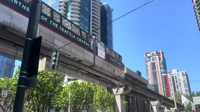 |
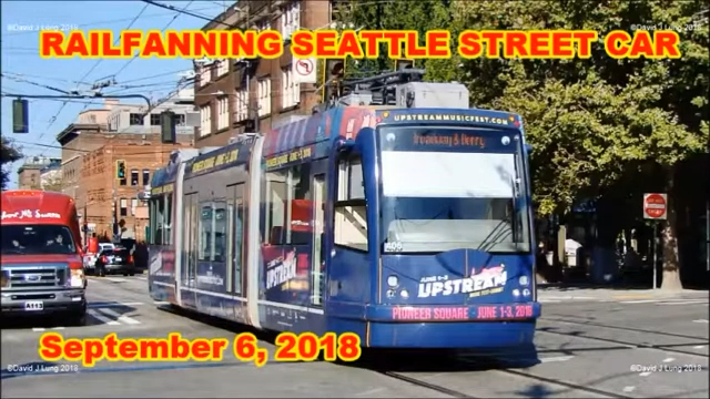
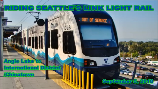
| Above: YouTubeCA video - Seattle Streetcars - September 6, 2018 - Length: 8:20 mins. | Above: YouTubeCA video - Riding the Seattle Link Light Rail Line | September 05, 2018 - Length: 27:42 mins. | Above: YouTubeCA video - Riding the Seattle Center Monorail - Length: 13:59 mins. |
PHOTOS
 |
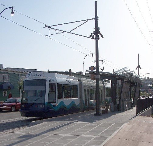 |
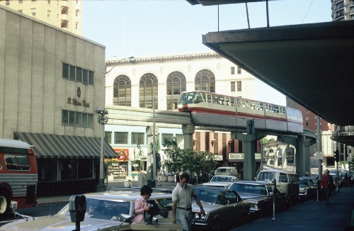 |
MAPS
THE SEATTLE-TACOMA REGION
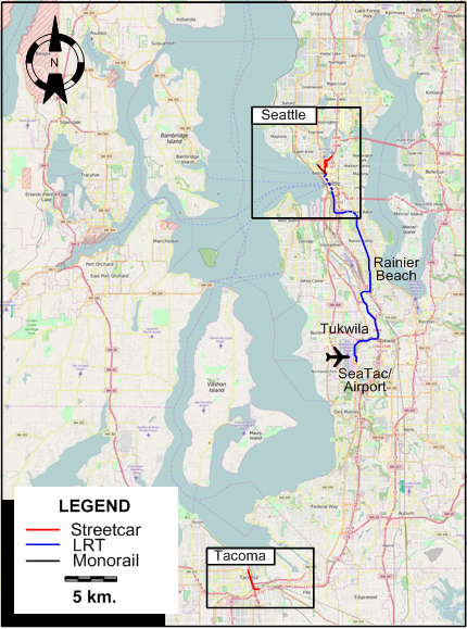
INSET: SEATTLE - CENTRAL AREA
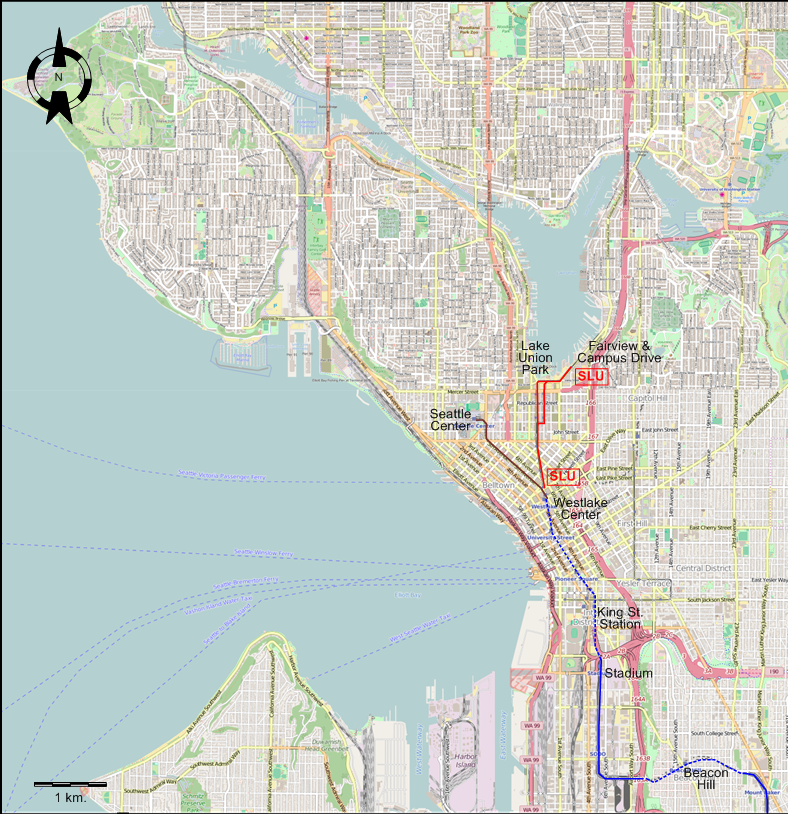
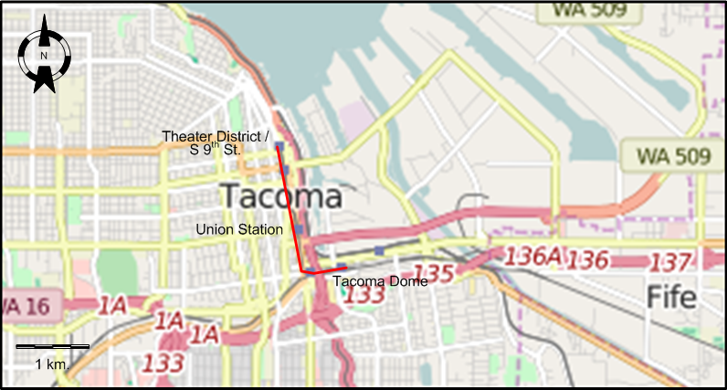
INSET: TACOMA
I created the above maps by overlaying OpenStreetMap (OSM) maps with my own data. The underlying map data is © OpenStreetMap contributors, licensed under the Open Database License (ODbL).
Please note that the OSM maps used as a template for these maps corresponds to the situation at the time the map was downloaded and may show features that did not exist at the time the GS Tram Site is supposed to show. In particular, it may show bridges and highways that were built later.
ROUTES
STREETCAR ROUTE
Operator: King County Metro Transit
| Westlake Center - Fairview & Campus Drive |
LIGHT RAIL ROUTES
Operator: Sound Transit
| Central Link | Westlake Center - King Street (Union) Station - Beacon Hill - Rainier Beach - Tukwila - Seattle-Tacoma International Airport |
| Tacoma Link | Theater District/S 9th Street - Union Station - Tacoma Dome |
MONORAIL ROUTE
Operator: Seattle Monorail Services
| Westlake Center - Seattle Center |
CHARACTERISTICS OF THE SYSTEM
NETWORK LENGTH
- Streetcar line: 2.1 km.
- Light rail lines: 27.7 km.
- Central Link: 25.1 km.
- Tacoma Link: 2.6 km.
- Monorail: 1.9 km.
HISTORY
- Horse-trams:
- Seattle: 1884 - 1889
- Tacoma: 1888 - ?;
- Cable cars: 27 Sept. 1888 - 2 Sept. 1940 (some were steam-operated initially, but all became electric after 3 June 1912)
- Streetcars (electric):
- Seattle: 30 March 1889 - 13 Apr. 1941; 12 Dec. 2007 - today
- Tacoma: - 8 Apr. 1938
- Waterfront (tourist) streetcar: 29 May 1982 - 19 Nov. 2005
- Interurbans (electric):
- Seattle-Everett Interurban: 1907 - 1919 (sold to Seattle Electric, later, Pacific NW Traction Southern Division, service until 20 Feb. 1939)
- Everett-Snohomish Interurban: 1 Dec. 1903 - 1921
- Bellingham & Skagit Interurban (later, Pacific NW Traction Northern Division): 1 Sept. 1912 - 1 June 1930
- Seattle-Tacoma Interurban: 25 Sept. 1902 - 1928
- Light rail:
- Seattle: 18 July 2009 - today
- Tacoma: 22 Aug. 2003 - today
- Monorail: 24 March 1962 - today
GAUGE
- Light rail / Streetcars (1st & 2nd generation) / Tourist streetcar: 1435 mm.
- Cable cars: 1067 mm. (except for the Front Street line: 1435 mm.)
SOURCES
- Blanchard, L. The Street Railway Era in Seattle: A Chronicle of Six Decades Forty Fort (PA): Harold E. Cox, 1968.
- Price, J.H. "Museum News [Seattle]", Modern Tramway & Light Rail Transit, Jan. 1982 (45:529), p.30-31.
- Ryan, C. & Stadler, K.K. Seattle-Everett Interurban Railway. Charleston (SC): Arcadia, 2010
- Simons, V. "Seattle: Cutting edge LRT solutions", Tramways & Urban Transit, Jan. 2016 (79:937), p.9-13.
- Streetcar routes - April 1st, 1931 Seattle: Seattle Municipal Street Railway, 1931 (Mimeographed)
- Taplin, M.R. "Miraculous in Seattle", Tramways & Urban Transit, Oct. 2009 (72:862), p.380-381.
- Wing, W.W. To Seattle by trolley: The story of the Seattle-Everett Interurban and the "Trolley that went to sea". Edmonds (WA): Pacific Fast Mail, 1988
- Zahler A., Marti A. & Thomsen G. Seattle's South Park. Charleston (SC): Arcadia, 2006
WIKIS
- Central Link
- First Hill Streetcar
- History of Link Light Rail
- King County Metro
- Link Light Rail
- Puget Sound Electric Railway
- Seattle Center Monorail
- Seattle Municipal Street Railway
- Seattle Streetcar
- Sound Transit
- South Lake Union Streetcar
- Tacoma Link
- Transportation in Seattle
- University Link Tunnel
- Waterfront Streetcar
WEB SITES
- Crowley W. Street Railways in Seattle (on HistoryLink.org)
- Holmgren, D.F. The California Street Cable Railroad Company’s Connection to the Emerald City - Seattle
- King County Metro
- More than 100 years ago, streetcars ran throughout Seattle. Here’s how they met their demise.
- Richardson, R. White Center: — Thumbnail History (on HistoryLink.org)
- Seattle Center Monorail
- Seattle Streetcar
- Seattle Transit Blog
- Sound Transit
- Tacoma Link Light Rail Line
- Thompson, J. Cable Car Lines in the Pacific Northwest
- Veka, C.H. Seattle’s Street Railway System and the Urban Form: Lessons from the Madison Street Cable Car (paper submitted at the University of Washington, 2007)
Copyright Gabor Sandi 1998-2026
Disclaimer: Everything on this site was written and/or prepared at the author's discretion. The author has tried to be accurate where facts are presented, but this does not mean that these facts are necessarily accurate. People needing more reliable information should refer to appropriate sources presented, on the Internet or elsewhere, by authoritative professional or academic bodies.
To get in touch with the webmaster, send an e-mail to g_sandi at hotmail.com.
Flags on this site are from the FOTW Flags Of The World website.