 |
 |
 |
 |
 |
 |
 |
 |
 |
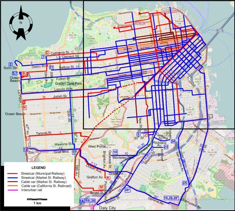
INSET: DOWNTOWN SAN FRANCISCO

THE SAN MATEO INTERURBAN

THE EAST BAY AREA (OVERALL)

INSET: OAKLAND AND BERKELEY

ABBREVIATIONS ON THE OAKLAND & BERKELEY MAP
| Al. | The Alameda | WS | Woolsey St. |
| PVA | Pleasant Valley Av. | Y&H | Yerba Buena & Hollis St. |
I created the above maps by overlaying OpenStreetMap (OSM) maps with my own data. The underlying map data is © OpenStreetMap contributors, licensed under the Open Database License (ODbL).
Please note that the OSM maps used as a template for these maps corresponds to the situation at the time the map was downloaded and may show features that did not exist at the time the GS Tram Site is supposed to show. In particular, it may show bridges and highways that were built later.
ROUTES
STREETCAR ROUTES OPERATED BY THE SAN FRANCISCO MUNICIPAL RAILWAY
| A | Ferry Bldg. – Market St. – Geary St. – 10th Av. - Fulton St. |
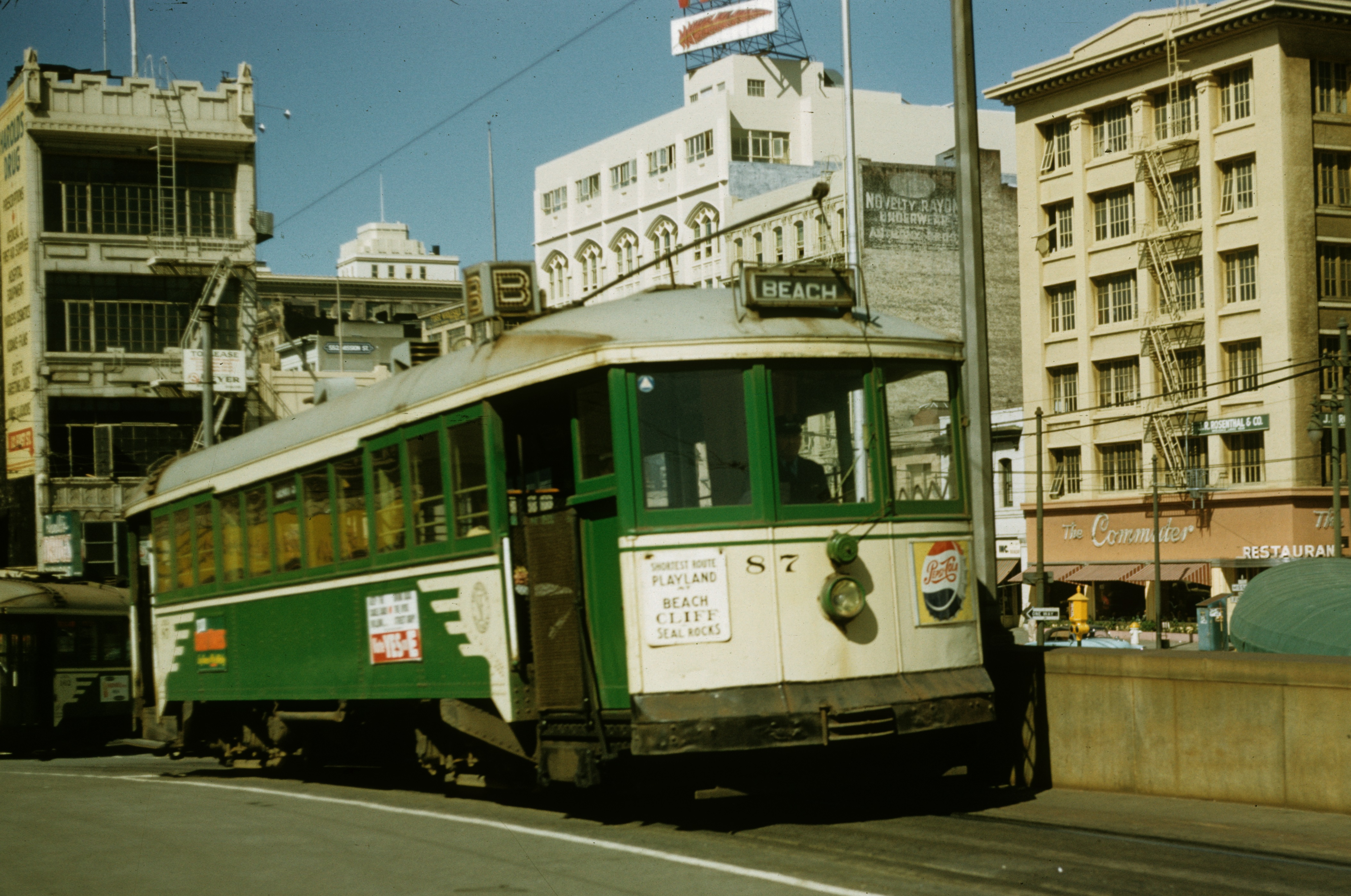
| B | Ferry Bldg. – Market St. – Geary St. – 33rd St. - Balboa St. - 45th Av. - Ocean Beach |
| C | Ferry Bldg. – Market St. – Geary St. – 2nd Av. – California St. – 33rd Av. |
| D | Ferry Bldg. – Market St. – Geary St. - Van Ness Av. – Union St. – Steiner St. - Greenwich St. – Presidio |
| E | Ferry Bldg. - Washington St. [back: Jackson St. - Embarcadero] - Columbus Av. – Union St. – Presidio |
| F | Scott St. – Chestnut St. – Van Ness Av. – North Point St. – Columbus Av. – Stockton St. – Market St. |
| H | Fort Mason – Van Ness Av. – 11th St. – Potrero Av. – Army St. (now Cesar Chavez St.) |
| J | Ferry Bldg. – Market St. – Church St. – 30th St. |
| K | Ferry Bldg. – Market St. – Twin Peaks Tunnel – West Portal – Ocean Av.- Brighton Av. – Grafton Av. |
| L | Ferry Bldg. – Market St. – Twin Peaks Tunnel – Taraval St. – 47th Av. |
| M | Ferry Bldg. – Market St. – Twin Peaks Tunnel – West Portal – Ocean Av.- 19th Av. - Broad St. - Plymouth Av. |
| N | Ferry Bldg. – Market St. – Duboce Tunnel - Carl St. - Judah St. – La Playa |
Last day of operation of San Francisco Municipal Railway streetcar lines abandoned between 5 Dec. 1932 and 29 Sept. 1944:
- 1932 Dec. 5: A
- 1939 Aug. 6: M
STREETCAR ROUTES OPERATED BY THE MARKET STREET RAILWAY
| 1 | Ferry Bldg. – Market St. – Sutter St. – Presidio Av. – California St. – 6th Av. - Clement St. – 33rd Av. - California St. |
| 2 | Ferry Bldg. – Market St. – Sutter St. – Presidio Av. – California St. – Euclid Av. – Clement St. – 33rd Av. - Geary Blvd. – Sutro Station |
| 3 | Ferry Bldg. – Market St. – Sutter St. – Fillmore St. – Jackson St. – Presidio Av. - California St. |
| 4 | Ferry Bldg. – Market St. – Eddy S. [back: Turk St.] – Divisadero St. – Sacramento St. – 6th Av. – [Clement St. - 8th Av.] [back: 6th Av.] - Fulton St. (Golden Gate Park) |
| 5 | Ferry Bldg. – Market St. – McAllister St. – Fulton St. – La Playa - Ocean Beach (Balboa St.) |
| 6 | Ferry Bldg. – Market St. – Haight St. – Masonic Av. - Carl St. - Parnassus Av. – Judah St. - 9th Av. – Pacheco St. |
| 7 | Ferry Bldg. – Market St. – Haight St. – Lincoln Way – La Playa - Ocean Beach (Balboa St.) |
| 8 | Ferry Bldg. – Market St. – Castro St. - 18th St. |
| 9 | Ferry Bldg. – Market St. – Valencia St. – Mission St. - 29th St. - Noe St. |
| 10 | Ferry Bldg. – Mission St. – 14th St. - Guerrero St. - Chenery St. - Monterey St. - Genesee St. |
| 11 | Ferry Bldg. – Mission St. – 22nd St. - 24th St. - Hoffman Av. |
| 12 | Ferry Bldg. – Mission St. – Ocean Av. – Sloat Blvd. – 47th Av. (San Francisco Zoo) |
| 14 | Ferry Bldg. – Mission St. – Ocean Av. – Daly City (at San Jose Av.) |
| 15 | Jefferson St. - Powell St. - Broadway - Kearny St. - 3rd St. - SP Depot |
| 16 | Ferry Bldg. -Embarcadero - Broadway - Kearny St. - 3rd St. - SP Depot - 4th St. - 3rd St. - San Bruno Av. - Sunnydale Av. (City Line) |
| 17 | Ferry Bldg. – Market St. – Haight St. – Lincoln Way – 20th Av. – Wawona St. - 19th St. - Sloat Blvd. |
| 18 | 5th St. & Market St. – Mission St. – Ocean Av. – Daly City (at San Jose Av.) |
| 19 | North Point St. - Polk St. - Post St. - Larkin St. - 9th St. - Brannan St. |
| 20 | SP Depot – Townsend St. - 4th St. – O'Farrell St. [back: Ellis St.] – Divisadero St. – Oak St. [back: Page St.] – Stanyan St. (Golden Gate Park) |
| 21 | Ferry Bldg. – Market St. – Hayes St. – Stanyan St. - Fulton St. – 8th Av. – Clement St. |
| 22 | Broadway – Fillmore St. – 16th St. – 18th St. – 3rd St. - 23rd St. |
| 22C | Marina Blvd. - Fillmore St. – Broadway [Between Green St. and Broadway, the steep hill ride required attachment to an unpowered cable] |
| 23 | Divisadero St. – Sacramento St. - Fillmore St. – McAllister St. - Gough St. - Valencia St. - Mission St. - Richland Av. - Andover St. |
| 24 | Fulton St. (Golden Gate Park) - [6th Av.] [back: 8th Av. - Clement St.] - 6th Av. – Sacramento St. – Divisadero St. – Page St. [back: Oak St.] - Fillmore St. – 16th St. – Mission St. - Cortland Av. - Folsom St. |
| 25 | 5th St. & Market St. – 5th St. – Bryant St. - Army St. - San Bruno Av. - 3rd St. |
| 26 | Ferry Bldg. – Mission St. – 14th St. - Guerrero St. - Chenery St. - San Jose Av. - Daly City |
| 27 | Market St. - 2nd St. - Bryant St. [back: 8th St. - Brannan St.] - Bryant St. - 26th St. - Mission St. |
| 28 | Ferry Bldg. – Embarcadero - Harrison St. - 2nd St. - Brannan St. - SP Depot |
| 29 | Davis St. - Broadway - Kearny St. - 3rd St. - SP Depot - 4th St. - 3rd St. - San Bruno Av. - Sunnydale Av. (City Line) |
| 30 | In 2 sections. Section 1: Market & 8th St - 8th St. - Bryant St. - 16th St. Section 2: Mission St. & 22nd St. - 22nd St. - S. Van Ness Av. - Army St. - 3rd St. |
| 31 | Ferry Bldg. – Market St. – Eddy S. [back: Turk St.] – Turk St. – Balboa St. – 30th Av. |
| 33 | 3rd St. - Harrison St. - 14th St. - Guerrero St. - 18th St. - Ashbury St. - Waller St. - Stanyan St. (Golden Gate Park) |
| 34 | Chestnut St. - Sansome St. - Bush St. - Kearny St. - Post St. - Taylor St. - 6th St. - Brannan St. |
| 35 | Ferry Bldg. – Embarcadero - Howard St. - S. Van Ness Av. - 24th St. - Rhode Island St. |
| 36 | Ferry Bldg. – Embarcadero - Folsom St. - Precita Av. & York St. |
| 37* | Market St. - Post St. - Leavenworth St. - McAllister St. - Larkin St. - Market St. |
| 39* | Mission St. - Geneva Av. - Visitacion Valley (Sunnydale Av.) |
| 41 | Market St. - 2nd St. - Brannan St. - 3rd St. - SP Depot |
| 42 | California St. - 1st St. - Folsom St. - 2nd St. - Brannan St. - [3rd St. - SP Depot - Townsend St. - 4th St.] [back: Brannan St.] - Brannan St. - 5th St. - 5th St. & Market St. |
| DE | Jackson St. - Divisadero St. - Sacramento St. (Divisadero extension) |
* Route numbers 37 and 39 are fictitious, and are used here for the convenience of readers. In reality, no route numbers were used for these routes.
Last day of operation of Market Street Railway streetcar lines abandoned between 5 Dec. 1932 and 29 Sept. 1944:
- 1932 Dec. 7: DE (Divisadero Street Extension)
- 1934 (exact date ?): 37*
- 1935 June 15: 18, 23 (north of Richland Av., with abandonment of streetcar service on Gough St.)
- 1935 Aug. 1: 28 (Harrison St. section), 30 (8th St. section), 34 (between Brannan and Mission)
- 1935 Oct. 5: 33
- 1936 Apr. 5: 34
- 1937 July 31: 39*
- 1939 Jan. 15: 26 (restored south of Ocean Av. on 1943 May 17
- 1939 June 25: 19 (south of Market St.)
- 1939 Dec. 5: 35 (Ferry Bldg. - Howard St. - S. Van Ness Av. section)
- 1940 Jan. 28: 35 (24th St. section)
- 1940 Apr. 1: 28
- 1940 June 30: 30 (restored 1942 Dec. 7)
- 1940 June 23: 23 (as the Richland Shuttle)
- 1941 (exact date?): 22C
- 1941 Apr. 5: 24
- 1941 May 11: 15, 16 (restored over a shorter route on 1943 March 22), 29, 42
- 1942 Apr. 15: 10
- 1944 (exact date ?): 30
SAN MATEO INTERURBAN RAILWAY (OWNED AND OPERATED BY THE MARKET STREET RAILWAY)
| 40 | 5th St. & Market St. – Mission St. – Ocean Av. – Daly City – Colma - Leipsic Jnctn. - San Bruno - Millbrae - Burlingame - San Mateo (Third & "B" Streets) |
| SS | [South San Francisco Line] Leipsic Jnctn. - Grand Av. - South San Francisco |
Last day of operation of a San Mateo Interurban Line:
- 1938 Dec. 31: SS
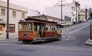
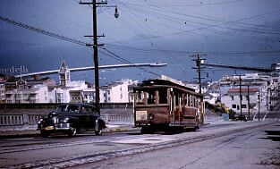
CABLE CAR ROUTES OPERATED BY THE MARKET STREET RAILWAY CO.
| Powell - Mason | Powell & Market – Powell St. – Jackson St. [back: Washington St.] - Mason St. – Bay St. |
| Jackson - Washington | Powell & Market – Powell St. – Jackson St. [back: Washington St.] – Alta Plaza Park |
| Sacramento - Clay | Embarcadero - Sacramento St. [back: Larkin St. - Clay St.] - Sacramento St. - Fillmore St. |
| Castro | 18th St. - Castro St. - 26th St. |
Last day of operation of Market Street Railway cable car lines abandoned between 5 Dec. 1932 and 29 Sept. 1944:
- 1941 Apr. 5: Castro
- 1942 Feb. 15: Sacramento - Clay
CABLE CAR ROUTES OPERATED BY THE CALIFORNIA STREET CABLE RAILROAD CO.
| California | California & Drumm – California St. – Presidio Av. |
| Jones St. Shuttle | Jones & Market – Jones St. – Jones & O'Farrell |
| Hyde - O'Farrell | O'Farrell & Market – O'Farrell St. – Jones St. – Pine St. – Hyde St. – Beach St. |
INTERURBAN ROUTES
Operator: Key System
| A | Key System Pier Terminal - Poplar St. - 11th St. (Oakland) - 3rd. Ave & E. 18th St. |
| B | Key System Pier Terminal - Poplar St. - Oakland (Grand Av. - Trestle Glen Rd. - Trestle Glen) |
| C | Key System Pier Terminal - Oakland (40th St. - 41st St. & Piedmont Av.) |
| E | Key System Pier Terminal - Claremont Av. - Claremont Hotel |
| F | Key System Pier Terminal - Berkeley (Adeline St. - Shattuck Av. - University Av.) |
| G | Berkeley (Sacramento & Delaware - Westbrae) |
| H | Key System Pier Terminal - Berkeley (Sacramento St. - Northbrae) |
| OS | Oakland (41st St. & Piedmont Av. - Oakland Av. [Shuttle service]) |
Note: Lettered route designations A-H for Key System interurban routes were only adopted in Nov. 1934, but are used here for the convenience of readers.
First day of operation of new Key System interurban lines between 5 Dec. 1932 and 29 Sept. 1944:
- 1939 Jan. 15: A, B, C, E, F, H (all in the section San Francisco Bridge Terminal - Bay Bridge - Oakland); OS merged into C
- 1941 March 22: A (1st Av. - 14th St. - 105th Av. [San Leandro])
- 1941 Apr. 3: A (Melrose - Havescourt)
- 1941 Aug. 6: F (University Av. - Northbrae)
Last day of operation of Key System interurban lines abandoned between 5 Dec. 1932 and 29 Sept. 1944:
- 1941 July 25: G, H
STREETCAR ROUTES IN OAKLAND AND BERKELEY
Operator: Key System
| 1 | Hayward - Richmond | San Rafael Ferry - Richmond - San Pablo Av. - 11th St. [Back: 12th St.] - 14th St. - Melrose - San Leandro - Hayward |
| 2 | San Pablo - Ashby | 2nd St. - Broadway [back: Washington St.] - San Pablo Av. - Ashby Av. |
| 3 | Grove & W 8th | 7th St. - Pine St. - 8th St. - Washington St. - San Pablo Av. - Grove St. - University Av. - Oxford St. - Hearst Av. - Arch St. |
| 4 | Shattuck | 1st St. - Broadway - Telegraph Av. - Shattuck Av. - University Av. - Oxford St. - Euclid Av. - Regal Rd. |
| 5 | Telegraph | 1st St. - Broadway - Telegraph Av. - Bancroft Way - Oxford St. - University Av. - 3rd St. |
| 6 | College | 8th St. - Broadway - College Av. - Bancroft Way - Oxford St. - University Av. - Grove St. - The Alameda - Kensington / Thousand Oaks |
| 7 | E 16th | Jefferson St. - 13th St. [back: 12th St.] - 12th St. - 18th St. - 16th St. (Foothill Blvd.) - Ygnacio Av. - 55th Av. (to Fleming Av.) |
| 8 | Arlington | Jefferson St. - 13th St. [back: 12th St.] - 12th St. - 14th St. - Melrose - San Leandro - Hayward |
| 9 | East Alameda | 8th & Clay - Clay St. - 13th St. - 12th St. - 14th St. - Alameda (Park St. & San Jose Av.) |
| 10 | Piedmont & Hopkins | 35th Av. - Hopkins St. - 14th Av. - 18th St. - 12th St. - 12th St. [back: 13th St.] - Broadway - Piedmont Av. - Highland Av. - Crocker Av. |
| 11 | Oakland & 38th | Hopkins St. - 38th Av. - 14th St. - 12th St. - 13th St. [back: 12th St.] - Broadway - 24th St. - Harrison St. - Oakland Av. - Piedmont Av. - Rio Vista |
| 12 | Grand & Hollis | Yerba Buena & Hollis St. - Adeline St. - 24th St. - Market St. - 14th St. - Webster St. - Grand Av. - Oakland Av. |
| 14 | E 18th & W 16th | SP 16th St. Station - 16th St. - Wood St. - 12th St. - 1st Av. - 18th St. - 14th Av. - 21st St. - 25th Av. - 26th Av. - 27th St. - Fruitvale Av. |
| 16 | Leona Heights | 12th St. & Poplar St. - 12th St. - 14th St. - Right-of-way - Leona Heights |
| 17 | 8th Av. | Jefferson St. - 13th St. [back: 12th St.] - 12th St. - 18th St. - 8th Av. - E 28th St. & 13th Av. [Peak service only] |
| 18 | Park Blvd. & Lakeshore | Oakmore Rd. - Park Blvd. - 13th St. - 12th St. - Broadway - Grand Av. - Lakeshore Av. - Walavista Av. |
| 22 | Fruitvale Av. | E 11th St. - Fruitvale Av. - Hopkins St. |
| 23 | 23rd Av. | E 14th St. - 23rd Av. - E 27th St. |
| 24 | Dwight Way | University Av. - 6th St. (Berkeley) - Dwight Way - College Av. |
| 25 | Park Av. - Emeryville | Halleck St. - Park Av. - San Pablo Av. |
| 27 | Cemetery | Pleasant Valley Av. - Piedmont Av. - Mountain View Cemetery |
| 31 | Alcatraz Av. | Berkeley (Adeline St. - Alcatraz Av. - College Av. - Bancroft Way - Telegraph Av.) |
| CS1 | Chestnut St. | 8th St. - Chestnut St. - 1st St. (Shipyards) [Rush hour and Saturday service only] |
1 Not an official route designation.
Last day of operation of Key System streetcar lines abandoned between 5 Dec. 1932 and 29 Sept. 1944:
- 1933 May 3: 9
- 1933 June 21: 17, 23
- 1933 Nov. 7: 1 (Ashby Av. - Richmond - San Rafael Ferry)
- 1934 Nov: Route 31 is renamed G (later K), in line with it being considered a Key System interurban route.
- 1935 March 10: 1, 8 (both San Leandro - Hayward)
- 1935 June 19: CS
- 1935 Sept. 9: 6 (1000 Oaks branch)
- 1935 Oct. 20: 12 (Yerba Buena & Hollis St. - Adeline St. - 24th St. - Market St. section)
- 1936 Apr. 1: 16
- 1937 Feb. 1: 5 (University Av. to 3rd St.)
- 1937 March 1: 22
- 1937 March 27: 25
- 1937 March 31: 27
- 1938 Feb. 1: 24
- 1938 July 31: 7
- 1943 Sept. 26: 14 (E of 13th & Jefferson)
Operator: East Bay Electric Lines
| AE | Alameda, Encinal Av. Line | Alameda Pier - Main St. - Encinal Av. - High St. S |
| AF | Alameda, Fruitvale Line | Oakland Pier Terminal - 7th St. - SP main line - Fruitvale Bridge - Lincoln Av. - Main St. - Alameda Pier |
| AL | Alameda, Lincoln Av. Line | Alameda Pier - Main St. - Lincoln Av. - High St. S |
| BC | Berkeley, California St Line | Oakland Pier Terminal - SP 16th St. Station - Stanford Av. - California St. - Thousand Oaks |
| BE | Berkeley, Ellsworth St. Line | Oakland Pier Terminal - SP 16th St. Station - Stanford Av. - Adeline St. - Woolsey St. - Ellsworth St. - Bancroft Way |
| BN | Berkeley, 9th St. Line | Oakland Pier Terminal - SP 16th St. Station - 9th St. - Solano Av. - Thousand Oaks |
| BS | Berkeley, Shattuck Av. Line | Oakland Pier Terminal - SP 16th St. Station - Stanford Av. - Adeline St. - Shattuck Av. - Northbrae - Solano Av. - Thousand Oaks |
| OD | Oakland, 7th St & Dutton Av. Line | Oakland Pier Terminal - 7th St. - SP main line - Melrose - Bancroft Av. - Havenscourt - Dutton Av. |
| OE | Oakland, 18th St. Line | Oakland Pier Terminal - SP 16th St. Station - 18th St. - 20th St. - Webster St. - 1st St. |
Note: The lettered route designations for the East Bay Electric Lines streetcar lines were not used by the operator, and are used here for the convenience of readers only.
End of service of East Bay Electric Lines streetcar lines abandoned between Dec. 1932 and July 1941 (end of all services of the system):
- 1933 March: BC, BE, OE
- 1939 Jan.: AF
- 1941 Jan.: AE, AL
- 1941 March: OD
- 1941 July: BN, BS
CHARACTERISTICS OF THE SYSTEM
NETWORK LENGTH
- Streetcar lines (San Francisco): ? km.
- Streetcar lines (Oakland - Berkeley): ? km.
- Cable car lines: ? km.
- Interurban lines (Key System): ? km.
- Interurban line (San Mateo): 32 km. (?)
HISTORY
- San Francisco streetcars: (horse-drawn) 4 July 1860 - 1882; (electric) 1892 - today.
- San Francisco cable-cars: 1 Sept. 1873 - today.
- BART (Subway): 11 Sept. 1972 - today; H-Line: 22 Nov. 1914 - today
- Key System (Interurbans): 26 Oct. 1903 - (Into San Francisco only from 15 Jan. 1939, following the opening of the Bay Street Bridge on 12 Nov. 1936) - 20 Apr. 1958.
- East Bay Electric Lines (Interurbans) (from Dec. 1938 Interurban Electric Railway (IER)): 1911 - July 1941
- Northern Electric Railroad (Interurbans) (from 1925 Sacramento Northern Railway): 1905 - 1941
- San Mateo Interurban: 27 Apr. 1892 - 15 Jan. 1949
- Oakland-Berkeley streetcars: (horse-drawn) 1869 - 1893; (electric) 1891 - 28 Nov. 1948
- Oakland cable-cars: 1886 - ?
GAUGE
- Streetcars: 1435 mm. (some early streetcar lines of the predecessors of the Key System in Oakland were 1067 mm. [3 1/2"])
- Cable-cars: 1067 mm.
- BART (Subway): 1676 mm.
- Interurbans: 1435 mm.
TRAM PRESERVATION
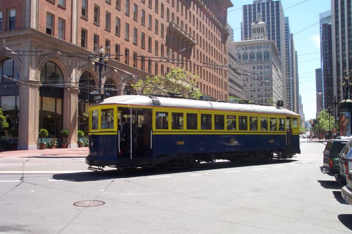
The San Francisco Railway Museum displays many relics of the streetcar and cable car history of the city. The Market Street Railway operates many historic streetcars over actual line F of the San Francisco streetcar system (Muni). The cable car system has its own museum at the Cable Car Museum at Washington and Mason.
The Western Railway Museum in Rio Vista Junction, Suisun City, about 40 miles (65 km.) north-east of San Francisco, has both restored heritage streetcars and interurbans in its collection, running them on museum tracks for visitors.
SOURCES
- "Around San Francisco Bay", The Bulletin - National Railway Historical Society, 1970 (35: 2), p.10-52.
- "Balancing act on Fillmore", Inside Track, 2014 (No.1), p.7-10.
- Currington, B. "San Francisco Municipal Railway modernisation (Part 1)", Modern Tramway & Light Rail Transit, Oct. 1984 (47: 565), p.339-347.
- Currington, B. "San Francisco Municipal Railway modernisation (Part 3: Completion)", Modern Tramway & Light Rail Transit, Jan. 1985 (48: 568), p.16-24.
- Demoro, H.W. "A documented account of the conversion from rail service to motor bus bv the Key System", National Railway Bulletin, 1979 (44: 6), p.4 - 44.
- Dodge, J.W. et al. "Key System interurban lines", The Western Railroader, date ?, p.3-14.
- From shore to shore: The Key Route [San Francisco (?)]: Peralta Associates, 1948.
- "East Bay transit: Oakland-Berkeley streetcars, 1937-1948", The Western Railroader, May 1973 (36: issue 397), p.2-8.
- Grahl, A, "San Francisco: More than sunny skies", Tramways & Urban Transit, Feb. 2026 (89: 1058), p.50-53.
- Laflin, A.H. (Jr) "A chronology of changes in San Francisco Street RY routes since 1944", Timepoints Special Reference Supplement No. 7, June 1953.
- Laubscher, R. On track - A field guide to San Francisco's historic streetcars & cable cars. Berkeley: Heyday, 2014.
- "Los Angeles and San Francisco", The Modern Tramway, Nov. 1949 (12: 143), p.221-224.
- Market Street Railway Co. [Timetable and route map]. San Francisco, May 1941.
- "Municipal Railway of San Francisco", The Western Railroader, Aug. 1961 (24: 8), p.2-12.
- Rice, W. "Andrew Smith Hallidie's cable legacy", Tramways & Urban Transit, Apr. 1999 (67: 736), p.136-139.
- Rice, W. "San Francisco rail is moving forward", Tramways & Urban Transit, Sept. 1998 (61: 729), p.336-339.
- Rice, W. & Echeverria, E. The Key System: San Francisco and the Eastshore Empire. Charleston (NC): Arcadia Publishing, 2007.
- "Richmond Shipyard Railway", The Western Railroader / The Western Railfan, Sept. 1981 (44: 491), p.1-8.
- Russell, M. "San Francisco's decade of achievement", Tramways & Urban Transit, Apr. 2010 (73: 868), p.156-157.
- Russell, M. "Waterfront torpedoes", Tramways & Urban Transit, Feb. 2017 (80: 950), p.76-77.
- "San Francisco Municipal Railway, 1950-1964", The Western Railroader, Jan. 1965 (28: 1), p.2-16.
- "San Francisco Municipal Railway - Merger of 1944", The Western Railroader, 1963 (26: ?), p.2-24.
- Sappers, V. Key System streetcars Berkeley: Signature Press, 2007.
- Simons, V. "San Francisco: Are Muni and BART running out of cash?", Tramways & Urban Transit, July 2023 (86: 1027), p.268-272.
- Smallwood, C. The White Front cars of San Francisco Glendale (CA): Interurbans, 1978
- Townley, R.P. San Francisco transit milestones Manuscript, 2005.
- Vielbaum, W., Hoffman, P., Ute, G. & Townley, R. San Francisco's Market Street Railway. Charleston (NC): Arcadia Publishing, 2004.
- Vielbaum, W., Townley, R., Rice, W., Echeverria, E. & Holmgren, D. San Francisco's interurban to San Mateo. Charleston (NC): Arcadia Publishing, 2005.
WIKIS
- BayArea Rapid Transit (BART)
- East Bay Electric Lines
- History of Bay Area Rapid Transit
- Key System
- List of defunct San Francisco Municipal Railway lines
- List of San Francisco Municipal Railway lines
- Market Street Railway (transit operator)
- Market Street Subway
- Muni Metro
- Sacramento Northern Railway
- San Francisco cable car system
- San Francisco Municipal Railway (Muni)
- San Francisco Railway Museum
- Shipyard Railway
- Third Street Light Rail Project
WEB SITES
- AC Transit
- BART (San Francisco Bay Area Rapid Transit)
- Bay Area Rails: Then and now
- The Cable Car Home Page (by Joe Thompson)
- Market Street Railway
- Metropolitan Transportation Commission
- OB&E (Oakland Berkeley & Eastern)
- San Francisco Cable Car Website
- San Francisco Municipal Transportation Agency (SFMTA)
- San Francisco Railway Museum
Special thanks to Bob Townley of Fairfield CA and to Alexander Rapp of Boston MA for their kind help in preparing these maps.
Copyright Gabor Sandi 1998-2026
Disclaimer: Everything on this site was written and/or prepared at the author's discretion. The author has tried to be accurate where facts are presented, but this does not mean that these facts are necessarily accurate. People needing more reliable information should refer to appropriate sources presented, on the Internet or elsewhere, by authoritative professional or academic bodies.
To get in touch with the webmaster, send an e-mail to g_sandi at hotmail.com.
Flags on this site are from the FOTW Flags Of The World website.