 |
 |
 |
 |
 |
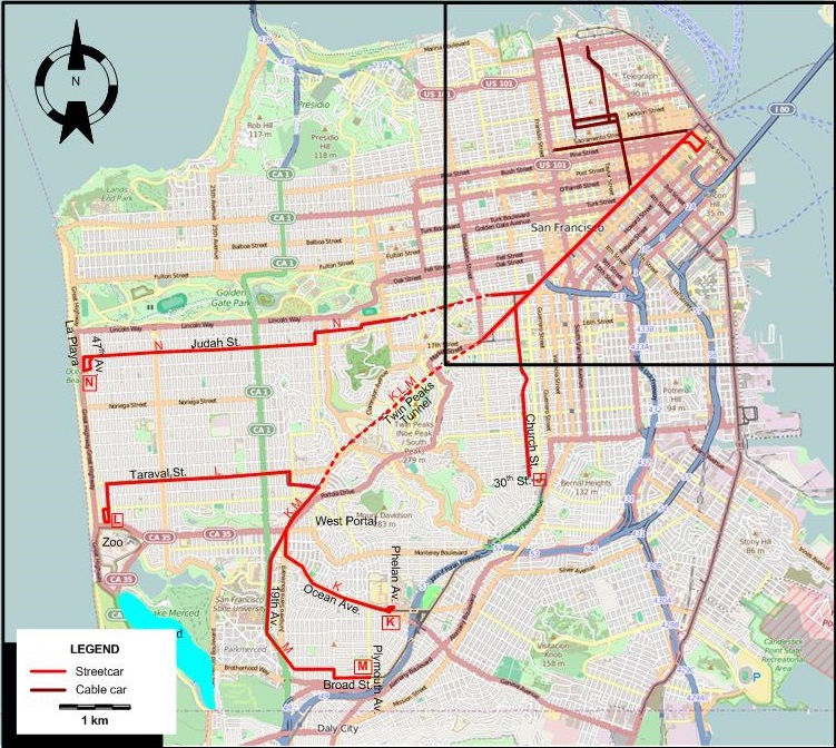
INSET: DOWNTOWN SAN FRANCISCO
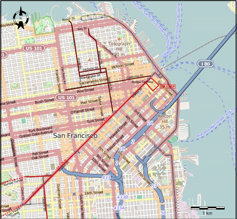
I created the above maps by overlaying OpenStreetMap (OSM) maps with my own data. The underlying map data is © OpenStreetMap contributors, licensed under the Open Database License (ODbL).
Please note that the OSM maps used as a template for these maps corresponds to the situation at the time the map was downloaded and may show features that did not exist at the time the GS Tram Site is supposed to show. In particular, it may show bridges and highways that were built later.
ROUTES
STREETCAR ROUTES
Operator: San Francisco Municipal Railway (MUNI)
| J | Bridge Terminal - Market Street - Church - 30th St. |
| K | Bridge Terminal – Market St. – Twin Peaks Tunnel – West Portal – Ocean Av.- Phelan Av. |
| L | Bridge Terminal - Market St. – Twin Peaks Tunnel – Taraval St. – San Francisco Zoo |
| M | Bridge Terminal – Market St. – Twin Peaks Tunnel – West Portal – Ocean Av.- 19th Av. - Broad St. - Plymouth Av. [Evenings, Sundays and holidays: Ferry Bldg. - West Portal only] |
| N | Bridge Terminal – Market St. – Sunset Tunnel - Judah St. – La Playa |
CABLE CAR ROUTES
Operator: San Francisco Municipal Railway (MUNI)
| Mason | Powell & Market – Powell St. – Jackson St. [Back: Washington St.] - Mason St. – Bay St. |
| Hyde | Powell & Market – Powell St. – Jackson St. [Back: Washington St.] – Hyde St. – Beach St. |
| California | California & Market – California St. – Van Ness Av. |
CHARACTERISTICS OF THE SYSTEM
NETWORK LENGTH
- Streetcar lines (San Francisco): ? km.
- Cable car lines: 17.2 km.
HISTORY
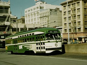
- San Francisco streetcars: (horse-drawn) 4 July 1860 - 1882; (electric) 1892 - today.
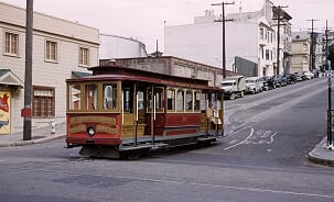
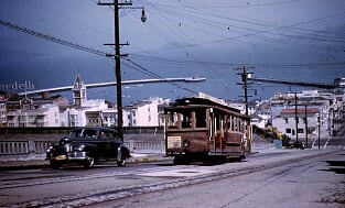
- San Francisco cable-cars: 1 Sept. 1873 - today.
- BART (Subway): 11 Sept. 1972 - today; H-Line: 22 Nov. 1914 - today
- Key System (Interurbans): 26 Oct. 1903 - (Into San Francisco only from 15 Jan. 1939, following the opening of the Bay Street Bridge on 12 Nov. 1936) - 20 Apr. 1958.
- East Bay Electric Lines (Interurbans) (from Dec. 1938 Interurban Electric Railway (IER)): 1911 - July 1941
- Northern Electric Railroad (Interurbans) (from 1925 Sacramento Northern Railway): 1905 - 1941
- San Mateo Interurban: 27 Apr. 1892 - 15 Jan. 1949
- Oakland-Berkeley streetcars: (horse-drawn) 1869 - 1893; (electric) 1891 - 28 Nov. 1948
- Oakland cable-cars: 1886 - ?
GAUGE
- Streetcars: 1435 mm. (some early streetcar lines of the predecessors of the Key System in Oakland were 1067 mm. [3 1/2"])
- Cable-cars: 1067 mm.
- BART (Subway): 1676 mm.
- Interurbans: 1435 mm.
TRAM PRESERVATION
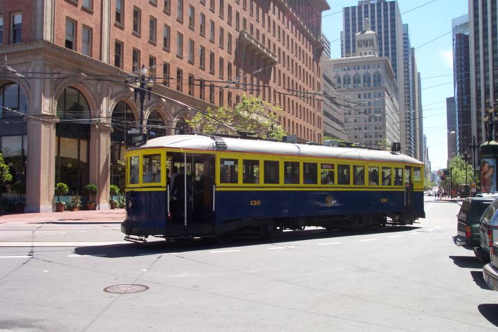
The San Francisco Railway Museum displays many relics of the streetcar and cable car history of the city. The Market Street Railway operates many historic streetcars over actual line F of the San Francisco streetcar system (Muni). The cable car system has its own museum at the Cable Car Museum at Washington and Mason.
The Western Railway Museum in Rio Vista Junction, Suisun City, about 40 miles (65 km.) north-east of San Francisco, has both restored heritage streetcars and interurbans in its collection, running them on museum tracks for visitors.
SOURCES
- "Around San Francisco Bay", The Bulletin - National Railway Historical Society, 1970 (35: 2), p.10-52.
- "Balancing act on Fillmore", Inside Track, 2014 (No.1), p.7-10.
- Currington, B. "San Francisco Municipal Railway modernisation (Part 1)", Modern Tramway & Light Rail Transit, Oct. 1984 (47: 565), p.339-347.
- Currington, B. "San Francisco Municipal Railway modernisation (Part 3: Completion)", Modern Tramway & Light Rail Transit, Jan. 1985 (48: 568), p.16-24.
- Demoro, H.W. "A documented account of the conversion from rail service to motor bus bv the Key System", National Railway Bulletin, 1979 (44: 6), p.4 - 44.
- Dodge, J.W. et al. "Key System interurban lines", The Western Railroader, date ?, p.3-14.
- From shore to shore: The Key Route [San Francisco (?)]: Peralta Associates, 1948.
- "East Bay transit: Oakland-Berkeley streetcars, 1937-1948", The Western Railroader, May 1973 (36: issue 397), p.2-8.
- Grahl, A, "San Francisco: More than sunny skies", Tramways & Urban Transit, Feb. 2026 (89: 1058), p.50-53.
- Laflin, A.H. (Jr) "A chronology of changes in San Francisco Street RY routes since 1944", Timepoints Special Reference Supplement No. 7, June 1953.
- Laubscher, R. On track - A field guide to San Francisco's historic streetcars & cable cars. Berkeley: Heyday, 2014.
- "Los Angeles and San Francisco", The Modern Tramway, Nov. 1949 (12: 143), p.221-224.
- Market Street Railway Co. [Timetable and route map]. San Francisco, May 1941.
- "Municipal Railway of San Francisco", The Western Railroader, Aug. 1961 (24: 8), p.2-12.
- Rice, W. "Andrew Smith Hallidie's cable legacy", Tramways & Urban Transit, Apr. 1999 (67: 736), p.136-139.
- Rice, W. "San Francisco rail is moving forward", Tramways & Urban Transit, Sept. 1998 (61: 729), p.336-339.
- Rice, W. & Echeverria, E. The Key System: San Francisco and the Eastshore Empire. Charleston (NC): Arcadia Publishing, 2007.
- "Richmond Shipyard Railway", The Western Railroader / The Western Railfan, Sept. 1981 (44: 491), p.1-8.
- Russell, M. "San Francisco's decade of achievement", Tramways & Urban Transit, Apr. 2010 (73: 868), p.156-157.
- Russell, M. "Waterfront torpedoes", Tramways & Urban Transit, Feb. 2017 (80: 950), p.76-77.
- "San Francisco Municipal Railway, 1950-1964", The Western Railroader, Jan. 1965 (28: 1), p.2-16.
- "San Francisco Municipal Railway - Merger of 1944", The Western Railroader, 1963 (26: ?), p.2-24.
- Sappers, V. Key System streetcars Berkeley: Signature Press, 2007.
- Simons, V. "San Francisco: Are Muni and BART running out of cash?", Tramways & Urban Transit, July 2023 (86: 1027), p.268-272.
- Smallwood, C. The White Front cars of San Francisco Glendale (CA): Interurbans, 1978
- Townley, R.P. San Francisco transit milestones Manuscript, 2005.
- Vielbaum, W., Hoffman, P., Ute, G. & Townley, R. San Francisco's Market Street Railway. Charleston (NC): Arcadia Publishing, 2004.
- Vielbaum, W., Townley, R., Rice, W., Echeverria, E. & Holmgren, D. San Francisco's interurban to San Mateo. Charleston (NC): Arcadia Publishing, 2005.
WIKIS
- BayArea Rapid Transit (BART)
- East Bay Electric Lines
- History of Bay Area Rapid Transit
- Key System
- List of defunct San Francisco Municipal Railway lines
- List of San Francisco Municipal Railway lines
- Market Street Railway (transit operator)
- Market Street Subway
- Muni Metro
- Sacramento Northern Railway
- San Francisco cable car system
- San Francisco Municipal Railway (Muni)
- San Francisco Railway Museum
- Shipyard Railway
- Third Street Light Rail Project
WEB SITES
- AC Transit
- BART (San Francisco Bay Area Rapid Transit)
- Bay Area Rails: Then and now
- The Cable Car Home Page (by Joe Thompson)
- Market Street Railway
- Metropolitan Transportation Commission
- OB&E (Oakland Berkeley & Eastern)
- San Francisco Cable Car Website
- San Francisco Municipal Transportation Agency (SFMTA)
- San Francisco Railway Museum
Special thanks to Bob Townley of Fairfield CA and to Alexander Rapp of Boston MA for their kind help in preparing these maps.
Copyright Gabor Sandi 1998-2026
Disclaimer: Everything on this site was written and/or prepared at the author's discretion. The author has tried to be accurate where facts are presented, but this does not mean that these facts are necessarily accurate. People needing more reliable information should refer to appropriate sources presented, on the Internet or elsewhere, by authoritative professional or academic bodies.
To get in touch with the webmaster, send an e-mail to g_sandi at hotmail.com.
Flags on this site are from the FOTW Flags Of The World website.