VIDEO
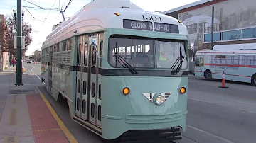 |
| Above: YouTubeCA video - Living Here - El Paso, Sun Metro Streetcars - Length: 6:01 mins. |
PHOTO
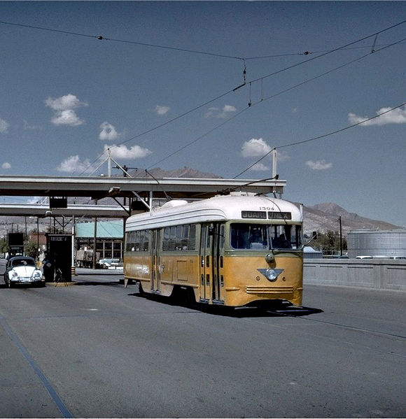 |
MAP
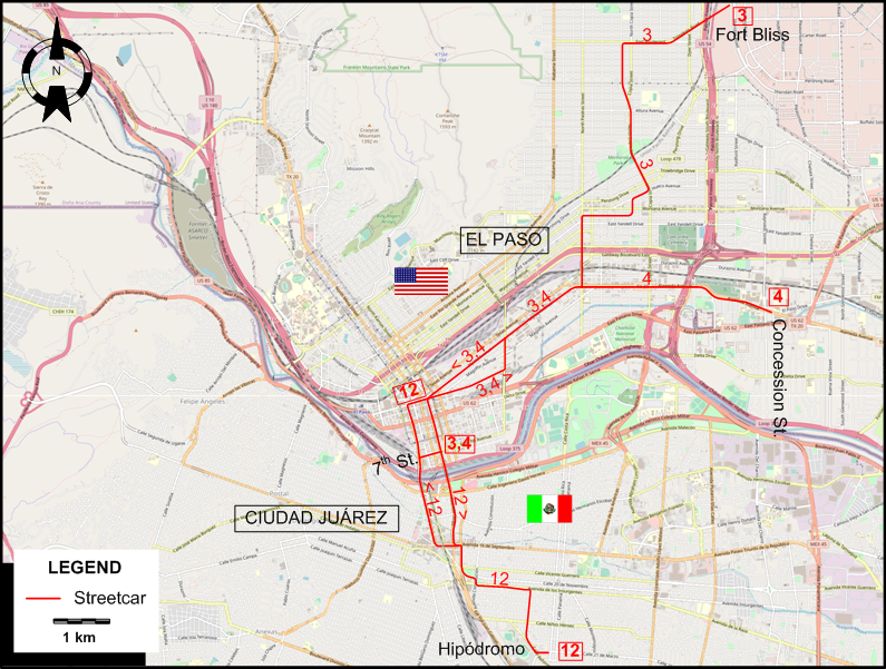
I created the above map by overlaying OpenStreetMap (OSM) maps with my own data. The underlying map data is © OpenStreetMap contributors, licensed under the Open Database License (ODbL).
Please note that the OSM map used as a template for this map corresponds to the situation at the time the map was downloaded and may show features that did not exist at the time the GS Tram Site is supposed to show. In particular, it may show bridges and highways that were built later.
STREETCAR ROUTES
Operator: El Paso Electric Railway
| 3 | Fort Bliss | Downtown El Paso (7th St.) - Fort Bliss |
| 4 | Park | Downtown El Paso (7th St.) - Concession St. |
| 12 | Juarez, Mexico | Downtown El Paso - Ciudad Juárez (Hipódromo) |
CHARACTERISTICS OF THE SYSTEM
NETWORK LENGTH
- Streetcar lines: ca. 25 km.
HISTORY
- Mule/horse-drawn streetcars: 1882 – 1902.
- Electric streetcars (first generation): 11 Jan. 1902 – 4 May 1974.
- Interurban to Ysleta: 27 Aug. 1913 - 1926.
- Electric streetcars (second generation): 9 Nov. 2018 - today.
GAUGE
- All systems: 1435 mm.
SOURCES
- Jenkins, M. "The tramways of Mexico - Part 3: Tampico and El Paso - Juarez", Modern Tramway, Oct. 1974 (37: 442), p.334-339.
- Leinbach, H. El Paso Electric Company Transportation Division. San Antonio: Texas Division, Electric Railroaders Association, 1975.
- Simons, V. "El Paso’s streetcar resurrection", Tramways & Urban Transit, March 2019 (82: 975), p.96-98.
- Simons, V. "Fall and rise of the El Paso streetcar", Tramways & Urban Transit, Aug 2017 (80: 956), p.288-292.
WIKIS
WEB SITES
Also, many thanks to Mr Russell Powers of Lone Tree, CO, USA, for kindly sending me information and documents concerning the history of the El Paso / Juárez streetcar system.
Copyright Gabor Sandi 1998-2026
Disclaimer: Everything on this site was written and/or prepared at the author's discretion. The author has tried to be accurate where facts are presented, but this does not mean that these facts are necessarily accurate. People needing more reliable information should refer to appropriate sources presented, on the Internet or elsewhere, by authoritative professional or academic bodies.
To get in touch with the webmaster, send an e-mail to g_sandi at hotmail.com.
Flags on this site are from the FOTW Flags Of The World website.