VIDEO
 |
| Above: YouTubeCA video - TECO Line Streetcar System, Tampa, Florida - Length: 11:18 mins. |
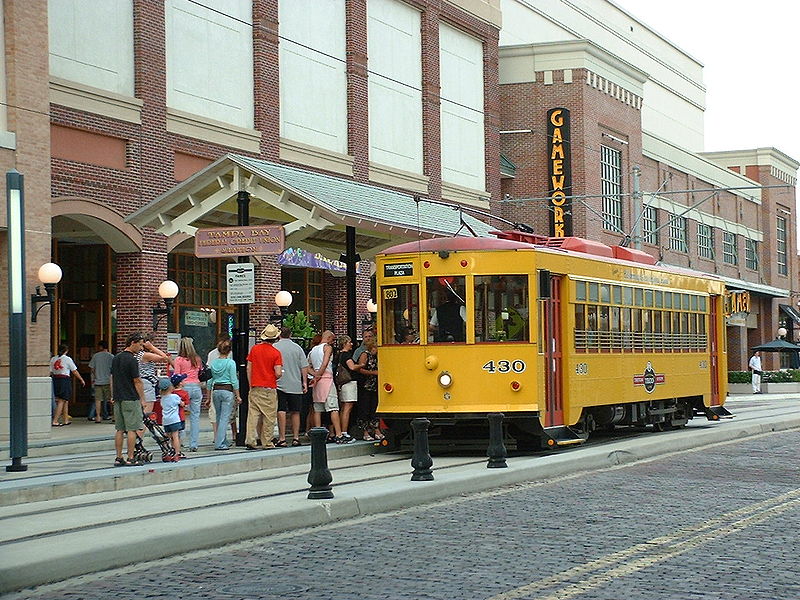
PHOTO
 |
MAP
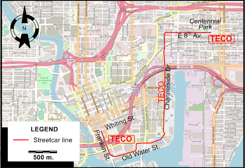
I created the above map by overlaying OpenStreetMap (OSM) maps with my own data. The underlying map data is © OpenStreetMap contributors, licensed under the Open Database License (ODbL).
Please note that the OSM map used as a template for this map corresponds to the situation at the time the map was downloaded and may show features that did not exist at the time the GS Tram Site is supposed to show. In particular, it may show bridges and highways that were built later.
HERITAGE STREETCAR ROUTE
Operator: Hillsborough Area Regional Transit (HART)
| TECO | Franklin & Whiting - Franklin St. - Old Water St. - Channelside Dr. - E 8th Av. - Centennial Park |
CHARACTERISTICS OF THE SYSTEM
NETWORK LENGTH
- Streetcar lines: 4.4 km.
HISTORY
- Steam streetcars: 1885-1893.
- Electric streetcars (1st generation): 1893 - 3 Aug. 1946.
- Electric streetcars (2nd generation): 19 Oct. 2002 - today.
GAUGE
- Streetcars (1st generation): 1435 mm.
- Streetcars (2nd generation): 1435 mm.
SOURCES
- Simons, V. "Tampa and TECO: Community-based streetcar operations", Tramways & Urban Transit, July 2014 (77: 919), p.283-286.
- Taplin, M. "Tampa: The streetcars have come back", Tramways & Urban Transit, June 2003 (66: 786), p.214-216.
WIKIS
WEB SITES
Also, many thanks to Mr Russell Powers of Lone Tree, CO, USA, for kindly sending me information and documents concerning the history of the Tampa streetcar system.
Copyright Gabor Sandi 1998-2026
Disclaimer: Everything on this site was written and/or prepared at the author's discretion. The author has tried to be accurate where facts are presented, but this does not mean that these facts are necessarily accurate. People needing more reliable information should refer to appropriate sources presented, on the Internet or elsewhere, by authoritative professional or academic bodies.
To get in touch with the webmaster, send an e-mail to g_sandi at hotmail.com.
Flags on this site are from the FOTW Flags Of The World website.